
| নরডিক দেশ: ডেনমার্ক, ফিনল্যান্ড, আইসল্যান্ড, নরওয়ে, সুইডেন ভাইকিংস এবং ওল্ড নর্স • ইতিহাস • সামি সংস্কৃতি • শীত • প্রবেশের অধিকার • নৌকা বাইচ • হাইকিং • রান্না • সংগীত • নর্ডিক নয়ার |
মধ্যে নরডিক দেশ এর ফিনল্যান্ড, আইসল্যান্ড, নরওয়ে এবং সুইডেন এখানে বিরাট জনবহুল অঞ্চল রয়েছে areas প্রান্তরের ব্যাকপ্যাকিং এবং একাধিক ডে লজ-টু-লজ হাইকিং এবং এমনকি বেশিরভাগ শহর ও গ্রামগুলির কাছাকাছি এমনকি উচ্চ চূড়ান্ত পরিবহণ সহ নরওয়ের দিন বাড়ির জন্য অঞ্চল। নরডিক দেশগুলিতে, আগ্নেয়গিরির আইসল্যান্ড থেকে ফিনল্যান্ডের পূর্ব বনাঞ্চল, নরওয়ের আলপাইন পাহাড় থেকে ডেনমার্কের কোমল নিম্নভূমি এবং দক্ষিণ সুইডেন পর্যন্ত প্রচুর প্রাকৃতিক দৃশ্য রয়েছে। দ্য ঘোরাফেরা করার স্বাধীনতা, বলা অ্যাক্সেস অধিকার বা, সুইডিশ / নরওয়েজিয়ান ভাষায় এলিম্যান্স্র্যাটেন / এলিম্যানস্রেটেন ("প্রত্যেক মানুষের অধিকার"), বেশিরভাগ প্রকৃতির যে কারও জন্য অ্যাক্সেস দেয়।
শীতকালে, যার অর্থ জানুয়ারি থেকে ফেব্রুয়ারি বা অক্টোবর থেকে মে পর্যন্ত হতে পারে, গন্তব্যের উপর নির্ভর করে, ক্রস কান্ট্রি স্কিইং যাওয়ার উপায়টি হ'ল কমপক্ষে অনেক দূরত্বের জন্য কমপক্ষে অনেক জায়গায় - প্রান্তরের ব্যাকপ্যাকিং এবং ব্যাক-কান্ট্রি স্কিইংকে কম-বেশি একই ক্রিয়াকলাপ হিসাবে বিবেচনা করা হয়। হাইকিং ট্রেলগুলি সহ গন্তব্যগুলিতে, শীতকালে প্রায়শই স্কিরি ট্র্যাক থাকে।
নীচের কিছু পরামর্শ প্রাকৃতিক ভূদৃশ্য অন্বেষণ করার অন্যান্য উপায়গুলির জন্যও প্রাসঙ্গিক।
জন্য ফেরো দ্বীপপুঞ্জ, গ্রিনল্যান্ড এবং সোয়ালবার্ড, তাদের প্রধান নিবন্ধ দেখুন।
নরডিকের অন্যান্য দেশের তুলনায় ডেনমার্কের প্রান্তরের অঞ্চলগুলি খুব কম, তবে এখনও দেশে বহিরঙ্গন জীবনের কিছু সুযোগ রয়েছে। দেখা ডেনমার্কে আদিম শিবির.
| COVID-19 তথ্য: আর কোনও সংরক্ষণ ছাড়া আর কোনও নরওয়েজিয়ান প্রান্তরের কুঁড়েঘরে পৌঁছানোর অনুমতি নেই। ফিনল্যান্ডে ২০২০ সালের বসন্তে সুবিধাগুলি বন্ধ ছিল, তবে পুনরায় চালু করা হয়েছিল এবং দর্শকদের কেবলমাত্র জনাকীর্ণ বিশ্রামের স্থানগুলি এড়াতে এবং সাবধানতার সাথে স্বাস্থ্যকরতা, দূরত্ব ইত্যাদির পরামর্শগুলি অনুসরণ করতে বলা হয়েছে, সাবান এবং জীবাণুনাশক সরবরাহ করা হয় না, তাই আপনার নিজেরাই বহন করা উচিত। | |
| (তথ্য সর্বশেষ আপডেট হয়েছে 02 ফেব্রুয়ারী 2021) |
বোঝা

| “ | তাঁর আগুনের দরকার আছে, এখন তিনি এসেছেন, হাঁটুতে ঠাণ্ডা দিয়ে অসাড়; খাদ্য এবং পোশাক ঘুরে বেড়ান কে রিমি পড়েছে তার ফলস্বরূপ। | ” |
Áহভামাল | ||
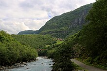
নরওয়ে, সুইডেন এবং ফিনল্যান্ড একসাথে দশ মিলিয়ন বর্গকিলোমিটার এলাকা জুড়ে, অস্ট্রিয়া এবং সুইজারল্যান্ডের চেয়ে দশগুণ প্রশস্ত। পর্বতারোহণের অঞ্চলটিতে আর্দ্র, হালকা আটলান্টিক ফিজার্ডস এবং নরওয়ের উপকূলগুলি রয়েছে, স্ক্যান্ডিনেভিয়ার পাহাড়ের বুনো আলপাইন উঁচু চূড়াগুলির মধ্যে দিয়ে, অভ্যন্তরের প্রশস্ত মালভূমি এবং গভীর বনাঞ্চল পর্যন্ত।
কয়েক বছর আগে নর্ডিক দেশের বেশিরভাগ মানুষ গ্রামাঞ্চলে বাস করতেন। খুব কম সংখ্যক জনসংখ্যার এবং ক্ষুদ্র ক্ষেত্রের সাথে বনায়ন, ফিশিং এবং বেরি বাছাই অনেককে গুরুত্বপূর্ণ পরিপূরক আয় দিয়েছে। আজ, স্থানীয় ভ্রমণকারীদের বেশিরভাগ গ্রীষ্মের কুটিরঘরের জন্য হাইকিং, ফিশিং এবং বেরি বাছাই ছুটির প্রয়োজনীয় অংশ। প্রত্যেকেই মারাত্মক ব্যাক কাউন্ট্রি হাইকার নন - তবে বেশ কিছু লোক রয়েছে।
নর্ডিক বহিরঙ্গন traditionতিহ্যের একটি দিক, শিকার, অনেকের জন্যই আশ্চর্যজনক যেসব দেশ ভূমি মালিকদের পক্ষে উচ্চ শ্রেণীর জন্য সংরক্ষিত ছিল। নর্ডিক দেশগুলিতে বনগুলি সবসময় কৃষকদের মালিকানাধীন ছিল এবং এগুলি কখনও কখনও গুরুত্বপূর্ণ পরিপূরক হিসাবে খাদ্য শিকার করে। গ্রামাঞ্চলে স্থানীয় শিকার ক্লাবের অংশ হওয়া স্বাভাবিক। ফিনিশ শব্দ মরুভূমির জন্য, erämaaএর অর্থ হান্টিং এবং ফিশিং গ্রাউন্ড। পুরানো কালে লোকেরা খাবার এবং ফুর্স পেতে সুনির্দিষ্টভাবে ট্রেকিং করতে যেত এবং হাইকিংয়ে অন্তত কিছু পর্বতারোহণের জন্য এই traditionতিহ্যের চিহ্ন রয়েছে ces
এমনকি প্রত্যন্ত অঞ্চলগুলি খুব কমই সত্যই ছোঁয়াচে। উত্তরে বেশিরভাগ অঞ্চলগুলি মাংসপালনের জন্য ব্যবহৃত হয় are বেশিরভাগ সুরক্ষিত বন বনজ ব্যবহারের জন্য ব্যবহৃত হয়। অনুশীলনে, বেশিরভাগ লোকেরা এটি কেবল মাঝে মধ্যেই লক্ষ্য করবেন।
বিশেষত উত্তরে, খুব কম সংখ্যক জনসংখ্যার কারণে ট্রেইলগুলি প্রধান পর্যটক রিসর্টগুলির কাছাকাছি ব্যতীত অন্যদিকে বেশ শান্ত হবে। বাইরের রাস্তাগুলির বাইরে আপনি খুব কম লোকের কাছাকাছি শহর দেখতে পাবেন। প্রধান রাস্তাগুলির কাছাকাছি আপনি ট্র্যাফিক শুনতে পাচ্ছেন, তবে খুব কম জনবহুল অঞ্চলে আপনি শীঘ্রই কেবল নীরবতা শুনতে পাবেন।
জলবায়ু ও ভূখণ্ড

নরওয়ের খাড়া পাহাড় থেকে আটলান্টিক উপকূলের মাঝারি ও বৃষ্টিপাতের জলবায়ু থেকে অভ্যন্তরীণ ফিনল্যান্ডের প্রায় মহাদেশীয় জলবায়ু এবং দক্ষিণের উষ্ণ শীতকালীন জলবায়ু থেকে নরওয়ের খাড়া পাহাড় থেকে প্রায় ফিনিশ অস্ট্রোবোথনিয়ার সমতল সমভূমি পর্যন্ত অঞ্চল এবং আবহাওয়ার পরিস্থিতি ব্যাপকভাবে পরিবর্তিত হয় vary পাহাড়ের হিমবাহে এবং খুব উত্তরে টুন্ড্রায়।
নরওয়ের জমির 5% এরও কম অঞ্চল বিকাশ করা হয়েছে (খামার জমি, রাস্তাঘাট, শহর), এবং অনুপাত অন্যান্য দেশে একই রকম। নরওয়েতে প্রায় 50% অঞ্চলটি বনবিহীন এক প্রকার খোলা জায়গা, শক্ত গাছহীন স্থল এবং খালি পাথর সহ 30% এরও বেশি বনভূমি এবং প্রায় 5% জলাভূমি এবং বগ (বিশেষত পূর্ব নরওয়ে, ট্রানডেলাগ এবং ফিনমার্কে) ৫% হ'ল মিঠা জল (নদী এবং হ্রদ) এবং ১% স্থায়ী বরফ বা তুষার। ফিনল্যান্ডে, 70০% বনভূমি, যখন উন্মুক্ত স্থানটি বেশিরভাগ হ্রদ এবং জঞ্জাল নিয়ে গঠিত, খুব উত্তরেও বৃহত্তর ঝর্ণা অঞ্চল। এছাড়াও সুইডেনে জলাভূমিগুলি প্রচলিত (প্রায় 20% অঞ্চল)। আইসল্যান্ডের প্রায়% 63% অনুর্বর প্রাকৃতিক দৃশ্য, ২৩% কোন ধরণের উদ্ভিদ রয়েছে, ১২% হিমবাহ দ্বারা আচ্ছাদিত এবং ৩% হ্রদ রয়েছে are
আবহাওয়ার পূর্বাভাস পরিষেবাগুলি সাধারণত ভাল মানের হয়, তবে তাদের ব্যাখ্যা করার জন্য স্থানীয় অভিজ্ঞতার প্রয়োজন হতে পারে: স্থানীয় টপোলজির উপর নির্ভর করে বাতাসের পরিস্থিতি পরিবর্তিত হয় এবং তাপমাত্রার জন্য কেবলমাত্র গড় দিনের ম্যাক্সিমাকে অনেক পূর্বাভাসে বলা হয়, তারতম্য এবং রাতের তাপমাত্রা হ্রাস করতে হয়। বাতাস সাধারণত উঁচু এবং বন্ধ্যা পাহাড় এবং বাইরের উপকূলে আরও শক্তিশালী। প্রদত্ত দিনের সর্বাধিক এবং ন্যূনতম তাপমাত্রার মধ্যে পার্থক্য সাধারণত 3–15 ° C (5–30 ° F) এর মধ্যে থাকে, যদি না উল্লেখযোগ্য আবহাওয়ার পরিবর্তন হয় are একটি পরিষ্কার আকাশ সাধারণত ঠান্ডা রাত মানে। জুলাইয়ের গড় সর্বোচ্চ তাপমাত্রা জানুয়ারীতে প্রায় 15 ডিগ্রি সেন্টিগ্রেড (15 ডিগ্রি ফারেনহাইট), উচ্চ পর্বতমালার উপর নির্ভর করে অবস্থানের উপর নির্ভর করে প্রায় 15 ডিগ্রি সেলসিয়াস (60 ° ফাঃ) থেকে প্রায় 23 ডিগ্রি সেন্টিগ্রেড (75 ° ফাঃ) পর্যন্ত থাকে high গণনা করা হয়নি উত্তরের অভ্যন্তরীণ শীতকালে তাপমাত্রার চূড়াগুলি গ্রীষ্মে 35 ° C (95 ° F) থেকে -50 ° C (-55 ° F) হতে পারে।
ফিনল্যান্ডের জন্য আবহাওয়ার পূর্বাভাস পরিষেবা এবং জলবায়ু সম্পর্কিত তথ্য পাওয়া যায় আবহাওয়া ইনস্টিটিউট (স্মার্টফোন) বা ফোরকা, নরওয়ের জন্য আবহাওয়া অফিস এবং আবহাওয়ার খবর এবং আইসল্যান্ডের জন্য আইসল্যান্ডীয় আবহাওয়া অফিস.
অঞ্চলটি ওয়েস্টারলিজ এবং সুবার্টিকের মধ্যে সীমান্ত অঞ্চলে; আবহাওয়া একটি নির্দিষ্ট আবহাওয়া ব্যবস্থা দ্বারা প্রভাবিত হতে পারে বা বিকল্প আবহাওয়ার পূর্বাভাস দেওয়া কঠিন হতে পারে। আটলান্টিক উপকূলের কাছে (অর্থাত্ আইসল্যান্ডে এবং নরওয়েতে এবং এর নিকটে) এবং উচ্চতাতে আবহাওয়ারে দ্রুত পরিবর্তনগুলি সাধারণ।

উঁচু পর্বতমালা এবং হিমবাহগুলি বছরের কিছু সময় ভ্রমণ করা কঠিন। উচ্চতা বিচার করার সময়, মনে রাখবেন যে ফিনল্যান্ড এবং নরওয়ের উত্তরের অংশগুলিতে গাছের রেখাটি 400 মিটারের নিচে ভাল হতে পারে। নরওয়ে এবং আইসল্যান্ডের উঁচু পাহাড়গুলিতে শীতের পরে জুনের পরে তুষারপাত থাকতে পারে এবং পুরো গ্রীষ্মে বড় বড় প্যাচগুলি থাকতে পারে। পায়ে হেঁটে, নরওয়ের উঁচু পর্বতগুলি সাধারণত গ্রীষ্মের প্রথমার্ধে এবং শরত্কালের প্রথম দিকে দেখা যায় (সাধারণত জুলাই থেকে সেপ্টেম্বর পর্যন্ত দর্শকদের প্রতিটি অঞ্চলের জন্য নির্দিষ্ট তথ্য পাওয়া উচিত)।
উঁচু পর্বতমালার পৃষ্ঠটি বেশিরভাগ ক্ষেত্রেই বেশ জটলা হয়, প্রায়শই আলগা শিলা, পাথর, তুষার এবং হিমবাহ - হাইকিং সাধারণত কঠোর হয় এবং ভাল বুটের প্রয়োজন হয়। এই উগ্র, অনুর্বর পৃষ্ঠটি মহাদেশীয় ইউরোপ বা ইউএস রকিজের চেয়ে নরওয়েতে অনেক কম উচ্চতায় প্রদর্শিত হবে; এমনকি সমুদ্রপৃষ্ঠ থেকে 1000 থেকে 1500 মিটার উঁচুতে উচ্চতর আলপাইন পরিস্থিতি রয়েছে যা গ্রীষ্মের মধ্যে খুব কমই উদ্ভিদ এবং তুষারক্ষেত্রের অবশিষ্ট থাকে।

নিম্ন উচ্চতায়, তবে গাছের রেখার উপরে, প্রায়শই একটি সহজ ঝরঝরে পড়ে যায় fell এটি ফিনল্যান্ডের খুব উত্তরে এবং উঁচু পর্বত এবং সুইডেনের বনের মধ্যে যেমন "লো ঝরনা" (ল্যাগফজল) এর সাধারণ অঞ্চল the গাছের লাইনের কাছে ভিজা ভূখণ্ড প্রায়শই ঘন হয়ে উইলো দিয়ে আবৃত থাকে (সালিক্স) গুল্মগুলি, বেশ সহজেই যেতে পারা যায়। উপত্যকাগুলি প্রায়শই বনভূমি হয়, মূলত পতিত বার্চ সহ, তবে পাইনযুক্ত কিছু দাগ এবং কিছুটা নিচু স্থানে, পাইন এবং স্প্রস বন রয়েছে।
পাইন এবং স্প্রুস অরণ্য মহান উত্তর ইউরেশিয়ান তাইগা বেল্টের পশ্চিমতম অংশ part তাইগা বেল্টটি বেশিরভাগ ফিনল্যান্ড এবং সুইডেন এবং নরওয়ের কিছু অংশ (বিশেষত পূর্ব নরওয়ে এবং কিছু সীমান্ত অঞ্চল) জুড়ে রয়েছে। নিম্নভূমিগুলিতে, বিশেষত ফিনল্যান্ড এবং সুইডেনের কিছু অংশে, বিস্তৃত মাইর এবং বগ রয়েছে। বরফযুগীয় এস্কারগুলি ছেড়ে যায়, যা ল্যান্ডস্কেপকে কিছু অঞ্চলে একটি অদ্ভুত রোলিং চরিত্র দেয়। দক্ষিণ ফিনল্যান্ড এবং সুইডেনের বেশিরভাগ অংশ সমুদ্রপৃষ্ঠের নীচে ছিল যখন বরফটি চলে যায়, এবং নীচু পাহাড়ের উপরেও প্রায়শই দেখা যায় যেখানে গাছগুলি বৃদ্ধি পায় যেখানে যথেষ্ট মাটি জমেছে এবং পাহাড়ের চূড়ায় একটি বিরল বন দেয়। কিছু অঞ্চল বাদে জমির সামান্য অংশ হ'ল কৃষিজমি। বনাঞ্চলের আধিপত্য, যদিও এর বেশিরভাগ অংশ বনায়নের জন্য ব্যবহৃত হয়, অনেকগুলি ক্লিয়ারিং সহ। পুরাতন বন এখানে এবং সেখানে পাওয়া যায়, শক্ত ভূখণ্ড দ্বারা সংরক্ষণ করা এবং রাস্তা এবং নদী থেকে অনেক বেশি বড় অঞ্চল।
উচ্চতা এবং ল্যান্ডফর্ম


সর্বাধিক উচ্চতা হ'ল স্ক্যান্ডিনেভিয়ান উপদ্বীপের পশ্চিম অংশগুলিতে নরওয়ের খুব দক্ষিণে, মধ্য নরওয়ে এবং সুইডেনের সাথে সীমান্ত অঞ্চলের মধ্য দিয়ে এবং অবধি ট্রমস এবং ফিনমার্ক খুব উত্তরে কাউন্টি। এই উচ্চতাগুলি প্রায়শই স্ক্যান্ডিনেভিয়ান পর্বত হিসাবে উল্লেখ করা হয়। সর্বাধিক শীর্ষ সম্মেলনগুলি নরওয়েতে জোটুনহেইমেন, যেখানে সর্বোচ্চ শিখরটি 2469 মি। নরওয়েতে প্রায় 200 টি শৃঙ্গ 2000 মিটারের বেশি - বেশিরভাগ জোটুনহেইমেনে তবে এর মধ্যেও রোনডানে এবং ডোভ্রেফজেল। সুইডেনের সর্বোচ্চ শৃঙ্গ রয়েছে ল্যাপল্যান্ড নরওয়ের সীমান্তের নিকটে, 2000 মিটারের উপরে কয়েক মুঠো পিক। আইসল্যান্ডের সর্বোচ্চ পর্বতগুলি রয়েছে আইসল্যান্ডের অভ্যন্তর এবং দক্ষিণ আইসল্যান্ড, 2000 মিটারের উপরে একটি শিখর। নরওয়ের নিম্নভূমিগুলি মূলত উপত্যকা এবং উপকূলে সীমাবদ্ধ। সাধারণভাবে, উচ্চতর উচ্চতা বলতে বন্যতম ভূখণ্ডকেও বোঝায়, বিশেষ করে নরওয়ের আটলান্টিক উপকূল বরাবর প্রচুর সংখ্যক জাল (যেমন) সোগনেফজর্ড) এবং বিশাল সমুদ্র যেমন সরাসরি rising লোফোটেন। আরও মৃদু ল্যান্ডফর্ম (উচ্চ মালভূমি) সহ কিছু উচ্চ উচ্চতা রয়েছে যেমন হার্ডঞ্জেরভিদ্দা মালভূমি, ডোভ্রেফজেল, পূর্ব নরওয়ের দুর্দান্ত উপত্যকাগুলি এবং ফিনমার্কসভিডা (অভ্যন্তর অভ্যন্তরের দীর্ঘ প্রসারিত) ফিনমার্ক মালভূমি)। খুব উত্তরের শীতল জলবায়ুর কারণে, ফিনমার্কসবিদ্দা এবং ফিনমার্কের অন্যান্য উচ্চতা সমুদ্রপৃষ্ঠ থেকে মাত্র 300 থেকে 500 মিটার উর্ধ্বেও বন্ধ্যা হয়ে রয়েছে।
পশ্চিমাংশের বিপরীতে, ফিনল্যান্ড বন বা খোলা রেঞ্জগুলির সাথে সৌম্য ভূমিগুলির দ্বারা আরও বেশি বৈশিষ্ট্যযুক্ত। ফিনল্যান্ডের সর্বোচ্চ উচ্চতা কেবল প্রায় 1300 মি এবং সমুদ্রপৃষ্ঠ থেকে 1000 মিটারেরও বেশি উঁচু পর্বতগুলি কেবলমাত্র চরম উত্তর-পশ্চিমে ফিনল্যান্ডের "বাহু" তে পাওয়া যাবে। পূর্বে কয়েকটি ব্যাতিক্রমের জন্য সংরক্ষণ করুন, আপনি খুব কমই 300 মিটার দক্ষিণে পর্বতগুলির মুখোমুখি হবেন ল্যাপল্যান্ড। অন্যদিকে, ফিনল্যান্ডের বেশিরভাগ অংশ হ্রদ এবং স্রোতে আবৃত।
ফিনল্যান্ডের তুলনায়, সুইডেন পাহাড়ী এবং স্টকহোমের উত্তরের বেশিরভাগ অংশ – অসলো লাইন কোন বড় শহর ছাড়াই বনভূমি। অবশেষে স্ক্যানিয়া, সুইডেনের দক্ষিণতম অংশ ডেনমার্ক, নেদারল্যান্ডস বা উত্তর জার্মানি-র অনেক বেশি স্মরণ করিয়ে দেয় - এটি মূলত প্যানকেক হিসাবে সমতল এবং এর বেশিরভাগ অংশ কৃষিজমি।
আইসল্যান্ড একইভাবে নরওয়ের মতো বন্ধ্যা is আইসল্যান্ডের সর্বোচ্চ উচ্চতা আইসল্যান্ডের অভ্যন্তর এবং উত্তর-আইসল্যান্ডের ট্রল্লাস্কাগি পর্বতমালায় রয়েছে range আইসল্যান্ডের অন্য কোথাও উচ্চতা 600 মিটারের চেয়ে কম।
পর্বতমালা

নরওয়েজিয়ান ভাষায়, "পর্বত" ("ফিজেল") বেশিরভাগ গাছের লাইনের উপরে পৌঁছানো উচ্চারণকে বোঝায়। কম খাড়া, তুলনামূলক স্তরযুক্ত, উচ্চারিত শৃঙ্গ ছাড়াই গাছহীন প্লেটিয়াসকে প্রায়শই "ভিডেডি" বলা হয় (নীচের তালিকায় উত্তরটির প্রশস্ত ফিনমার্কসভিডা উদাহরণস্বরূপ যেমন মালভূমি অন্তর্ভুক্ত রয়েছে)।
স্ক্যান্ডিনেভিয়ান পর্বতমালাগুলি প্রায় মানচিত্রে বিভক্ত হতে পারে।
- A & B: আর্কটিক পর্বতমালা
- কেবনেকাইস সহ সারেক জাতীয়পার্ক, লিনজেন আল্পস, লোফোটেন, স্বার্থিসেন হিমবাহ, নারিক, ক্যাসিভারসি ওয়াইল্ডারনেস এরিয়া
- সি: মধ্য সীমান্তের উচ্চভূমি (নরওয়ে এবং সুইডেন)
- ডি: এফজর্ডস ব্যাপ্তি
- সুন্ন্মার এবং সহ রোমসডাল আল্পস, জোসেস্টালব্রাইন হিমবাহ, বেশিরভাগ সোগনেফজর্ডেন
- ই: মধ্য পর্বতমালা
- সহ রোনডানে-ডোভ্রেফজেল, জোটুনহেইমেন (উত্তর ইউরোপে সর্বোচ্চ)
- এফ: দক্ষিন উচ্চভূমি
- সহ হার্ডঞ্জেরভিদ্দা মালভূমি এবং রোগাল্যান্ড/Setesdal মুরল্যান্ড
.তু
গ্রীষ্মে পর্বতারোহণের মরসুম সাধারণত মে মাসের মাঝামাঝি থেকে সেপ্টেম্বরের শুরুতে উত্তর এবং উচ্চ পর্বতমালা বাদে, যেখানে এটি জুনে শুরু হয়, এমনকি কিছু এলাকায় জুলাই মাসেও। এই সময় হাইকিং বেশিরভাগ ক্ষেত্রে সহজ এবং বছরের অন্যান্য অংশের তুলনায় প্রস্তুতি, দক্ষতা এবং গিয়ারের প্রয়োজন কম রয়েছে - তবে কিছু গন্তব্য এখনও দাবি করছে। গ্রীষ্মের বেশিরভাগ মশা এবং মাঝারি অংশগুলি বেশিরভাগ অঞ্চলে উপদ্রব হয়, বিশেষ করে জুনের শেষ থেকে আগস্ট পর্যন্ত উত্তরে ট্রেনলাইনের নীচে। আগস্টের রাতের অন্ধকার হয়ে যায়, শীতকালের জন্য শিশুরা স্কুলে ফিরে আসে এবং কিছু পর্যটক সুবিধা দেয়।
শরত্কালের শুরুর দিকে (বেশিরভাগ সেপ্টেম্বর) সময় হয় ruskaপাতাগুলি যখন লাল এবং হলুদ হয়ে যাচ্ছে তখন একটি বিশেষ সুন্দর দৃশ্য ল্যাপল্যান্ড এবং ফিনমার্ক (তবে সময়টি প্রায়শই সংক্ষিপ্ত থাকে - শীতকাল শীঘ্রই আসতে পারে)। অনেক স্থানীয় মাশরুম এবং লিংগবেরি বাছাই করতে বের হন। এটি প্রায়শই একটি চমৎকার হাইকিংয়ের মরসুম; দিনগুলি সাধারণত হালকা থাকে, যদিও হিমশীতল রাতে প্রদর্শিত হতে পারে এবং প্রথম তুষারপাত মাসের শেষের দিকে প্রদর্শিত হতে পারে। পোকামাকড় বেশিরভাগ ক্ষেত্রে চলে যায় এবং বায়ু সাধারণত খাস্তা হয়। অন্যদিকে, শেষের দিকে শরত্কাল (অক্টোবর-নভেম্বর) বেশিরভাগ দর্শনার্থীর পক্ষে সেরা seasonতু নয়: এটি অন্ধকার এবং ভেজা এবং অদ্ভুত তুষারপাতের সাথে নির্ভরযোগ্য কোনও তুষার কভার নেই (স্কি রিসর্টগুলি খোলা থাকে তবে প্রায়শই কৃত্রিম তুষার উপর নির্ভর করে) । নভেম্বর মাসে তাপমাত্রা মাঝে মাঝে দক্ষিণ ফিনল্যান্ডে 15 ডিগ্রি সেন্টিগ্রেড (5 less ফাঃ) বা তারও কম চলে যায়।
মিডউইনটারে উত্তরে কোনও সূর্যোদয় হয় না - এবং প্রচণ্ড শীত হতে পারে। দিনগুলি দক্ষিণেও ছোট। ফাদার ক্রিসমাসের জন্মভূমিতে আপনি আর্কটিক নাইট বা ক্রিসমাসটি দেখতে চাইতে পারেন (ফিনস বিশ্বাস করেন যে তিনি ল্যাপল্যান্ডে থাকেন এবং ব্রিটিশদের সৈন্যরা তাকে দেখতে আসেন)। অন্যথায় আপনি শীতের যাতায়াতের জন্য দক্ষিণে বা উত্তরের বসন্তের প্রথম দিকে পছন্দ করতে পারেন। আপনি যদি স্কি রিসর্ট সুবিধা ব্যবহার করতে চলেছেন, শীতের ছুটিতে শিখরগুলি নোট করুন; আপনি কিছু সময় দর কষাকষি করতে পারেন। আরো দেখুন নর্ডিক দেশগুলিতে শীতকাল.
অনেক স্থানীয়দের কাছে বসন্ত অনেক প্রিয় seasonতু is দিনগুলি হালকা, সূর্য শক্তিশালী এবং প্রকৃতি জাগ্রত হয়। বন্যপ্রাণী হাইকসের দাবি এখানে থাকতে পারে, এখানে গভীর তুষার এবং সেখানে খালি জমি এবং প্রচুর পরিমাণে জল, তবে অনেকগুলি গন্তব্য অপ্রয়োজনীয়। উত্তরে এবং উঁচু পর্বতমালায় জুন এখনও স্রোতে এবং উঁচু পর্বতগুলিতে তুষার এবং গর্ভের উঁচু জলের গলে যাওয়ার সময় জুলাই বা তার পরে অবধি চলতে পারে। পচা তুষার এবং উচ্চ জলের ফলে গ্রীষ্মের প্রথমদিকে যে কোনও জায়গায় গ্রীষ্মের শুরুতে ক্ষতিগ্রস্ত অঞ্চলে চলাচল করা কঠিন হয়ে পড়ে। পরে অবশিষ্ট তুষার প্রায়শই কমপ্যাক্ট হয়, চলার পক্ষে যথেষ্ট শক্ত।
নরওয়ের উঁচু পর্বতমালায় স্প্রিং বিশেষত দেরিতে, এমনকি জুনে কিছু অঞ্চল কেবল স্কাইতে প্রবেশযোগ্য। নরওয়েজিয়ান যেমন পাহাড়ের ক্ষেত্রে এটি সত্য জোটুনহেইমেন এবং হার্ডঞ্জেরভিদ্দা, যেখানে জুনের পরে তুষারপাত অব্যাহত থাকতে পারে এবং গ্রীষ্মের শেষের দিকে তুষার বড় প্যাচ থাকতে পারে। এমনকি ফিনল্যান্ডে একটি মিডসামার স্কিইং প্রতিযোগিতা রয়েছে (এ এ কিলপিজারভি)। নরওয়েজিয়ানরা তাদের স্কিগুলি এমন জায়গায় নিয়ে যায় যেখানে তারা স্কি দিয়ে চালিয়ে যেতে পারে foot
ঘোরাফেরা করার স্বাধীনতা

প্রত্যেকের মৌলিক অধিকার (অ্যাক্সেসের অধিকার, ঘোরাঘুরির স্বাধীনতা) হ'ল স্বাধীনভাবে পায়ে, স্কি বা নৌকাযোগে ঘোরাঘুরি করার অধিকার, তাঁবুতে রাতারাতি থাকার অধিকার এবং ভোজ্য বেরি এবং মাশরুম বাছাই করার অধিকার। কোন অ-প্রান্তর অঞ্চলগুলিতে অধিকার প্রয়োগগুলি দেশগুলির মধ্যে কিছুটা পরিবর্তিত হয় - উদাঃ আইসল্যান্ডে রাস্তা বন্ধ কোনও আবদ্ধ জায়গায় প্রবেশের জন্য জমির মালিকের অনুমতি প্রয়োজন - কিছু বিবরণ হিসাবে do অধিকারগুলি (আরও সঠিকভাবে: ভূমির মালিকের নিষেধের অধিকারের অভাব) প্রত্যাশার সাথে রয়েছে বিবেচনাধীন হওয়ার এবং নির্দিষ্ট আইন ভাঙার অনুমতি দেয় না, ক্ষতি করে (যেমন ক্রমবর্ধমান ফসলের সাথে জমিতে হাঁটতে বা জঞ্জাল ফেলে বা খোলা ফটকগুলি পিছনে ফেলে) বা অশান্ত বাসিন্দা বা বন্যজীবন। কিছু বিবরণ আইনে কোডেড, তবে অনেক কিছুই ব্যাখ্যার অবধি; আদালত মামলাগুলি বিরল।
জাতীয় উদ্যান এবং অন্যান্য "অফিসিয়াল" গন্তব্যগুলিতে যাওয়ার সময়, নির্দিষ্ট ক্ষেত্রের জন্য নির্দেশাবলী পড়ুন। বেশিরভাগ প্রদত্ত পরিষেবাগুলি (যেমন নির্ধারিত ক্যাম্পফায়ার এবং ক্যাম্পিং সাইটগুলি) স্থানীয় বিধিনিষেধের জন্য ক্ষতিপূরণ দেয়। আপনাকে ট্রেইলগুলি অনুসরণ করতে উত্সাহিত করা হয় (কখনও কখনও বাধ্যতামূলক), যেখানে এগুলি সরবরাহ করা হয়।
দেখা প্রবেশের অধিকার আরও পুঙ্খানুপুঙ্খ আলোচনার জন্য এবং সম্ভবত নির্দিষ্ট দেশগুলির জন্য গাইডের লিঙ্ক।
আগুন
- আরো দেখুন: ক্যাম্পফায়ার
আগুন দেওয়ার সময় আপনার সর্বদা সতর্ক হওয়া উচিত - নিশ্চিত হয়ে নিন যে এর অর্থ কী। এটি সর্বদা দেখানো উচিত এবং সাবধানতার সাথে নির্বাচিত হওয়া উচিত। বিশেষত স্প্রস, যা নর্ডিক দেশগুলিতে বিস্তৃত, প্রচুর পরিমাণে জ্বলনযোগ্য উপাদান তৈরি করে। সম্ভব হলে শনাক্ত করা ক্যাম্পফায়ার সাইটগুলি ব্যবহার করুন। শিলা (যা ক্র্যাক হবে) বা পিটগুলিতে আগুন লাগাবেন না (যা নির্ভরযোগ্যরূপে নিভানো শক্ত)। আপনি যতক্ষণ সাবধান হন ততক্ষণ সুইডেনে আপনার অনুমতি লাগবে না। আইসল্যান্ডে আগুন সুরক্ষিত জায়গাগুলির বাইরে অনুমতি দেওয়া হয়েছে যেখানে দাবানলের বা অন্য ক্ষতির কোনও ঝুঁকি নেই (তবে কাঠের কাঠের অভাব হয়) is নরওয়েতে, আগুন লাগানো সাধারণত 15 এপ্রিল থেকে 15 সেপ্টেম্বর পর্যন্ত বন, বিল্ডিং এবং অন্যান্য দাহ্য পদার্থ থেকে বা সরকারীভাবে নির্ধারিত সাইটগুলি থেকে উদারভাবে নিরাপদ দূরত্বে নিষিদ্ধ। ফিনল্যান্ডে সর্বদা খোলা আগুনের জন্য জমির মালিকের অনুমতি প্রয়োজন, তবে উত্তরে রাজ্যের মালিকানাধীন বেশিরভাগ জমির জন্য সাধারণ অনুমতি রয়েছে (আচ্ছাদিত অঞ্চলগুলি এবং শর্তাদি পরীক্ষা করুন)। আগুন জ্বালানোর অনুমতি দেওয়া অগত্যা কাঠের কাঠ নেওয়ার অধিকারকে বোঝায় না; গাছ বা নান্দনিক বা পরিবেশগত দিক থেকে মূল্যবান লগগুলির ক্ষতি করবেন না। আইসল্যান্ডে কাঠ একটি বিশেষত দুর্লভ সম্পদ এবং যা আনুষ্ঠানিকভাবে অনুমোদিত নয় তবে অন্য দেশে কোনও ক্ষতি (এবং এইভাবে গৃহীত) না করার ফলে সেখানে অবশ্যই খারাপ হতে পারে। জরুরী পরিস্থিতিতে আপনি নিজের রায় ব্যবহার করেন।
বিশেষত শুষ্ক পরিস্থিতিতে, বাইরে যে কোনও উন্মুক্ত আগুনের উপর সম্পূর্ণ নিষেধাজ্ঞা থাকতে পারে (ডিসপোজেবল গ্রিল এবং অনুরূপ সহ)। ফিনল্যান্ডে গ্রীষ্মে এ জাতীয় নিষেধাজ্ঞাগুলি প্রচলিত থাকে, বেশিরভাগ আবহাওয়ার পূর্বাভাস অঞ্চলে (ল্যাপল্যান্ডে: পৌরসভা দ্বারা) বিজ্ঞাপন দেওয়া হয় "বন আগুনের সতর্কতা" হিসাবে (metsäpalovaroitus/বিভিন্ন স্কোর স্ক্র্যাশব্র্যান্ড)। বসন্তে ঘাসের আগুনের জন্য একটি সতর্কতা থাকতে পারে, যা ততটা গুরুতর নয়, তবে এখনও লক্ষণীয়। ক্যাম্পিং স্টোভগুলিকে খোলা আগুন হিসাবে বিবেচনা করা হয় না, তবে তারা প্রায়শই দাবানল শুরু করতে যথেষ্ট সক্ষম, তাই তাদের (এবং আপনার ব্যবহৃত ম্যাচগুলির সাথে) সাবধান হন। সুইডেনে নিষিদ্ধের কেন্দ্রীয়ভাবে বিজ্ঞাপন দেওয়া হয় না; নিষেধাজ্ঞাগুলি জরুরী পরিষেবাগুলি দ্বারা সিদ্ধান্ত নেওয়া হয়, সাধারণত আঞ্চলিক বা পৌর পর্যায়ে।
জাতীয় উদ্যান এবং অনুরূপগুলিতে ফ্রিউড কাঠ সহ বিনামূল্যে ক্যাম্প ফায়ার সাইট রয়েছে। কয়েকটি বড় বড় জাতীয় উদ্যান এবং প্রান্তর অঞ্চলে আগুন লাগানোর অনুমতি দেওয়া যেতে পারে যেখানে আশেপাশে কোনও ক্যাম্প ফায়ার সাইট নেই (এলাকার নিয়মগুলি পরীক্ষা করুন)। অতিরিক্ত পরিমাণে আগুন লাগাবেন না, তবে অল্প পরিমাণে আগুনের কাঠ ব্যবহার করুন। যদি কিছুটা কাঠের তৈরি তৈরি হয় এবং কিছু না হয়, বা কিছু বাইরে থাকে তবে নতুন কাঠের কাঠ ব্যবহার করা উচিত পরিবর্তে ঘরে তৈরি করা উচিত। আপনার সাধারণত প্রকৃতি থেকে পুনরায় পূরণ করা উচিত নয়। এই উদ্দেশ্যে প্রায়শই একটি কুড়াল এবং সম্ভবত একটি করাত রয়েছে, বিশেষত আরও প্রত্যন্ত স্থানে, তবে আপনি নিজের জিনিসটি বহন করতে চাইতে পারেন। একটি ভাল ছুরি বেসিক বেঁচে থাকার গিয়ার এবং জলরোধী প্যাকড স্পেয়ার্সের সাথে ম্যাচ করা উচিত, আর কোনও ভাড়া বাড়ানো উচিত।

কঠিন পরিস্থিতিতে আগুন জ্বালানোর জন্য, প্রায় তিন ধরণের টেন্ডার সাধারণত বনে পাওয়া যায়: মাতাল শুকনো ডালগুলি কম পরিমাণে ঝাঁকুনিতে পড়ে (ঝাঁকুনির জন্য সহজেই নিন - ঝাঁকুনি সহজেই সংক্রামিত হয়), বার্চের ছাল (ছাল সাদৃশ্য নয়) অন্যান্য গাছের) বা রজনীয় পাইন কাঠ। তিনটির জন্য বিভিন্ন কৌশল প্রয়োজন, সুতরাং কোথাও প্রশিক্ষণ দিন যেখানে উপাদানগুলি ব্যবহার করার আগে ক্ষতিগ্রস্থ হয় না। স্প্রুস ডালগুলি ব্যবহার করে আপনার যথেষ্ট পরিমাণে সূক্ষ্ম উপাদান এবং পর্যাপ্ত বাতাস এবং পর্যাপ্ত উত্তাপের মধ্যে সঠিক সমঝোতা হওয়া দরকার (আপনার নিজের হাত ব্যবহারের প্রয়োজন হতে পারে; আপনার আগুনকে সম্মান করা উচিত তবে ভয় পাবেন না)। বার্চের ছাল ব্যবহার করা সহজ, তবে এটি কীভাবে আচরণ করে তা পরীক্ষা করুন। এটিকে কাঠ থেকে বড় টুকরো টুকরো করার জন্য একটি ছুরি দরকারী। পাইনের জন্য কীটি হ'ল যথেষ্ট পরিমাণে টুকরো টুকরো করা উচিত। টিন্ডার হিসাবে পাইন ব্যবহারযোগ্য একটি তাজা কাটা ঘ্রাণ দ্বারা স্বীকৃত এবং এটি দীর্ঘ মৃত কিন্তু পচা না, প্রায়শই একটি অন্যথায় বিচ্ছিন্ন শ্যাওলা coveredাকা স্টাম্পের শক্ত অংশ হিসাবে (আপনার চোখের প্রশিক্ষণ দিন!)। পতিত বার্চ অরণ্যে, যেখানে কোনও শুকনো কাঠ নেই, বার্চ কাঠটি পাতলা পর্যাপ্ত টুকরো টুকরো টুকরো করা উচিত এবং আগুন ধরে যাওয়ার জন্য অত্যন্ত পাতলা করা উচিত (ঘন আগুনের কাঠ মশাকে উপসাগর রাখতে রাখতে ব্যবহার করা যেতে পারে এবং এটি শুকানোর পরে) যথেষ্ট). গাছের লাইনের উপরে আপনি শুকনো ডালগুলি ব্যবহার করতে পারেন তবে পর্যাপ্ত শুকনো কাঠের কাঠ পাওয়া খুব কঠিন be
আলো
উত্তর অক্ষাংশের কারণে, বছরের বেশিরভাগ দিন সূর্য দিগন্তের কাছাকাছি ঘুরে বেড়ায়। গোধূলিটি নিরক্ষীয় অঞ্চলের কাছাকাছি স্থানে প্রায় দক্ষিণে আধ ঘন্টার বেশি এবং সম্ভবত আর্টিক নাইটে (দিনের আলো নেই) বেশ কয়েক ঘন্টা ধরে থাকে।
শরতের শেষের দিকে এবং শীতের শুরুতে দিনের আলো সীমাবদ্ধ থাকে এবং হাইকিংয়ের জন্য উপলব্ধ সময়গুলি কমপক্ষে ঘন বনাঞ্চলে, রুক্ষ ভূখণ্ডে এবং যেখানে অভিমুখীকরণ কঠিন, বিশেষত শরতের শেষের দিকে আকাশ মেঘলা থাকে বলে খুব সীমাবদ্ধ থাকে। শীতকালে তুষার এমনকি তারকাকে রাতে কিছুটা আলোকপাত করতে সহায়তা করে, যা আপনি একবার অভ্যস্ত হয়ে উঠলে সহজেই উন্মুক্ত অঞ্চলে যথেষ্ট হতে পারে - চাঁদর আলো প্রচুর অনুভব করতে পারে।
মে থেকে জুলাই রাত পর্যন্ত পুরো অঞ্চল জুড়ে বেশ হালকা are এখানে মধ্যরাতের সূর্য দীর্ঘ উত্তরে দেড় মাস এবং এমনকি কয়েক ঘন্টা (আপেক্ষিক) অন্ধকার এমনকি দক্ষিণে মিডসুমারের আশেপাশে। আগস্টের মধ্যে, রাতের অন্ধকার হয়ে যায় এবং শরতের শেষের দিকে, তুষার আসার আগে, খুব দীর্ঘ অন্ধকার সন্ধ্যা হয়।
সচেতন থাকুন যে পরিষ্কার বাতাস, হ্রদ এবং তুষার ক্ষেত্রের প্রতিচ্ছবি এবং সামান্য উদ্ভিদের কারণে গ্রীষ্মে সূর্যের রশ্মিগুলি উচ্চ উচ্চতায় খুব শক্তিশালী হতে পারে।
মানুষ
.jpg/220px-Amanda_Delara_(29519019388).jpg)
যে কোনও তথ্যকেন্দ্রের স্টাফ, হোটেল এটেটেরা সাধারণত ইংরেজিতে সাবলীল থাকে এবং পর্যটকদের উদ্দেশ্যে করা তথ্য বেশিরভাগ ক্ষেত্রেই ইংরেজিতে পাওয়া যায়। বড় বড় পর্যটকের আকর্ষণে, হোটেলগুলিতে এবং এর মতো বেশিরভাগ ক্ষেত্রে বেশ কয়েকটি ভাষায় কর্মীরা সাবলীল থাকে, তবে পারিবারিক ব্যবসায়ের ক্ষেত্রে প্রবীণরা তাদের মাতৃভাষা বাদে প্রয়োজনীয় সাবলীল হন না। আপনি বেশিরভাগ ইংরেজিতে টিকে থাকতে সক্ষম হবেন, যদিও - এবং আপনি গোহাতে জন্ম নেওয়া সামির সাথে দেখা করতে পারেন তবে বেশ কয়েকটি বিদেশী ভাষায় সাবলীলভাবে কথা বলতে পারেন।
স্ক্যান্ডিনেভিয়ান দেশগুলির উত্তর হল এর জন্মভূমি সামি মানুষ; তারা কয়েকটি পৌরসভাতে সংখ্যাগরিষ্ঠ এবং অন্যদের মধ্যে বড় সংখ্যালঘু। অর্ধ শতাব্দী আগে ভাষা রাজনীতির কারণে অনেক সামি কথা বলে না সামি, তবে অনেকেই বিশেষত উত্তরের ফিনিশ এবং সুইডিশ ল্যাপল্যান্ড এবং বেশিরভাগ নরওয়েজিয়ান ভাষায় করেন ফিনমার্ক। তারা দেশের সংখ্যাগরিষ্ঠ ভাষা এবং সীমান্তগুলির দ্বারাও সম্ভবত প্রতিবেশী দেশটির ভাষা (সুইডিশ এবং নরওয়েজিয়ান ভাষা পারস্পরিক স্বাক্ষরিত)। সুইডিশ ভাষাতে ফিনিশ উপভাষাগুলি (মেইনকেলি, কাভেন; সংখ্যাগরিষ্ঠ ভাষা ছাড়াও) বলার মতো বড় দল রয়েছে টর্নেডালেন এবং ফিনমার্কের কিছু অংশে।
এর দ্বীপপুঞ্জে উসিমায়াদক্ষিণে দ্বীপপুঞ্জ সমুদ্র, একটি জমি এবং উপকূল অস্ট্রোবোথনিয়া সুইডিশ হ'ল সনাতন ভাষা। ফিনিশ বা ইংরেজিতে আপনি বেঁচে থাকবেন, তবে ফিনিশ ভাষায় তাদের স্বাগত জানানোর চেষ্টা করে সুইডিশভাষী লোকেরা খুব বেশি প্রভাবিত হবেন না।
ল্যাপল্যান্ড এবং ফিনিশ দ্বীপপুঞ্জের মতো খুব কম জনবহুল অঞ্চলে পর্যটন অনেকের জন্য একটি গুরুত্বপূর্ণ পরিপূরক আয়। ছোট পরিবার ব্যবসায়গুলি অগত্যা ইন্টারনেটে বা পর্যটন ব্রোশিওরে বিজ্ঞাপন দেয় না। আপনার চোখ খোলা রাখতে হবে এবং স্থানীয়ভাবে জিজ্ঞাসা করতে হবে।
গন্তব্য
- আরো দেখুন: নরওয়ে হাইকিং গন্তব্য, ফিনিশ জাতীয় উদ্যান

- আগুনের আগমন দরকার নবাগতের
- যার হাঁটু হিমশীতল;
- মানুষের প্রয়োজন মাংস এবং পরিষ্কার লিনেন
- কে ঝরনা পার হয়ে গেছে ... – হ্যাভমাল
ঘোরাঘুরির স্বাধীনতা আপনাকে আরও কোথাও কোথাও যেতে দেয়। দেশের সমস্ত অঞ্চলে বন বা অন্যান্য ধরণের প্রকৃতি জনসাধারণের জন্য উন্মুক্ত। যারা প্রান্তরে ব্যাকপ্যাকিং পছন্দ করেন বা বেশ কয়েক দিন ধরে রাস্তা বন্ধ রাখতে চান তারা মধ্য নরওয়ের পর্বতের ঠিক পূর্ব দিকে ফিনল্যান্ড, নরওয়ে এবং সুইডেনের উত্তর অন্তর্গত অঞ্চলে (জোতুনহিমেন, হার্ডডেঞ্জারভিডা, ডোভ্রে) স্বল্প জনবহুল অঞ্চলগুলির সন্ধান করতে পারেন might ), পূর্ব ফিনল্যান্ডে এবং আইসল্যান্ডের অভ্যন্তরে কোনও কোনও জায়গায় আপনি কোনও রাস্তা না দেখেই একশো কিলোমিটার বেশি বা কম একদিকে যেতে পারেন।
নরওয়েতে, সারা দেশে দিন বাড়ানোর বা দীর্ঘতর ভ্রমণগুলির জন্য ট্রেইল রয়েছে। অন্যান্য দেশগুলিতে সর্বত্র অনুন্নত অঞ্চলও রয়েছে, কাঠের মধ্যে হাঁটার জন্য বা বেরি বাছাইয়ের জন্য উপযুক্ত, তবে দীর্ঘ পথের জন্য উপযুক্ত পথচিহ্ন বা অন্যান্য রুটের জন্য আপনাকে সাধারণত মানচিত্রটি আরও কিছুটা অধ্যয়ন করতে হবে, বা কিছুটা দূরত্ব ভ্রমণ করতে হবে একটি উপযুক্ত ট্রেইলহেড
মনে রাখবেন যে নর্ডিক দেশগুলিতে প্রান্তরে ব্যাকপ্যাকিংয়ের অর্থ কোনও অবকাঠামো ছাড়াই পর্বতারোহণের অর্থ হতে পারে, সম্ভবত কিছু দিনের জন্য কারও সাথে দেখা না করা এবং কিছু ভুল হয়ে যাওয়ার পরে আপনার নিজেরাই থাকাও। এটি এমন অনেক লোকের জন্য আসে, তবে আপনি যদি আপনার দক্ষতায় সন্দেহ করেন তবে উপযুক্ত রুটগুলি বেছে নিন। সমস্ত স্তরের আপস উপলব্ধ।
সর্বোত্তম পর্বতারোহণ বা দৃশ্যাবলী জাতীয় উদ্যান বা প্রকৃতি সংরক্ষণাগারে অগত্যা নয়। তবে এটি প্রথমে "অফিসিয়াল" বা অন্যথায় সুপরিচিত গন্তব্যগুলি বিবেচনা করে উপযুক্ত হবে, যা কিছু মূল্যবান প্রকৃতি এবং কিছু দুর্দান্ত প্রাকৃতিক দৃশ্যকে আচ্ছাদন করে। এগুলির জন্য তথ্য এবং পরিষেবাগুলি খুঁজে পাওয়াও সহজ।
বিভিন্ন ধরণের সুরক্ষিত অঞ্চলগুলি কখনও কখনও একে অপরের সাথে মিশে যায়। উদাহরণস্বরূপ, জাতীয় উদ্যানের অভ্যন্তরে কঠোর বিধিনিষেধ বা পার্কের বাইরের একটি সীমিত সীমানা জোন এমন অঞ্চল থাকতে পারে। এছাড়াও সুরক্ষিত অঞ্চলগুলি রয়েছে যা হাইকারের উপর সামান্য প্রভাব ফেলে, মূলত ভূমি মালিক এবং পরিকল্পনা কর্তৃপক্ষের ক্রিয়াকলাপকে সীমাবদ্ধ করে।
ফিনল্যান্ডে, জাতীয় উদ্যান, প্রান্তরের অঞ্চল এবং অন্যান্য কয়েকটি গন্তব্য মেটসাহেলিটাস, ফিনিশ বনায়ন প্রশাসন দ্বারা রক্ষণাবেক্ষণ করা হয়, যেখানে গন্তব্যগুলি এবং সাধারণভাবে চলাচলের বিষয়ে তথ্য রয়েছে Nationalparks.fi। তাদের গ্রাহকসেবা পয়েন্ট এবং জাতীয় উদ্যানের দর্শনার্থী কেন্দ্রগুলিতেও তথ্য সরবরাহ করা হয়, যেখানে আপনি ঝুপড়িতে একটি বিছানা সংরক্ষণ করতে পারবেন বা ফিশিং (বা এমনকি শিকার) পারমিট কিনতে পারবেন। এছাড়াও ফিনিশ জাতীয় উদ্যান বেশিরভাগ "অফিসিয়াল" গন্তব্যগুলির তথ্য রয়েছে।
নরওয়ে, ট্র্যাকিং সমিতি দেশের সমস্ত অঞ্চলে তাদের অনেকগুলি ঝুপড়ি (পর্বত লজগুলি) এর মধ্যে ট্রেইল বজায় রাখে।
জাতীয় উদ্যান

নরওয়েতে, "জাতীয় উদ্যান" প্রাথমিকভাবে অনুন্নত অঞ্চলের সুরক্ষিত স্থিতি নির্দেশ করে। হাইকিং এবং দৃশ্যাবলি প্রায়শই বাইরে পার্কগুলির সমান সুন্দর। জাতীয় উদ্যানগুলি প্রায়শই "সুরক্ষিত ল্যান্ডস্কেপ" এর একটি জোন দ্বারা বেষ্টিত থাকে, যা হাইকারের দৃষ্টিকোণ থেকে প্রায়শই সবচেয়ে আকর্ষণীয় এবং সাধারণত সবচেয়ে অ্যাক্সেসযোগ্য প্রান্তর।
অন্যথায় জাতীয় উদ্যানগুলি সর্বাধিক সুস্পষ্ট গন্তব্য। এগুলি বিশেষত দেখার-যোগ্য প্রকৃতিটি কভার করে, পরিষেবাগুলি সাধারণত সহজেই পাওয়া যায় এবং বেশিরভাগ হ'ল হ'ল হ'ল। দর্শনার্থী কেন্দ্রগুলির কাছাকাছি স্থানে সাধারণত ছোট্ট ট্রেলগুলি থাকে, কিছু সাধারণ প্রকৃতির কিছু দ্রুত দেখার জন্য উপযুক্ত, দিনের ভ্রমণের জন্য এবং কম অভিজ্ঞ যাত্রীদের জন্য। বৃহত্তরগুলির মধ্যে এমন একটি প্রত্যন্ত অঞ্চলও রয়েছে যারা তাদের নিজস্ব পথে হাঁটতে চায়। অন্য কয়েকটি দেশে অনুশীলনের বিপরীতে, জাতীয় উদ্যানগুলিতে রাস্তা, বেড়া বা প্রহরী নেই - নরওয়েতে কেবল ট্রেইল এবং লজ রয়েছে।
দেশজুড়ে জাতীয় উদ্যান রয়েছে, বেশিরভাগ ধরণের বন্য (এবং কিছু চাষ করা) ল্যান্ডস্কেপগুলি coveringেকে রাখে: ফিনিশ জাতীয় উদ্যান, সুইডিশ জাতীয় উদ্যান, নরওয়েজিয়ান জাতীয় উদ্যান, আইসল্যান্ডীয় জাতীয় উদ্যান.
দর্শনার্থী কেন্দ্রগুলি ("ন্যাচুরাম", "নাসজোনালপারক্রেস্ট্রে"), কখনও কখনও পার্কের থেকে খুব দূরে অবস্থিত, প্রায়শই এই অঞ্চলের প্রকৃতি এবং সংস্কৃতির একটি দরকারী ভূমিকা দেয়। ফিল্ম, গাইডেড ট্যুর বা অনুরূপ, আগে থেকে মূল্যবান পরীক্ষণযোগ্য হতে পারে। কয়েকটি কেন্দ্র বাইরে মৌসুমের বাইরে বন্ধ থাকে বা একেবারেই চালিত হয় না।
বিনোদনমূলক অঞ্চল
বিনোদনমূলক অঞ্চলগুলি প্রায়শই জাতীয় উদ্যানের চেয়ে সহজেই পৌঁছে যায় এবং এতে কম বিধিনিষেধ থাকতে পারে। এগুলির মধ্যে অনেকগুলি পর্বতারোহণের জন্য উপযুক্ত, যদিও এগুলি বেশিরভাগ জাতীয় উদ্যানের চেয়ে ছোট এবং খুব কমই খুব শোভন দৃশ্যের অফার দেয়।
ফিনল্যান্ডে জাতীয় হাইকিং অঞ্চল মেটসাহেলিটাস দ্বারা পরিচালিত হয়।
বেশিরভাগ শহরে কমপক্ষে কিছু বিনোদনমূলক অঞ্চল রয়েছে, সাধারণত স্থানীয় বাসে বা শহরের কেন্দ্র থেকে হাঁটাচলা করে reac কয়েকটি শহরের বাইরের চলাচলের ব্যাপক সম্ভাবনা রয়েছে। উদাহরণস্বরূপ অসলো মেট্রো এবং সিটি বাসের নাগালের মধ্যে এবং এর মধ্যে সু-রক্ষণাবেক্ষণ ট্রেইল বা পাথ (কয়েকটি আলোকসজ্জা সহ) সহ বিস্তীর্ণ বন রয়েছে within বার্গেন শহরের কেন্দ্রের পাশে বেশ কয়েকটি পর্বত রয়েছে।
বেশিরভাগ স্কি রিসর্ট এবং এর মতোই চারপাশে হাইকিং এবং স্কিইং রুট রয়েছে। কখনও কখনও তারা জাতীয় উদ্যান ট্রেইল নেটওয়ার্কের সাথে সংযুক্ত হয়।
প্রকৃতি মজুদ

প্রকৃতি সংরক্ষণাগারে সাধারণত সুরক্ষার সর্বাধিক কঠোর রূপ থাকে এবং নির্দিষ্ট সংরক্ষণাগারের জন্য নিয়মগুলি আগাম পরীক্ষা করা উচিত। এগুলি প্রকৃতি রক্ষার জন্য, নিজস্ব স্বার্থে এবং গবেষণার জন্য তৈরি করা হয়েছে। সাধারণত বড়দের মধ্য দিয়ে হাইকিং ট্রেলগুলি থাকে এবং সুরক্ষিত এলাকার বাইরে কিছু থাকার ব্যবস্থা বা শিবিরের সুবিধা থাকতে পারে। তারা খুব বিশেষ বা ভাল সংরক্ষিত প্রকৃতি ঘিরে থাকতে পারে। এগুলি বেশিরভাগ জাতীয় উদ্যানের চেয়ে ছোট এবং (ট্রেলগুলি সহ) সাধারণত এক দিনের ভ্রমণের জন্য বা এক দিনের বাড়ির জন্য উপযুক্ত। শীতের সময় বা নীড়ের মরসুমের বাইরে প্রায়ই ট্রেইল থেকে বিচ্যুতি অনুমোদিত হয়।
বন্যতা অঞ্চল
ফিনল্যান্ডের বন্যতা অঞ্চল remoteতিহ্যবাহী ব্যবসা ব্যতীত অবকাঠামো নির্মাণ বা অন্য কোনও শোষণের উপর কঠোর বিধিনিষেধের সাথে দূরবর্তী অঞ্চলগুলি হ'ল (যেমন রেণডিয়ার পশুপালন, শিকার করা বা পরিবারের প্রয়োজনে কাঠ নেওয়া)। স্ট্যাটাসটির কোনও হাইকারের উপর খুব কম প্রভাব পড়ে, তবে এটি প্রস্তুত আকর্ষণীয় ট্রেলগুলি চান না তাদের জন্য আকর্ষণীয় গন্তব্য। অঞ্চলগুলি রেণডিয়ার পশুপালনের জন্য গুরুত্বপূর্ণ, সেখানে ফিশার থাকতে পারে তবে বেশিরভাগ ক্ষেত্রে আপনি একা থাকবেন সম্ভবত বেশ কয়েকদিন। এই অঞ্চলে কয়েকটি ট্রেইল এবং প্রান্তরের ঝুপড়ি রয়েছে এবং কাছাকাছি জায়গায় সাধারণত কিছু পর্যটন পরিষেবা রয়েছে। ছোট গেম শিকারের জন্য লাইসেন্স (মরসুমে) সাধারণত পাওয়া যায়। উদাহরণস্বরূপ, দেখুন কসিভারসি, প্যারিসারজি এবং মুউতকাতুন্তুরিত.
আনুষ্ঠানিক গন্তব্য
আপনি যে কোনও জায়গায় কম বাড়াতে পারেন। "অফিসিয়াল" গন্তব্যটি ব্যবহার না করার স্বাভাবিক কারণ হ'ল আপনি যে জায়গাতে অন্যথায় অবস্থান করছেন বা পাশ কাটিয়ে যাচ্ছেন সেই জায়গার কাছে আপনি বাড়তি বা ঘোরাফেরা করতে চান। এমনকি বড় শহরগুলির কাছাকাছি স্থানে সাধারণত প্রচুর পরিমাণে ছড়িয়ে দেওয়া প্রকৃতি থাকে। স্থানীয় লোকেরা প্রায়শই জাতীয় উদ্যান এবং অন্যান্য পর্বতারোহণের জায়গাগুলির মতো "অফিসিয়াল" গন্তব্যের মধ্যে পার্থক্য করে না। ঘোরাফেরা করার স্বাধীনতা আপনাকে যতক্ষণ পর্যন্ত গজ, চাষাবাদ জমি এবং অনুরূপ থেকে দূরে রাখে ততক্ষণ আপনি এটি উপভোগ করতে পারবেন। আপনি যখন লোকদের সাথে সাক্ষাত করেন এবং বিবেচ্য হন এবং বিনয়ী হন এবং অন্যকে বিরক্ত না করার চেষ্টা করেন।
Most of the countries (about 95% of Norway) is some kind of wilderness where the public is allowed to hike. Even in such wilderness there may be occasional roads reserved for logging, hydro power construction or power line maintenance. In Finland such roads are common in unprotected areas and provide easy access for berry pickers and hikers alike, while ruining the feel of wild nature – choose routes where the forestry roads (and clearings) are not too common. In Norway there are in addition many roads to summer farms (seter) in the forests or mountains or to abandoned farms. Such roads may not be open to public traffic and are usually dead-end roads with minimal traffic. Seters are usually hubs for hiking trails in the area.
পদব্রজে গ্রামাঞ্চলে ভ্রমণ

Trails are often meant for use either in summer or in winter. When using them outside the intended season it is important to check the viability of the route. Winter routes are usually meant for cross-country skiing and may utilise the frozen lakes, rivers and bogs, while summer routes may have all too steep sections, go through areas dangerous in wintertime or simply be difficult to follow when marks are covered with snow. When evaluating the route, make sure you understand whether any descriptions are valid for the present conditions. Local advice is valuable.
Usually deviating from trails is allowed, except in nature reserves and restricted parts of national parks, although not encouraged in sensitive areas or areas with many visitors. Many experienced hikers prefer terrain without trails, at least for some hikes.
In addition to hiking trails at separate destinations there are some long distance hiking trails and hiking trail networks connecting nearby protected areas and recreational areas. They usually follow minor roads some or most of the distance, going through interesting natural surroundings wherever possible and sometimes passing by villages and tourist attractions, where you might be able to replenish. Lengths vary from suitable for a one day hike to the extreme European long distance paths. The longest routes are usually created by combining trails of different trail networks, which increases the risk of some parts not being well signed or maintained. There may even be parts missing. As hiking on other persons' land is perfectly allowed, you can make your own adjustments to the routes, but this may sometimes mean walking by a road or through unnecessarily difficult terrain.
On combined trails or trails that pass borders (between countries, municipalities or areas with different protection status), it is quite common that the markings or the maintenance standard change. Check that the same agent is responsible for the trail all the way or be prepared for it to change character. This is no problem if you have the equipment and skill to continue regardless, but can be problematic if you made your decision based on what the first part looked like. The character of the trail can change also for other reasons, such as leaving for the backwoods, reaching higher mountains or crossing mires.

In contrast to many trails in continental Europe, the hiking trails seldom go from village to village, but tend to mostly keep to non-inhabited areas. There is usually no transport (for instance for luggage) available. Where the trails follow traditional routes (from the time before the cars), they usually do so in the wilderness, where few villages are to be found. Newer trails have usually been made for exploring the natural landscape, not to connect settlements. Many trails lead from permanent settlements to shielings (summer farms, seter in Norwegian, fäbod in Swedish, karjamaja in Finnish) in the forest or in the high valleys, then onwards to pastures further into the uplands, high plateaus or high valleys. In Norway, such shielings are often starting points for hiking trails at higher altitudes, DNT lodges are often found at old shielings.
There are trails usable with wheelchair or prams, but this is not typical. Many trails follow quite narrow and rough paths. Even trails that start wide and smooth may have sections that are muddy (possibly with duckboards) or narrow, steep and rocky. This is true also for some very popular trails, such as the one to Trolltunga. Check, if this is important for you.
DNT maintains some 20,000 kilometres of summer trails in Norway. In the fells these are usually marked with cairns, some of which are marked with a red "T". In woods, markings are often red or blue stripes painted on trees. Winter routes and routes where the cairns would be destroyed in winter often have poles instead, also these usually with a red mark. Note that new or little used trails may be less worn than other paths leading astray. Winter routes are often marked with twigs instead of permanent marking, before the main season in spring. Markings in Finland and Sweden follow somewhat different standards.
The DNT trails are also classified: green trails do not require special skills and are often short (those suitable with wheelchair or pram are specially marked as such), blue trails require some fitness and basic skills, red trails require experience, fitness, good footwear and adequate equipment, while black trails can also be hard to navigate. Metsähallitus in Finland has some years ago started with a similar classification (with red and black combined and less emphasis on fitness, as the terrain is less demanding there).
In addition to the classification, DNT gives height profile and estimated time for the trails. The times are calculated for a fit and experienced hiker, excluding breaks – add considerable time to get a realistic estimate of total time needed.
There are three hiking routes in the Nordic countries that belong to the European long distance paths network (long sections are missing or unmarked at least in the Finnish parts):
- E1 hiking trail runs from Italy through Denmark and southern and middle Sweden to নর্ডকাপ in Norway
- E6 hiking trail runs from Turkey through Denmark, southern Sweden and Finland to Kilpisjärvi (the north-west tip of Finland by the Swedish and Norwegian border). You can continue by the Nordkalottleden.
- E10 hiking trail runs from Spain through Germany and Finland to Nuorgam (the northern tip of Finland, by the Norwegian border). থেকে Koli National Park প্রতি Urho Kekkonen National Park in Finland the route is known as the UKK route.
দ্য নর্ডকালোটেলডেন/Nordkalottruta trail (800 km) goes through Sweden, Norway and Finland offering versatile northern fell landscape, with easy to travel fell highlands, lush birch forests, glaciers and steep-sided gorges.
দ্য প্যাজেলান্টেলেন trail (140 km) and কুংসলেডেন trail (440 km) meander through the national parks of Swedish Lappland, one of Europe's largest remaining wilderness areas.
Some Finnish trails are described by Metsähallitus. For trails at specific destinations, see that destination. There are also trail networks maintained or marketed by municipalities and other entities, such as the Walks in North Karelia অন্তর্জাল.
Gear

For a basic idea about what to pack, have a look at packing for a week of hiking, প্রান্তরের ব্যাকপ্যাকিং এবং ঠান্ডা আবহাওয়া.
Good quality hiking equipment is available in many specialist shops, the largest probably being Partiovaruste / Scandinavian Outdoor Store, owned by a non-profit Finnish Girl and Boy Scout foundation. Such specialist shops should also be able to give good advice. Some equipment is available for rent at some destinations, especially if you are using a guide.
Every hiker must be familiar with the proper equipment for various seasons and areas as well as their style of hiking. In the Nordic area, choosing the right equipment may be particularly challenging outside the warmest summer and for the higher mountains.
Pack so that your spare clothes and outs won't get wet in rain and moist. Most backpacks are water repellent, but few if any are water resistant. Many have an integrated "raincoat", for others one is available as an add-on. Using plastic bags or similar inside the backpack is wise.
সারা বছর
- Map – 1:50,000 standard topographical maps with trekking info are generally recommended; 1:25,000 are available for some areas and give greater detail, necessary for hikes in forests, where sight is limited; 1:75,000 and 1:100,000 are usable for good trails but may not give enough details in rough or steep terrain
- Compass – you want robust, low-tech navigation
- First aid kit
- Bottle(s) for water – e.g. used mineral water bottles
- Sunglasses – in summer, on snow and at high altitude
- Sunscreen – particularly at high altitude and where there is sun and snow
- Sleeping bag, hiking mattress and tent – on overnight hikes, unless you know you will get by without
- Food, snacks
- Camping stove – on any longer hike
- Cutlery etc.
- ম্যাচ
- ছুরি – carrying a knife in a public place is illegal, unless you have a good reason, carrying it together with camping equipment is acceptable.
- Repair kit covering any essential gear (by your definition of essential on the hike in question – knife, rope and tape will get you a long way)
- Fabric in bright colour, such as a reflexive vest, to aid finding you if need be. Can be your tent, backpack or similar.
- .চ্ছিক
- satellite navigator (GPS) – not a substitute for map & compass
- Mobile phone (pack watertight and keep off most of the time)
- Binoculars
- Torch, candles: seldom needed in the white nights, but at least in autumn and winter a light source may be needed in the night; many wilderness huts lack electricity
- Towel (light)
- Nordic walking poles, walking staff or similar, to aid in keeping the balance in rough terrain and while fording
গ্রীষ্ম

On short hikes or in easy terrain you may get by without some of these. The right foot wear is the most important for a successful hike.
- Foot wear:
- Jogging shoes are acceptable on tractor roads and other smooth trails in the lowland
- Rubber boots are good in wet terrain, unless the terrain is too rough for them
- Hiking boots with ankle support and a sturdy sole on rougher trails and in some terrain off trails; some people prefer lighter footwear also on rough ground, do as you wish if you are sure-footed and have strong ankles
- Gaiters or tall (military style) boots useful in muddy areas, after snow fall or in areas with dense low bushes
- For steep hills, on very rocky surface, with crampons or heavy backpacks, stiff, durable mountain boots often needed
- Trousers:
- Flexible, light hiking/sport trousers in synthetic material is useful for most conditions, preferably water repellent, if you have two pairs one pair should probably be suitable for hot weather
- Shirt on body:
- Cotton or synthetic on warm days
- Wool or similar on cool days/high altitudes
- Walking staff can be useful in rough terrain and for fording, Nordic walking sticks also serve some of these needs
- In the backpack
- Mosquito repellent (for the warm season, particularly in the interior), in some areas a mosquito hat is very much recommended
- Wool underwear
- Shirt/jumper (wool or microfleece)
- Wind proof, water repellent jacket
- Raingear (on short hikes the jacket may be enough, on some hikes the raingear should be heavy duty)
- Head cover (for rain, warmth, sun and mosquitoes)
- Neck cover (in high altitude for all but the shortest hikes, otherwise probably not necessary)
- Light gloves/mittens (high altitude, also otherwise if weather can become cold)
- Light footwear for the camp (to let the foots rest and the heavy duty boots dry), possibly also for fording
শীত


Already 15 cm (half a foot) of snow makes walking arduous, and much more is common also in the south, in some areas more than two metres (6 feet) is possible. Walking is thus a serious option only around your base or camp, at much used trails (do not spoil skiing tracks!) or if you know there will be little snow. In addition, in early Winter (November-December) there is little or no daylight. On Norway's Atlantic side heavy snowfalls are common, particularly a bit inland and uphill. Several metres of snow has been recorded along the Bergen railway (near Hardangervidda)। In the city of ট্রমস the record is more than two meters, in the month of April, more than a metre heavy snow is common. The deep snow typical in Western Norway and Troms county is often heavy and sticky, making hiking really difficult.
Snowshoes probably work as well here as in Canada, and there are snowshoe trails at some destinations, but they are much slower than skis in most Nordic conditions.
এর অর্থ ক্রস কান্ট্রি স্কি are necessary for most Nordic winter hiking. Depending on conditions you may get away with skis meant for track skiing, but if you are going to ski off tracks, "real" cross-country skis are much better. There are many options though, mostly depending on whether you are going to mountainous terrain and whether deep loose snow is to be expected. Also check what possibly breaking parts there are, and whether the skiing boots are suitable for all conditions (warm enough etc.).
For clothing, advice for ঠান্ডা আবহাওয়া প্রয়োগ You should have light enough clothing not to get too sweaty going uphill (especially important when it is cold, as you will not get dry easily), but also warm enough when having sought shelter for a snow storm.
কিছু portable stoves fare badly in really cold conditions. Check that for yours.
Some mobile phones fare worse in cold weather than others. Having the phone off in a sealed bag close to your body protects it and its battery, but it might still not work when needed.
When the sun comes out in earnest, i.e. after midwinter, be careful about snow blindness and sunburn. Mountain goggles are good also in some windy conditions (the snow carried by strong wind sometimes feels like needles).
Most people hiking in winter in the north or in the mountains stay overnight indoors, at wilderness huts. In severe weather it may however be hard to get to the hut, and in some areas there simply are no huts where you would need them. If you might have to sleep outdoors, make sure your equipment is good enough. Some tools for digging snow can come handy. In the south, where temperatures are comparably manageable, even quite cheap winter sleeping bags are enough, at least in mild weather or when sleeping by a fire at a shelter.
Remember that the unmanned huts are usually heated by wood, and it may be as cold indoors as outside (even colder, if temperatures have risen) when you arrive. It will take some time and labour before it gets warm – and if your matches got wet you won't be able to light the fire (unless you find some hidden away in the hut). A good knife, matches, torch and candles are important equipment.
For areas where avalanches are possible, and on glaciers, special equipment is needed.
ভিতরে আস

From most towns there is some hiking terrain in reach by local bus and by foot. Here is some advice for more remote destinations, such as most national parks.
কোচ দ্বারা
There are usually coach connections with stops near your destination. Watch out for express coaches that may not stop at your stop. Connections that start as express may stop at all stops in the far north.
Some destinations do not have direct coach connections. There might be a school bus, a regular taxi connection or other special arrangements to use for the last ten or twenty kilometres.
গাড়িতে করে
- আরো দেখুন: ড্রাইভিং সুইডেন, নরওয়েতে গাড়ি চালানো, আইসল্যান্ডে গাড়ি চালানো

There are usually parking areas near the starting points of hiking routes in national parks and at similar destinations. You might, however, want to consider leaving your car farther away and use local transports, to be freer to choose the endpoint of your hike. On the other hand you can drive your car on minor roads without coach connections and stop at your whim – and for planned hikes you often can have a local business drive your car to a suitable location near the endpoint.
You are allowed to drive on some private roads, but not all. In Finland and Sweden roads that get public funding are open for all to use. Generally, unless there is a sign or barrier you are OK (watch out for temporarily opened barriers, which may be locked when you return). Parking may be disallowed in Norway except in designated places, in any case you should take care not to block the road or any exits. Some private roads are built for use with tractors, all-terrain vehicles or similar (or maintained only before expected use) and may be in terrible condition. In Iceland also many public roads (with numbers prefixed with "F") require four wheel drive cars and many mountain roads are closed in winter and spring.
শীতের গাড়ি চালানো requires skills and experience, and should be avoided unless you are sure you can handle it. Nordic roads are regularly covered in ice, slush or hard snow during winter. Not all minor roads are ploughed in winter. In Norway even some regional roads are always closed in winter and there is a telephone service (ph 175 in Norway) to ask about temporarily closed roads and road conditions.
নৌকাযোগে
Some destinations are best reached by boat. There may be a regular service, a taxi boat service or the possibility to charter a boat (crewed or uncrewed).
ট্যাক্সি দ্বারা
Taxi rides are expensive, but they may prove worthwhile to avoid hiring a car or bringing your own, and to allow you to choose starting and ending points of the hike more freely.
Sometimes there are special arrangements that can be used, such as a reduced rate or shared regular taxi service, or a possibility to use a taxi transporting children to or from school (minivan taxis are common for these services).
Although taxis in the towns are usually ordered via a calling centre, in the countryside you might want to call the taxi directly. Numbers may be available from the yellow pages of the phone catalogue, from tourist information centres, visitor centres or tourist businesses.
ট্রেনে

In Norway and Sweden there are train connections to some hiking destinations. Also in Finland train can be a good option for part of the voyage. Iceland has no railways. Long-distance trains often run রাতারাতি। There may be combined tickets, where you get a reduction on ferries or coaches by booking the voyage in a special way.
In Finland trains are especially useful for getting from the south (Helsinki, Turku, Tampere) to Lapland (রোভানিয়েমি, Kemijärvi, কলারি)। The overnight trains on this route also take cars (loaded quite some time before departure, and not to all stations, check details). Nearly all trains take bikes. There is usually a smooth transfer to coaches or minibuses to get farther.
সুইডেনে আবিসকো উপরে Luleå–নারিক রেলপথ (মালম্বান, "Iron Ore Railway") and Porjus on ইনল্যান্ডসান provide railway access into the ল্যাপোনিয়া national park complex or nearby destinations, such as Abisko National Park, Kebnekaise এবং কুংসলেডেন এবং নর্ডকালোটেলডেন ট্রেইল Bikes are not allowed on mainline SJ trains, except foldable ones.
In Norway Hardangervidda can be reached directly from the spectacular Bergensbanen railway between অসলো এবং বার্গেন, and some stations are available by train only. The Nordlandsbanen (Trondheim–Bodø) railway runs across the Saltfjellet plateau, while the Dovrebanen (Lillehammer–Trondheim) runs across the Dovrefjell plateau. The Malmbanan runs through the Narvik mountains and passes the wild areas at the border between Norway and Sweden.
বিমানে

Some destinations are remote. There may be an airport near enough to be worth considering. The airport probably has good connections to the area.
If you want to spend money you might be able to charter a seaplane or helicopter to get to the middle of the wilderness – but part of the joy is coming there after a tough hike and few areas are remote enough to warrant such a short-cut other than in special circumstances. There are flights for tourists to some destinations especially in Sweden, where also heliskiing is practised near some resorts, while such flights are available but scarce in Finland, and air transport into the wilderness generally is not permitted in Norway.
বাইকে
Most destinations are reachable by bike. If the destination is remote you might want to take the bike on a coach or train or rent a bike nearby. In Sweden only some trains take bikes. Foldable bikes can be taken also on the others.
By snowmobile
There are networks of snowmobile routes in parts of the countries, e.g. covering all of northern Finland. Rules for driving differ between the countries. Driving around by snowmobile is forbidden at many destinations, but routes by or through the areas are quite common. Ask about allowed routes and local regulations (and how they are interpreted) when you rent a snowmobile. বিঃদ্রঃ avalanche এবং বরফ সুরক্ষা implications and do not disturb wildlife. Maximum speed is about 60 km/h on land, with trailer with people 40 km/h, but lower speed is often necessary.
ভিতরে ফিনল্যান্ড driving snowmobile (moottorikelkka, snöskoter) on land requires landowner's permission. Driving on lakes or rivers is free, unless there are local restrictions. There are designated snowmobile routes and tracks especially in the north, leading by national parks and wilderness areas. The snowmobile routes maintained by Metsähallitus ("moottorikelkkareitti", "snöskoterled") are regarded roads and thus cost nothing to use, while snowmobile tracks ("moottorikelkkaura", "snöskoterspår") require buying a permit, giving "landowner permission". Beside Metsähallitus, also e.g. some local tourist businesses make snowmobile tracks. Snowmobile "safaris" (i.e. tours) are arranged by many tourist businesses. Minimum age for the driver is 15 years and a driving licence is required (one for cars or motorcycles will do). Helmets and headlights must be used. Check what tracks you are allowed to use; driving on roads is not permitted, except shorter stretches where necessary, as in crossing the road or using a bridge. দেখা Finnish Lapland#By snowmobile for some more discussion on snowmobiles in Finland.
Snowmobiles are extensively used by the local population in the north, especially by reindeer herders (permits are not needed for using snowmobiles in reindeer husbandry or commercial fishing).
ভিতরে সুইডেন snowmobiles may in theory be driven without permission, where driving does not cause harm (there has e.g. to be enough snow), but local regulations to the contrary are common, especially in the north. In the fell area driving is generally restricted to designated routes. Minimum age is 16. A driving licence is needed, a separate snowmobile licence unless the licence is from before 2000 (foreigners might be treated differently, ask). Headlights must be used.
ভিতরে নরওয়ে all use of motor vehicles in the wilderness is generally forbidden unless specific permission is obtained. A driver's licence covering snowmobile (snøskuter) is needed. Helmets and headlights must be used.
ভিতরে আইসল্যান্ড driving a registered and insured snowmobile is allowed when the ground is frozen enough and there is enough snow not to cause harm. Driving in national parks and cultivated lands however is forbidden. A driving licence for cars is needed.
ফি এবং পারমিট
- আরো দেখুন: Right to access in the Nordic countries
There are no entrance fees to national parks, wilderness areas or other hiking destinations, and entry is usually allowed from anywhere. There may however be service available for a fee, such as lodging in cabins (which is highly recommended at some destinations) – and of course fees for transportation, fishing permits and the like. Many services of visitor centres are free.
In most nature reserves only marked trails may be used; entry is entirely forbidden for the public to a few nature reserves and to a few restricted areas of national parks. The rules often vary by season: more severe restrictions when birds and mammals have offspring, often April–July, or when there is no snow cover. Otherwise you are mostly allowed to find your own paths.
Picking ভোজ্য berries and mushrooms is allowed even in most nature reserves, with limitations in non-protected areas varying by country. Non-edible species are usually protected in nature reserves. Collecting anything else, including invertebrates, stones or soil is usually forbidden in the reserves, often also in national parks.
Camping in nature reserves is usually forbidden, but there may be a suitable site (with toilet etc.) by the trail just outside the reserve.
মাছ ধরা

There are several systems for fishing permits. Normally you pay for a permit for fishing in general and separately to the owners of the waters or an agency representing them. Some fishing is free. Salmon waters (many inland waters in the north) are often not covered by the ordinary fees, but use day cards instead. Make sure you know the rules for the area you will be fishing in; there are minimum and maximum sizes for some species, some are protected, and there may be detailed local regulations. Note that there are parasites and diseases that must not be brought to "clean" salmon or crayfish waters by using equipment used in other areas without proper treatment (be careful also with carried water, entrails, which can be carried by birds etc.). Tourist businesses and park visitor centres should be happy to help you get the permits and tell about needed treatments.
In Finland, fishing with a rod and a line (with no reel nor artificial lure other than a jig) is free in most waters. For other fishing, people aged 18–64 are required to pay a national fishing management fee (2016: €39 for a year, €12 for a week, €5 for a day). This is enough for lure fishing with reel in most waters, but streams with salmon and related species, as well as some specially regulated waters (not uncommon at the "official" hiking destinations), are exempted. For these you need a local permit. Fishing with other tools (nets, traps etc.) or with several rods always requires permission from the owner of the waters, in practice often a local friend, who has a share. There are minimum sizes for some species, possibly also maximum sizes and protection times. The restrictions are published online at kalastusrajoitus.fi (national restrictions by species and local exceptions by water area), but in practice you probably have to check from a visitor centre, suitable business, local fisherman or the like.
In Norway fishing with a rod and a line is free in salt water (living bait and fish as bait are prohibited). Norway's rivers and lakes are generally private and landowner permission is required. In water with salmon and related species a state fishing licence is also needed.
In Sweden fishing from the shore with hand-held tools (rod-and-line, lure and similar fishing) is generally permitted in the biggest lakes (Vänern, Vättern, Mälaren and Hjälmaren in southern Sweden, Storsjön in Jämtland) and in the sea. For fishing with nets etc. or from a boat, check the regulations. Other waters are mostly private property and a permit is required. The permits can often be bought from e.g. a local petrol station or fishing shop, for some waters also on Internet or by SMS.
In Iceland fishing does require buying an permit from the land owner. This also applies to fishing within national parks.
শিকার
The additional meat got by hunting has always been welcome in the countryside, and hunting has remained a common pastime. Especially the hunt on elk get societies together, as the hunt is usually by driving. Among city dwellers hunting can be much more controversial.
For hunting yourself, you need general hunting and arms licences, and a permit for the specific area, time and intended game. Check the regulations well in advance. Some tourist businesses arrange hunting trips. If you are going to use such a service, they can probably help also with preparation and may enable hunting without licences, under their supervision.
The licences are usually easily obtained if you have such in your home country, but regulations are strict and some bureaucracy needed. You should of course acquaint yourself with local arms and hunting law, the game you are going to hunt and any similar protected species.
The permit is usually got either as a guest of a hunting club (which has obtained rights to hunting grounds), through a governmental agency (for state owned land; Finland: Metsähallitus, mostly for the wilderness areas) or through an association administering renting of private land (common in Norway).
Big game hunting in Norway (moose and red deer) is generally reserved for landowners and most forests are private. Reindeer hunting is possible in some areas of Southern Norway, largely on government land in the barren mountains. In Finland big game (including also wolves and bears in small numbers) requires special permits, usually acquired by the hunting club in an area. You may get a chance to join, but probably not to hunt independently.
আশেপাশে

Freedom to roam is mostly about getting around by foot or ski, but you may also want to use other equipment. There are often trails but seldom roads inside the protected areas.
You are allowed to use nearly any road, also private ones, unless you use a motorized vehicle. With a motorized vehicle you may drive on most private roads, but not on all (see গাড়িতে করে above), and use of motorized vehicles off road is restricted: usually you at least need landowner's permission. In Norway and Iceland there are also restrictions on the use of bicycles outside trails or tractor roads.
As all Nordic countries are members of the Schengen Agreement (and have far-reaching cooperation), border controls are minimal. Unless you have something to declare at customs, you can pass the border wherever – and if you have, visiting any customs office before you go on your hike may be enough. This is especially nice on the border between Sweden and Norway, on Nordkalottleden near Kilpisjärvi, where Norway, Sweden and Finland have common land borders, in Pasvik–Inari Trilateral Park কাছে কিরকনেস and (for the hardcore backcountry hiker) if combining visits to Lemmenjoki National Park এবং Øvre Anárjohka National Park। The border to রাশিয়া is quite another matter, paperwork is needed to visit that border area.
যদি তোমার কাছে থাকে একটা কুকুর, be sure to check the procedures: there are some animal diseases that need documented checking or treatment before passing the border.
Dogs should be on leash at all times, except where you know you are allowed to let them free. They can easily wreck havoc among nesting birds and among reindeer. They are disallowed altogether in some areas. In any case you must be capable of calling your dog back if it e.g. finds a wild animal, livestock or another dog.
Orienteering
.jpg/220px-In_the_forest_(Tromsø,_Norway).jpg)
At least on longer hikes you will need a compass, a suitable map and the skill to use them. Official trails are usually quite easy to follow, but there might be signs missing, confusing crossings and special circumstances (for instance fog, snow, emergencies) where you can get lost or must deviate from the route. Finding your way is your own responsibility. ক জিপিএস navigation tool is useful, but insufficient and prone to failure.
Magnetic declination is roughly in the range −15° (western Iceland) to 15° (eastern Finnmark), usually – but not always – negligible on land and in the inner archipelago. Finnish compasses often use the 60 hectomil for a circle scale; declination may be given as mils ("piiru"), i.e. 6/100 of degrees. One mil means about one metre sideways per kilometre forward, 10° about 175m/km.
As anywhere, compasses are affected by magnetic fields, and magnets have become common in clothing and gear, e.g. in cases for mobile phones. A strong magnet, or carrying the compass close to a weaker one, can even cause the compass to reverse polarity permanently, so that it points to the south instead of to the north. Check your gear.
জন্য ফিনল্যান্ড, Maanmittaushallitus makes topographic maps suitable for finding your way, in the scale 1:50,000 (Finnish: maastokartta, সুইডিশ: terrängkarta) for all the country, recommended in the north, and 1:25,000, earlier 1:20,000 (peruskartta, grundkarta) for the south. You can see the map sheet division and codes at কানসালাইসেন কার্ত্তাপাইক by choosing "order" and following directions. The former map sheets cost €15, the latter €12. For national parks and similar destinations there are also outdoor maps based on these, with huts and other service clearly marked and some information on the area (€15–20). Some of these maps are printed on a water resistant fabric instead of paper. For some areas there are detailed big scale orienteering maps, available at least from local orienteering clubs. Road maps are usually quite worthless for hikers once near one's destination.
Newer maps use coordinates that closely match WGS84 (EUREF-FIN, based on ETRS89), older ones (data from before 2005) a national coordinate system (KKJ/KKS/ISNET93; difference to WGS84 some hundred metres). In addition to coordinates in degrees and minutes (blue), metric coordinates are given in kilometres according to some of the old KKJ/YKJ grid, the local ETRS-TM grid and the national ETRS-TM35FIN grid. Old maps primarily show the metric (KKJ/YKJ) coordinates.
The data is free (since spring 2012) and available in digital form, packaged commercially and by hobbyists (but maps included in or sold for navigators are sometimes of lesser quality). The data is used by OSM and thus by OSM based apps. The map sheets are also available for বিনামুল্যে ডাউনলোড as png files (registration mandatory) at the National Land Survey; topographic raster maps 1:50,000 are about 10 MB for 50×25 km.
Online maps for all the country with Metsähallitus trails and services marked (most municipal and private ones missing) are available for general use এবং মোবাইল ডিভাইস.
Explanatory texts are usually in Finnish, Swedish and English. Maps can be ordered e.g. থেকে Karttakeskus.
জন্য আইসল্যান্ড সেখানে sérkort in 1:100,000 scale with walking path information. Online map from the national land survey.
জন্য নরওয়ে সেখানে Turkart (including trail and hut information etcetera; 1:25,000, 1:50,000 and 1:100,000) and general topographic maps by Kartverket (1:50,000, 1:100,000 and 1:250,000). Maps at 1:50,000 give enough detail for navigation in difficult Norwegian terrain (standard maps in Norway), maps 1:100,000 tend to be too course for hiking. Maps at 1:250,000 can be used for general planning, but not for navigation in the wilderness. Maps can be ordered e.g. থেকে Kartbutikken বা Statens Kartverk[মৃত লিঙ্ক]। Electronic maps are available from Norgesglasset। Online map for general planning is provided by the Trekking Association (DNT)। The DNT maps also have information on huts and routes. Although the info is in Norwegian, it is in a standard format, quite easy to grasp. Note that walking times are given as hours of steady walk, you have to add time for breaks, and you might not be able to keep the nominal speed.
Lantmäteriet, the Swedish mapping, cadastral and land registration authority, used to publish printed maps of Sweden. Since 1 July 2018 they only publish maps on their website, where it is possible to download maps in the scales of 1:10 000 and 1:50 000.
For fell areas in সুইডেন there were two map series by Lantmäteriet, Fjällkartan 1:100 000 covering all the fell area, and Fjällkartan 1:50 000 covering the southern fells. The maps included information on trails, huts, weather etcetera, were adapted to the trails and overlapped as needed. They were renewed every three to five years.
For most of the country there is Terrängkartan (1:50 000, 75 cm x 80 cm). The road map, Vägkartan (1:100 000), covers the area not covered by Fjällkartan and includes topographic information. It may be an acceptable choice for some areas.
Lantmäteriet has an online map.
Maps are often for sale in well equipped book stores, outdoor equipment shops and park visitor centres. Maps for popular destinations may be available in all the country and even abroad, maps for less visited areas only in some shops. Ordering from the above mentioned web shops is possibly restricted to domestic addresses.
Note that maps, especially when based on older data, can have coordinate systems other than WGS84.
ভিতরে border areas you often need separate maps for the countries. Some electronic maps handle the situation badly (the device showing blank areas of one map instead of information of the other map).
Polaris (North Star) is high in the sky, often seen also in sparse forest, but low enough that the direction is easily seen. অন্যান্য natural orienteering aids include ant nests (built to get as much warmth from the sun as possible, thus pointing to the south), moss preferring the shadow and the boundary between grey and red of pine tree trunks, being lower on one side.
Fording

On marked routes there are usually bridges or other arrangements at any river, but at least in the backcountry in the north, in the mountains and in Iceland there are often minor (or "minor") streams too wide to jump over. In times of high water fording may be difficult or even impossible. Asking about the conditions beforehand, being prepared and – if need be – using some time to search for the best place to ford is worthwhile. Asking people one meets about river crossings ahead is quite common.
In Norway and Sweden it is common to have "summer bridges", which are removed when huts close in autumn. Off season you have to ford or take another route unless there is strong enough ice or snow cover. It is not always obvious from the maps what bridges are permanent (and permanent bridges can be damaged by spring floods). Not all bridges are marked at all on the maps, so you can have nice surprises also.
At some crossings there may be special arrangements, such as safety ropes. At lakes or gentle rivers there may be rowing boats, make sure you leave one at the shore from where you came.
Often the streams are shallow enough that you can get to the other side by stepping from stone to stone without getting wet (at some: if you have rubber boots or similar). The stones may be slippery or may wiggle; do not take chances.
In a little deeper water you will have to take off boots and trousers. Easy drying light footwear, or at least socks, are recommended to protect your feet against potential sharp edges. If you have wading trousers, like some fishermen, you can use those to avoid getting wet. A substitute can be improvised from raingear trousers by tying the legs tightly to watertight boots (e.g. with duct tape). Usually you get by very well without – avoiding drenching boots and raingear would your construction fail.
When your knees get wet the current is usually strong enough that additional support, such as a walking staff or rope, is needed. Keep the staff upstream so that the current forces it towards the riverbed, make sure you have good balance and move only one foot or the staff at a time, before again securing your position. Do not hurry, even if the water is cold. Usually you should ford one at a time: you avoid waiting in cold water or making mistakes not to have the others wait. People on the shore may also be in a better position to help than persons in the line behind.
Unless the ford is easy, the most experienced one in the company should first go without backpack to find a good route. If you have a long enough rope he or she can then fasten it on the other side. A backpack helps you float should you loose your balance, but it floating on top of you, keeping you under water, is not what you want. Open its belt and make sure you can get rid of it if needed.
The established place to cross a river is often obvious. Sometimes an established ford is marked on the map (Finnish: kahlaamo, Swedish, Norwegian: vad, vadested), sometimes it can be deduced (path going down to the river on both sides), sometimes you have to make your own decisions. Always make a judgement call: also established fords can be dangerous in adverse conditions, especially when you lack experience. বিপদজনক হতে পারে এমন কোনও নদী তৈরি করতে সক্ষম হওয়ার উপর কখনই নির্ভর করবেন না, পরিবর্তে জোর দেওয়া খুব কঠিন মনে হলে প্রয়োজন এড়াতে পর্যাপ্ত সময় সংরক্ষণ করুন।
কোথায় নদীটি পার হবেন তা সন্ধান করতে গিয়ে সরু বিন্দুটি অনুসন্ধান করবেন না: এটিই স্রোত সবচেয়ে শক্তিশালী। পরিমিত বর্তমান এবং মাঝারি গভীরতা সহ একটি বৃহত্তর বিভাগ আরও ভাল। নদীর তীরে শক্ত বালু উত্তম, যদিও খুব সাধারণ না। কখনও কখনও আপনি নদীর তীর ঘেঁষে বা কোনও র্যাপিডগুলিতে পাথরের উপরে ঝাঁপিয়ে পড়তে পারেন, তবে আপনার জীবনের সাথে জুয়া খেলবেন না (মন উইগলিং বা পিচ্ছিল পাথর, আলগা শ্যাওলা ইত্যাদি) with
সময় কয়েকটি ফোর্ডে কী হতে পারে। ভারী বৃষ্টিপাতের সাথে আপনার সম্ভবত যত তাড়াতাড়ি সম্ভব ফোর করা উচিত বা ছেড়ে দেওয়া উচিত। উজানে বরফ বা হিমবাহ সহ নদীগুলি শীতল রাতের পর সকালে আরও সহজ হবে।
কিছু নদীর জন্য পর্যাপ্ত পরিমাণে ছোট না হওয়া পর্যন্ত আপনাকে কেবল উজানে যেতে হবে। যখন কোনও সেতুটি নিখোঁজ হয় বা আপনি যখন উচ্চ জলের সময় ভ্রমণে আসেন তখন এটি ঘটে। যদি নদীটি বেশ কয়েকটি শাখা নদী সহ একটি হ্রদ থেকে আসে তবে হ্রদের উপরে কোনও পথ সন্ধান করা প্রায়শই একটি সমাধান হয়ে থাকে। আপনি পৃথক স্ট্রীমগুলিতে উপরে ও নিচে এড়াতে নদীর উপত্যকাগুলির পরিবর্তে রাস্তাগুলি অনুসরণ করতে পারেন।
বিরল ইভেন্টগুলিতে কোনও নদী পার হওয়ার সর্বোত্তম উপায় হ'ল একটি উন্নত রাফ ব্যবহার করা, যা নির্মাণ করা যায় উদাঃ। আপনার ব্যাকপ্যাকগুলি, একটি টার্প, দড়ি এবং কয়েকটা যুবক গাছ আপনার সরঞ্জামগুলি প্লাস্টিকের ব্যাগগুলিতে ভালভাবে প্যাক হয়েছে এবং আপনার কোনও বিপদে পড়ার মতো কোনও বর্তমান নেই তা নিশ্চিত করুন।
শীতকালে আপনি প্রায়শই তুষার এবং বরফের উপর দিয়ে নদীগুলি অতিক্রম করতে পারেন, তবে এটি দ্বিগুণ তরোয়াল: দ্রুত প্রবাহিত নদীতে বরফের বেধে বিভিন্ন পরিবর্তন হয় এবং প্রচণ্ড শীতের মধ্যেও কেবল তুষার সেতুতে openাকা খোলা জল বা জল থাকতে পারে। কোনও পূর্ববর্তী সংস্থাটি অতিক্রম করা স্নো ব্রিজগুলি আপনার জন্য ধসে পড়তে পারে। আপনার যদি অভিজ্ঞতার অভাব হয় তবে আপনার সিদ্ধান্তের উপর খুব বেশি নির্ভর করবেন না।
পায়ে হেঁটে

সংক্ষিপ্ত পর্বতারোহণের জন্য আপনার কোনও বিশেষ সরঞ্জামের প্রয়োজন পড়বে না।
বেশিরভাগ অঞ্চলে ভেজা ভূখণ্ড আশা করা যায়। রক্ষণাবেক্ষণের জন্য হাইকিং ট্রেলগুলির নিকৃষ্টতম স্থানে ডাকবোর্ড থাকে তবে এগুলি সর্বদা পর্যাপ্ত থাকে না।
কিছু পার্বত্য অঞ্চলে অঞ্চলটি পাথুরে এবং দৃ foot় পাদুকাগুলির জন্য প্রয়োজনীয়।
প্রত্যন্ত পতিত অঞ্চলে আপনার মানচিত্রে চিহ্নিত কয়েকটি সেতু এবং সেতুগুলি নিখোঁজ হতে পারে (বন্যার নদী দ্বারা ধ্বংস বা শীতের জন্য সরানো)। ফোরড এবং সম্ভবত উন্নত রাফ ব্যবহার করার জন্য প্রস্তুত থাকুন। বসন্তে জলের স্তর খুব বেশি হতে পারে (হিমবাহ থেকে নীচে প্রবাহ: গ্রীষ্মে) বা দীর্ঘ সময় ভারী বৃষ্টিপাতের পরে, জলস্রোতকে ঝুঁকিপূর্ণ করে তোলে যা অন্যথায় অপ্রতুল। আপনি সাধারণত পার্ক দর্শনার্থী কেন্দ্র এবং পর্যটক ব্যবসা থেকে শুরু করে ভ্রমণকারীদের ভ্রমণ থেকে শুরু করে কমপক্ষে চিহ্নিত ট্রেলগুলিতে এবং এলাকার সাধারণ পরিস্থিতি সম্পর্কে তথ্য পেতে পারেন। চিহ্নিত রুটে নদীর পারাপারগুলি বিপজ্জনক না হওয়া উচিত বা সাধারণ পরিস্থিতিতে বিশেষ দক্ষতার প্রয়োজন হয় না, তবে সর্বদা আপনার নিজের রায় ব্যবহার করুন।
কিছু কিছু জায়গায় বিশাল বিশাল বোগ রয়েছে। আপনি একবারে বেরোনোর আগে নিশ্চিত হয়ে নিন যে আপনি এটি বন্ধ করতে পারেন। মূল সমস্যাটি আপনার পথটি হারাচ্ছে যে আপনি যখন হাল ছেড়ে চলে যান এবং ফিরে যান, আপনি সেখানে খুব শক্ত দাগগুলি খুঁজে পান। এগুলি এড়ানো আপনি আপনার আসল রুটটি আরও বেশি করে পেয়ে যাবেন। যথাযথভাবে ব্যবহৃত রুটটি মনে রাখা অবাক করা কঠিন।
স্কি দ্বারা

শীতকালীন ভ্রমণগুলি সাধারণত দ্বারা সম্পন্ন হয় ক্রস কান্ট্রি স্কি। আরও অভিজ্ঞ হাইকাররা বাইরের ট্র্যাকগুলি ব্যবহারের উদ্দেশ্যে স্কিস তৈরি করেছে, যা মানুষ দ্বারা অদৃশ্য দেখায় এমন ল্যান্ডস্কেপে প্রান্তরে ভ্রমণকে সক্ষম করে। এছাড়াও সাধারণ ক্রস-কান্ট্রি স্কিসের সাহায্যে আপনি অবাক করা মতামত, প্রস্তুত ট্র্যাকগুলি সহ বা আপনার বেসের কাছাকাছি কিছু পরিস্থিতিতে ট্র্যাক ছাড়াই দীর্ঘ ভ্রমণেও অভিজ্ঞতা পেতে পারেন।
যেখানে হাইকিংয়ের ট্রেলগুলি রয়েছে, শীতকালে রক্ষণাবেক্ষণ করা স্কাই ট্র্যাকগুলি সহ প্রায়শই শীতকালে ক্রস কান্ট্রি স্কিইংয়ের রুটগুলি চিহ্নিত থাকে। রুটটি প্রায়শই গ্রীষ্মের রুটের থেকে পৃথক হয়, যেমন। খুব খাড়া বিভাগ এড়ানোর জন্য বা হিমশীতল হ্রদ এবং বগের সুবিধা নিতে। মান পৃথক। শহরগুলি এবং স্কি রিসর্টগুলির নিকটে রুটে ডাবল ট্র্যাক, একটি ফ্রি স্টাইল লেন এবং লাইট থাকতে পারে, অন্যদিকে ব্যাককন্ট্রিতে কিছু "স্কিইং ট্র্যাক" কিছুক্ষণের মধ্যে একবার স্নোমোবাইল সহ চালনা করে বজায় রাখা হয়। কয়েকটি স্কিইং রুট এমনকি অনিচ্ছাকৃত, যার অর্থ আপনি নিজের ট্র্যাকগুলি অনুসরণ করার পরেও তা অনুসরণ করতে হবে, যদি না কেউ ইতিমধ্যে না করে থাকে। বেশিরভাগ ক্ষেত্রেই ট্র্যাকগুলি নিয়মিতভাবে সাজানো হয় তবে তুষারপাতের অল্প সময়ের মধ্যেই অগত্যা নয়। ট্যুরিস্ট ব্যবসায় দ্বারা সাজানো ট্যুরে, আপনার মাঝে মাঝে আপনার জন্য বিশেষত ট্র্যাক তৈরি হতে পারে।
যখন স্নোমোবাইল ট্র্যাকগুলি থাকে তখন শিথিল তুষার থেকে স্কি করার চেয়ে এগুলি অনুসরণ করা আরও সহজ হতে পারে। সতর্ক থাকুন, যেহেতু স্নোমোবাইলগুলি বেশ দ্রুত গতিতে তাদের রুটগুলি অনুসরণ করে এবং স্বতন্ত্র চালকদের দ্বারা তৈরি ট্র্যাকগুলি আপনাকে পথভ্রষ্ট করতে পারে।
উত্তরের অভ্যন্তরীণ অঞ্চলে শীতের বেশিরভাগ অংশের জন্য তাপমাত্রা কম থাকতে পারে, যার অর্থ বরফ শুকনো এবং আলগা হয় (পোষাক ট্র্যাকগুলি ছাড়া এবং যেখানে বাতাস দ্বারা শক্ত হয়)। কিছু দিন (এবং রাত) অবিশ্বাস্যরকম ঠান্ডা হতে পারে। আর্টিক নাইটে স্কাই করার জন্য এটি মূল্য।
উত্তরের সর্বাধিক স্কিইং মরসুম হ'ল যখন দিনের তাপমাত্রা হিমাঙ্কের উপরে উঠে যায়, শীতের রাতের পরে সকালে একটি ভাল শক্ত পৃষ্ঠ দেয়। জন্য নজর রাখুন তুষারত্ব এবং রোদে পোড়া। খুব তাড়াতাড়ি উঠুন: প্রচণ্ড সূর্যের আলো এবং প্রায়শই উষ্ণ দিনগুলি তুষারকে নরম করে দেয় এবং স্নিগ্ধ ট্র্যাকগুলি বন্ধ করে দিয়ে বিকালে কষ্টকর হতে পারে।
উত্তরাঞ্চলে বা পাহাড়ে সুন্দর আবহাওয়া উপভোগ করার সময়, ভুলে যাবেন না যে আবহাওয়া দ্রুত পরিবর্তন হতে পারে। বৃক্ষবিহীন অঞ্চলে তুষার ঝড়ে ধরা পড়া বিপজ্জনক, বিশেষত যদি আপনি প্রশিক্ষিত না হন এবং প্রস্তুত না হন। এছাড়াও, যদি আপনি বিচলিত হয়ে পড়ে থাকেন এবং বাইরে রাতের বাইরে অংশ নিতে হয় তবে দিনের তুলনায় এটি অনেক বেশি শীতল হবে।
উত্তরের বসন্তের শেষের দিকে, যখন রাতের খুব বেশি শীত থাকে না, সকালে তুষারও নরম থাকে - বরফের বাম থাকায় অগত্যা স্কাই করা সহজ হয় না। একই সময়ে তুষার গলে প্রতিটি ক্ষুদ্র স্রোত বয়ে যায়। শেষ তুষারে ভ্রমণ করার পরিকল্পনা করছেন, আপনার শর্তগুলি বুঝতে পেরেছেন তা নিশ্চিত করা উচিত।
স্কেট দ্বারা

প্রায়শই হ্রদ, নদী এবং সমুদ্রের বরফের পরিস্থিতি দীর্ঘ দূরত্বে আইস স্কেটিং এবং হাইকিংয়ের অনুমতি দেয় স্কেট দ্বারা। আপনার নিজের দিকে যাওয়া একটি খারাপ ধারণা, কারণ বরফের পরিস্থিতি পূর্বাভাস দেওয়া শক্ত হতে পারে তবে ক্লাব এবং কিছু পর্যটন ব্যবসা ভ্রমণ করার ব্যবস্থা করে। যেহেতু অগভীর হ্রদগুলি হিমশীতল হয়েছিল, অভ্যন্তরীণ দ্বীপপুঞ্জটি কিছুটা এবং সমুদ্র অনেক পরে (বাতাস, স্রোত, স্থানীয় তুষারপাত ইত্যাদির উপর নির্ভর করে প্রচুর পরিমাণে বৈচিত্র সহ) সেখানে সাধারণত এমন কিছু জায়গা রয়েছে যেখানে বরফ বসার পর থেকে কেবল বা কেবল হালকা তুষারপাত হয়নি । স্থানীয় উত্সাহীরা জানেন কোথায় আপনার ভাগ্য চেষ্টা করতে হবে বা কাকে জিজ্ঞাসা করতে হবে। এই ধরণের স্কেটিংয়ের জন্য নির্দিষ্ট সুরক্ষা সরঞ্জাম আনার বিষয়টি নিশ্চিত করুন (যদি না আপনার গাইড এটি সরবরাহ না করে)।
বাইকে

বাইক চালানো সাধারণত ফিনল্যান্ড, সুইডেন এবং নরওয়েজিয়ান পাহাড়গুলিতে ঘোরাফেরা করার স্বাধীনতায় অন্তর্ভুক্ত থাকে তবে বাইকগুলি চিহ্নগুলি ফেলে দেয় এবং ক্ষয়ের কারণ হতে পারে - এবং আপনাকে ক্ষতির কারণ হতে দেওয়া হয় না। আপনি সংবেদনশীল বা অনাবৃত প্রকৃতি এড়াতে চাইতে পারেন। নরওয়ের নিম্নভূমিগুলিতে, যা ট্রেনলাইনের নীচে রয়েছে, কেবলমাত্র ট্রেইল এবং রাস্তায় সাইকেল চালানোর অনুমতি রয়েছে। নিচু অঞ্চলে নির্বাচন করা পথগুলিতে সাইকেল চালানোও নিষিদ্ধ। আইসল্যান্ডে আপনাকে কেবল ট্রেল, রাস্তা এবং পথে সাইকেল চালানোর অনুমতি দেওয়া হয়েছে।
কিছু জাতীয় উদ্যান এবং প্রান্তর অঞ্চলে কয়েকটি পথচিহ্নের সাথে বাইক চালানোর অনুমতি ও উত্সাহ দেওয়া হয়েছে, অন্যদিকে সুরক্ষিত অঞ্চলে বাইক চালানো অন্যথায় সুস্পষ্ট বা স্পষ্টভাবে নিষিদ্ধ হতে পারে।
অ্যাক্সেসের অধিকারের সুযোগ নিয়ে আপনি গ্রামাঞ্চলে ছোট ছোট রাস্তা ব্যবহার করে এবং তাঁবুতে আপনার রাত কাটাতে পারেন ordinary কিছু গবেষণা বি এন্ড বি: গুলি এবং অনুরূপ সার্থক প্রমাণ হতে পারে, উদাঃ একটি সুন্দর পরিবেশে চা এবং বান পেতে এবং স্থানীয়দের সাথে চ্যাট করতে। বি ও বিএস প্রায়শই হ্যান্ডিক্রাফ্ট বা ছাগলের পনির মতো তাদের নিজস্ব কিছু পণ্য বিক্রি করে। আগে থেকে একটি কল প্রয়োজন হতে পারে।
দ্য রালারভেজেন (নাভি রাস্তা) একটি জনপ্রিয় বাইসাইকেল রুট, মূলত অসলো – বার্গেন রেলপথ ধরে একটি নির্মাণ রাস্তা।
ঘোড়া দ্বারা
কমপক্ষে ফিনল্যান্ড এবং সুইডেনে ঘোড়ার অবাধে ঘোড়ায় চড়ানোর স্বাধীনতায় অন্তর্ভুক্ত রয়েছে, তবে যেখানে রাইডিং নৈমিত্তিকের চেয়ে বেশি, সেখানে কম রাস্তায় এবং ভূখণ্ডে এর প্রভাব পড়ে। আপনি যদি ঘোড়া ভাড়া নেন, স্থির স্থানীয় স্থানীয় মালিক এবং রাস্তা রক্ষণাবেক্ষণকারীদের সাথে সম্ভবত ব্যবস্থা আছে। আপনি কোন রুটগুলি ব্যবহার করবেন বলে জিজ্ঞাসা করুন।
নৌকাযোগে

অনেকগুলি গন্তব্য রয়েছে যা নৌকো দ্বারা সর্বোত্তমভাবে অভিজ্ঞ হয় বা যেখানে একটি ক্যানো একটি উপযুক্ত আলাদা অভিজ্ঞতা দেয়। কারও কারও কাছে, আপনি একটি স্থানীয় ব্যবসায়িক যাতায়াত রাখতে পারেন যা আপনি নদী বোট দিয়ে দূরত্বের কিছু অংশ রেখে পায়ে হেঁটে যেতে পারেন।
নরওয়েতে সমস্ত অভ্যন্তরীণ জলে, কিছু নির্দিষ্ট জলের মধ্যে মোটর পরিবহন নিষিদ্ধ। অনুমতি ব্যতীত ব্যক্তিগত পাইরে ব্যবহার করা যাবে না। অন্যথায় যতক্ষণ আপনি বিবেচ্য হন ততক্ষণে নৌকায় করে চলাচল করার ক্ষেত্রে খুব কমই কোনও বিধিনিষেধ রয়েছে।
ক্যানো এবং ছোট নৌকাগুলি প্রায়শই গন্তব্যের নিকটে ভাড়া দেওয়া যায়। ইয়টগুলি প্রায়শই বড় শহরগুলিতে চার্টার করা যায়। আপনি যদি বড় বা দ্রুত কোনও কিছু ব্যবহার করতে চান তবে আপনার সাধারণ নিয়মকানুনগুলি জানতে হবে। আরো দেখুন বাল্টিক সাগরে নৌকা চালানো.
আপনি যদি নিচে যাচ্ছেন র্যাপিডস কী জিজ্ঞাসা করতে হবে তা নিশ্চিত করার জন্য আপনার যথেষ্ট অভিজ্ঞতা থাকতে হবে বা আপনার গাইডটি জানেন যে আপনি শিক্ষানবিশ are অনেকগুলি পর্যটন ব্যবসা রয়েছে যা সাহায্য করে খুশি। আরও জন্য বিকল্প প্রচুর আছে শান্ত ক্যানোইংবিশেষত ফিনল্যান্ডে
ক্যানো, কায়াকস এবং অন্যান্য নৌকাগুলি দূষণ এড়াতে যথাযথ জীবাণুনাশক ছাড়াই জল ব্যবস্থার মধ্যে স্থানান্তরিত করা উচিত নয় (যেমন সালমন প্যারাসাইটস এবং ক্রাইফিশ প্লেগ; নৌকাটি পুরোপুরি শুকনো হয়ে যাওয়া যথেষ্ট হতে পারে), বা নির্দিষ্ট ক্ষেত্রে এটি পরীক্ষা করার প্রয়োজন নেই।
উপকূলে, বড় হ্রদে এবং দ্বীপপুঞ্জগুলিতে ভাল সুযোগ রয়েছে সমুদ্র কায়াকিং। গন্তব্যগুলি অন্তর্ভুক্ত দ্বীপপুঞ্জ সমুদ্র, হ্রদ সিস্টেম ফিনিশ লেকল্যান্ড এবং ম্যালারেন দ্বীপপুঞ্জ ভিতরে সোভেল্যান্ড.
দেখা

জাতীয় উদ্যানগুলির বিবরণ দিয়ে সাঁতার কাটা আপনাকে দেখতে চাইলে এমন জিনিসগুলির ধারণা দিতে পারে।
শীতের রাতে অনেকটা উত্তর উত্তরে, মাঝে মাঝে দক্ষিণে আপনি দেখতে পাবেন, নর্দান লাইটস (অররা বোরিয়ালিস)। আইসল্যান্ডের বেশিরভাগ অঞ্চলে, ট্রমস, ফিনমার্ক, উত্তরাঞ্চলীয় নরল্যান্ড এবং উত্তর ফিনিশ ল্যাপল্যান্ডে এগুলি 50-75% রাত পরিষ্কার আকাশের সাথে দেখা দেয় এবং মরুভূমিতে আপনার মশাল ব্যতীত আপনার কোনও আলোক দূষণ হয় না - আপনার রাতের দৃষ্টি নষ্ট করা এড়িয়ে যান । সম্ভাব্যতা সন্ধ্যার পর থেকে সর্বাধিক, যখন আপনার দিনটি সাধারণত সম্পন্ন হয় (যদি আকাশ পরিষ্কার থাকে আপনি সন্ধ্যায় কিছুক্ষণ বাইরে যেতে চাইবেন), তবে দিনের আলোর ঘন্টা এবং কিছুটা ভাগ্য সহ, আপনি সেগুলি আপনার পথটি আলোকিত করতে পারেন যা আরও শক্তিশালী যাদু তৈরি করে।
আপনি দেখতে পাচ্ছেন এমন অন্যান্য ঘটনা হ'ল ঘটনা, যেমন সূর্য কুকুর এবং হালকা স্তম্ভগুলি, যখন বায়ুমণ্ডলে বরফের স্ফটিকের মাধ্যমে সূর্য বা চাঁদের আলো প্রতিবিম্বিত হয় তখন এগুলি সমস্তই প্রকাশিত হয়।
এছাড়াও আছে মধ্যরাতের সূর্য উত্তর ল্যাপল্যান্ড এবং ফিনমার্কে বেশ কয়েক সপ্তাহ ধরে যখন আর্কটিক সার্কেলের উত্তরে সূর্য একেবারেই অস্ত যায় না। এমনকি যেখানে সূর্য আনুষ্ঠানিকভাবে অস্ত যায় সেখানে দক্ষিণ সুইডেনের জন্য কিছুতেই সত্যই অন্ধকার হয় না। অন্যদিকে, শীতের মাঝামাঝি সময়ে দিনের বেশিরভাগ সময় অন্ধকার হয়ে যাবে (আবার আর্কটিক সার্কেলের উপরে, আছে) মেরু রাত ক্রিসমাস প্রায় কয়েক সপ্তাহের জন্য)। এটি মেঘলা না থাকলে অরোরা দেখার ভাল সুযোগ তৈরি করে। দিনের মাঝখানে কয়েক ঘন্টার জন্য এখনও এক ধরণের "ভোর" থাকবে এবং তুষারটি উপস্থিত অল্প আলোকে প্রশস্ত করবে। বিশেষত বরফ coveredাকা গাছপালাবিহীন অঞ্চলগুলিতে পরিষ্কার চাঁদহীন রাতগুলি একটি icalন্দ্রজালিক অনুভূতি দেয়, যেখানে নক্ষত্রের (এবং সম্ভাব্য উত্তরাঞ্চলীয় আলো) দ্বারা সরবরাহ করা সামান্য আলো কোনও ব্যক্তির পথ সন্ধানের জন্য যথেষ্ট হতে পারে। আপনার টর্চগুলি (ফ্ল্যাশলাইট) ব্যবহার করা এড়িয়ে চলুন, কারণ চোখ পুরোপুরি অন্ধকারের সাথে সামঞ্জস্য হতে প্রায় এক ঘন্টা সময় নেয়।
তুষার শীতকালে কয়েক মাস নিয়মিত ঘটে - আবার, এই মরসুমটি শুরু হয় এবং পরে আপনি যে উত্তর দিকে যান শেষ হয়। হ্রদ এবং কিছুটা পরিমাণে সমুদ্র (বেশিরভাগ বোথনিয়ান উপসাগর এবং ফিনল্যান্ডের উপসাগর, প্রায়শই প্রায় সমস্ত বাল্টিক) জমে যায় এবং স্কি, স্কেট, আইস ফিশ বা এমনকি গাড়ি চালানোও সম্ভব বরফ শীতকালে (তবে কেবল বরফ যথেষ্ট ঘন হলে, স্থানীয়দের জিজ্ঞাসা করুন এবং দেখুন!)। কাছাকাছি যাওয়ার সর্বোত্তম উপায় ক্রস-কান্ট্রি স্কিইং হতে পারে। দ্য নরডিক দেশে শীত উষ্ণ দেশগুলির দর্শকদের জন্য সম্পূর্ণ নতুন অভিজ্ঞতা হতে পারে। আটলান্টিক উপকূলে এবং দক্ষিণ তৃতীয় অঞ্চলে আবহাওয়া উষ্ণতর হয় এবং পরিবর্তে খুব বেশি তুষারপাত না হলেও পূর্বের দিকে পুরো বৃষ্টি হতে পারে।
আবহাওয়া ল্যান্ডস্কেপগুলি আবহাওয়ার অবস্থার উপর নির্ভর করে অনেক পার্থক্য করে। কিছু পরিস্থিতিতে হিম হরেক রকমের কাঠামোযুক্ত উদ্ভিদকে আবৃত করে, অন্যথায় ভারী তুষার গাছগুলিকে coversেকে দেয়, কিছু ক্ষেত্রে বাতাস বা গলা ফেলার কারণে গাছগুলি খালি থাকে। বিশেষত উত্তরের চূড়ান্ত মুকুট-তুষার বোঝা বরফের উপরে শক্ত রিম তৈরি করে আর্দ্রতার মাধ্যমে তৈরি হয়। ভার সহ্য করার জন্য উত্তরে স্প্রস দক্ষিণে আরও বেশি বেড়ে যায়।

অনেক আছে বন। জংগল আইসল্যান্ড বাদে এই অঞ্চলে, উচ্চতর পাহাড়ের উপরে যেখানে কার্যত কিছুই বাড়তে পারে না, উত্তরের উচুভূমিতে এবং টুন্ড্রায়। তাইগা - বেশিরভাগ পাইন এবং স্প্রুস সহ কিছু বার্চ এবং ছোটখাটো প্যাচগুলি যেমন .g অ্যাস্পেন, অলডার এবং রোয়ান - অঞ্চলটির বেশিরভাগ অংশে আধিপত্য রয়েছে। দক্ষিণেও উদাঃ সৈকত এবং ওক গাছগুলি, যখন উত্তর দিকে এবং গাছের লাইনের কাছাকাছি পড়ে বার্চটির প্রাধান্য রয়েছে।
শরত্কালে পাতা পড়ার আগে হলুদ, কমলা এবং লাল হয়ে যায়। দিনের দৈর্ঘ্য এবং তাপমাত্রা আরও দ্রুত এই অঞ্চলের উত্তরাঞ্চলে নেমে যাওয়ার ফলে এটি আরও শক্তিশালী রঙ তৈরি করে। ফিনল্যান্ডে কিছু লোক এমনকি শরতের রঙগুলি হিসাবে পরিচিত ল্যাপল্যান্ডে ভ্রমণ করেন ruska (সময়টি ভুল হয়ে গেলেও একটি চমৎকার হাইকিংয়ের মরসুম)।

বৃহত্তম কিছু দ্বীপপুঞ্জ ইউরোপে স্ক্যান্ডিনেভিয়া পাওয়া যাবে। আপনি যদি স্টকহোম থেকে তুর্কু বা হেলসিঙ্কিতে নৌকায় ভ্রমণ করুন, বেশিরভাগ সময় আপনি বেশ কয়েকটি দ্বীপ দেখতে পাবেন। দ্য দ্বীপপুঞ্জ সমুদ্র তুর্কুর বাইরে প্রায় ৪০,০০০ রয়েছে (যদি আইলেটও গণনা করা হয়)। একটি খুব দীর্ঘ এবং আরও পার্বত্য দ্বীপপুঞ্জটি নরওয়েজিয়ান উপকূল জুড়ে প্রসারিত - পুরো দ্বীপপুঞ্জটি সম্পূর্ণরূপে अनुभव করতে হর্টিগ্রেটেন। অবশ্যই ছোট ছোট ফেরিগুলি আপনাকে দ্বীপ থেকে দ্বীপে নিয়ে যায়। নরওয়ের উপকূলে প্রায় 300,000 দ্বীপ রয়েছে, যা ইউরোপের অন্য কোনও দেশের চেয়ে বেশি। Kvarken - উভয় পক্ষের নোটিশের ছোট ছোট দ্বীপপুঞ্জের সন্ধান পাওয়া যায় উঁচু উপকূল কাছে উমে এবং Kvarken দ্বীপপুঞ্জ কাছাকাছি ভাসা, যা একসাথে গঠন ইউনেস্কোর ওয়ার্ল্ড হেরিটেজ সাইট। তবুও অন্য একটি দ্বীপপুঞ্জ পাওয়া যাবে বোহস্লান এর ঠিক উত্তরে গথেনবার্গ। যদি তুমি দেখতে চাও হ্রদ দ্বীপপুঞ্জ, দ্য ফিনিশ লেকল্যান্ডবিশেষত সায়মা, অবশ্যই যাওয়ার জায়গা।
সেখানে বরফ যুগের চিহ্নগুলি; প্রায় 10,000 বছর আগে অবধি শেষ অঞ্চলটি সমস্ত অঞ্চল এক কিলোমিটারেরও বেশি বরফ দ্বারা আচ্ছাদিত ছিল। এসেকার তৈরি হয়েছিল যেখানে মেটেরিয়াগুলি ক্রমবর্ধমান হিমবাহ দ্বারা দূরে সরিয়ে দেওয়া হয়েছিল এবং যেখানে গলে যাওয়া হিমবাহগুলির জল বালি, নুড়ি এবং পাথর নিয়ে আসে। বিশালাকার শিলাগুলি বরফ দ্বারা বহন করত এবং তাদের উত্স থেকে অনেক দূরে থাকত (প্রায়শই স্থানীয় লোককাহিনীতে দৈত্যকারণে দায়ী) cribed উত্তাল স্রোতে আলগা পাথর খোদাই করা বিশাল ক্যাটলস। হিমবাহ দ্বারা চালিত পাথর এবং নুড়িপাথরগুলি বেশিরভাগ তীরে মসৃণ বেডরক থেকে দেখা যায়, বেডরকটি তৈরি করেছিল। ছোট স্কেলে একই ঘটনাগুলি বিদ্যমান হিমবাহগুলিতে চলছে। কোলভানানুরোতে প্রকৃতি সংরক্ষণ করুন কন্টিওলাহটি 2500 মিলিয়ন বছর পূর্বে বরফের বয়সের চিহ্ন রয়েছে (sic!); ফিনিশ বেডরোক বিশ্বব্যাপী সবচেয়ে প্রাচীনতমদের মধ্যে রয়েছে (যার কারণে পর্বতগুলি নিখোঁজ রয়েছে: সেগুলি পরে গেছে, স্ক্যান্ডিনেভিয়ার পর্বতগুলি আরও কম বয়সে) are

উপরে সাংস্কৃতিক দিক, ফিনল্যান্ড, নরওয়ে এবং সুইডেনের উত্তরের অংশে আপনি অভিজ্ঞতা নিতে পারেন সামি সংস্কৃতি। এখানে এবং সেখানে আকর্ষণীয় পাথর এবং খোদাই করার জন্য রয়েছে - পেট্রোগ্লাইফস, রুনা পাথর, সীমান্ত চিহ্নিতকারী এবং স্মৃতিসৌধ। প্রাচীন ট্র্যাপিং পিটগুলি, বড় গেম (রেইনডিয়ার এবং মজ) শিকার করার জন্য ব্যবহার করা হয়েছিল, অনুর্বর উপকূলগুলিতে দেখা যায় - মনে রাখবেন যে প্রাচীন শিল্পকর্মগুলি আইন দ্বারা ডিফল্টরূপে সুরক্ষিত রয়েছে। নরওয়েজিয়ান উপকূল এবং পাহাড় উপত্যকাগুলি এখনও গৃহপালিত পশু চরাতে ব্যবহৃত হয় এবং গরু, ছাগল এবং ভেড়া দেখা দেওয়ার জন্য পর্বতারোহণের প্রস্তুত হওয়া উচিত এবং কিছু জায়গায় ঘোড়াও রয়েছে। সেখানে হাজার হাজার "গ্রীষ্মের খামার" ("সেটার", শিলিংস) ব্যবহৃত হত দুধ দাসীরা গ্রীষ্মে ছাগল এবং গরু থেকে পনির এবং মাখন তৈরি করত। কিছু কিছু অঞ্চলে এই জাতীয় শিলিংগুলি আধা যাযাবর জীবনযাত্রার অংশ ছিল যেখানে পুরো পরিবার গ্রীষ্মের সময় স্থানান্তরিত করে। এই শিলিংগুলি ধ্বংসাবশেষ হিসাবে উপস্থিত রয়েছে বা ছুটির কুঁড়েঘর হিসাবে রক্ষণাবেক্ষণ করা হয়, মুষ্টিমেয় এখনও ডেয়ারি হিসাবে চালিত হয়।
বন্যজীবন
- আরো দেখুন: ইউরেশিয়ান বন্যজীবন
পতিত অঞ্চলে এবং উত্তরে অনেকগুলি আর্কটিক প্রজাতি রয়েছে। তাইগায়, বিশেষত পূর্ব এবং উত্তরে, পূর্ব বা মধ্য ইউরোপে অনেক পূর্ব প্রজাতি পাওয়া যায় না। বৃহত্তর বনভূমি এবং অন্যথায় অনুন্নত অঞ্চলগুলি যেমন রয়ে গেছে, ইউরোপের আরও ঘনবসতিপূর্ণ অঞ্চলে বিরল বা বিলুপ্তপ্রায় এমন অনেক প্রজাতি পাওয়া গেছে, এমনকি সাধারণ।
বেশিরভাগ স্তন্যপায়ী প্রাণীদের জন্য, আপনার খুব সাধারণ দেখতে পাওয়া যায় এমন জায়গাগুলির জন্য কিছু ভাগ্যবান হতে হবে। আপনার শিবিরে খুব বেশি শব্দ না হওয়া এবং নিঃশব্দে হাঁটা, সম্ভবত বাতাসের বিরুদ্ধে হওয়া আপনার সম্ভাবনাগুলি বাড়িয়ে তুলতে সহায়তা করবে - পাশাপাশি তাদের নজরে নেওয়ার আগে আপনার খুব কাছে যাওয়ার ঝুঁকি নিয়ে পরামর্শের বিষয়ে মনে রাখবেন বিপজ্জনক প্রাণী। অনেক প্রাণী সন্ধ্যা ও ভোরের সময় সক্রিয় থাকে, তাই এই সময়গুলিতে আপনার চোখ খোলা রাখুন। আপনার প্রাণীদের যথাযথভাবে দেখার চেয়ে মল এবং পশুর ছাপগুলি - বিশেষত উপযুক্ত তাজা তুষারে - এবং অন্যান্য চিহ্নগুলিও খুঁজে পাওয়ার বড় সুযোগ রয়েছে।
আপনি যদি সুনির্দিষ্ট বন্যপ্রাণী দেখতে আগ্রহী হন তবে গাইড নিয়োগ সার্থক। তারা কোথায় এবং কখন সম্ভাবনা সবচেয়ে ভাল তা তাদের ট্রেসগুলি দেখাতে পারে এবং আপনার করার আগে তাদের স্পট করতে পারে। শর্ট কাটগুলি রয়েছে, যেমন টোপ সহ কোনও আড়ালে রাত কাটাতে। গাইডটি একই তরঙ্গদৈর্ঘ্যে রয়েছে এবং আপনার ইচ্ছাগুলি জানেন কিনা তা পরীক্ষা করে দেখুন।
বড় মাংসাশী

চারটি বড় (ভাল্লুক, নেকড়ে, ওলভারাইন এবং লিংক) লাজুক এবং খুব কমই দেখা যায় এমনকি পর্বতারোহণের চিহ্নগুলি জুড়ে আসতে পারে। নরওয়ে, সুইডেন এবং ফিনল্যান্ড একমাত্র ইউরোপের দেশ (রাশিয়া ব্যতীত) ওয়ালভারাইন রয়েছে। ওয়ালওয়ারাইন এবং লিংস বিস্তীর্ণ অঞ্চলগুলি কয়েক দিনের মধ্যে ঘোরাফেরা করে। বড় মাংসপোষীর কোনওটিই মানুষের জন্য হুমকিস্বরূপ নয়, ভাল্লুক মা ছাড়া যা তার বাচ্চাদের রক্ষা করবে।
এখানে ভালুক (ইউরেশিয়ান বাদামী ভাল্লুক, উরসাস আরক্টোস আরক্টোস) উত্তর সুইডেন, সমস্ত ফিনল্যান্ড এবং নরওয়ের কিছু অংশে। এটি বেশিরভাগ ক্ষেত্রে শঙ্কুযুক্ত বনে বাস করে, বৃহত্তম ঘনত্বের মধ্যে এটি উত্তর কারেলিয়া। শীতে ঘুমায়। বিস্ফোরণগুলি প্রায়শই সহজেই চিহ্নিত করা যায়, মৌসুমে বিলবেরি দ্বারা প্রভাবিত। উত্তর আমেরিকার ভালুকের বিপরীতে, তারা হাইকারদের খাবার পরে আসতে শিখেনি।
দ্য নেকড়ে স্ক্যান্ডিনেভিয়াতে বিলুপ্ত হয়েছিল, তবে ফিনল্যান্ড এবং রাশিয়া থেকে অভিবাসিত নেকড়ে লোকেরা এখন সীমান্ত দিয়ে কমবেশি টেকসই জনসংখ্যা প্রতিষ্ঠা করেছে পূর্ব নরওয়ে এবং মধ্য সুইডেন কাছাকাছি ভার্মল্যান্ড। বেশ ফিনল্যান্ডের রেইনডিয়ার পশুপালনের দক্ষিণে দক্ষিণে সমস্ত নেকড়ে রয়েছে। নেকড়ে নিজেই দেখার চেয়ে আপনি নেকড়ে শুনতে পাচ্ছেন বা তাদের ট্র্যাকগুলি বরফে দেখতে পাচ্ছেন। প্রশস্ত প্রিন্টগুলি একটি বড় কুকুরের সাথে সাদৃশ্যযুক্ত এবং বেশিরভাগ আচরণের অধ্যয়ন করে সনাক্ত করা হয়: নেকড়ে প্রায়শই কয়েক ঘন্টার সাথে দীর্ঘ দূরত্বে চলে যায় এবং তারা নিয়মিত সম্মুখ পাটি বাম থেকে ডানে এবং পিছনে সেই দীর্ঘ দূরত্বে পরিবর্তন করে। একটি প্যাকে নেকড়ে প্রায়শই একটি সাধারণ ট্রেল ব্যবহার করে কেবল একটি নেকড়ের মতো।
সর্বাধিক নলখাগড়া স্ক্যান্ডিনেভিয়ার পতন অঞ্চল এবং সুমেনসেলকি জলাশয় অঞ্চলে লেক-ফিনল্যান্ড এবং উত্তর ফিনল্যান্ডের মধ্যে পাওয়া যায়। উত্তর ও পূর্ব ল্যাপল্যান্ডেও বিচ্ছিন্ন জনসংখ্যা রয়েছে এবং এমনকি দক্ষিণ উপকূলে পৃথক ওয়ালভারাইনগুলি চিহ্নিত করা হয়েছে। নেকড়ে ফিরে আসার ফলে তারা বেশ উপকৃত হয়েছে। দ্য লিঙ্কস স্ক্যান্ডিনেভিয়ান উপদ্বীপ এবং ফিনল্যান্ডের বেশিরভাগ জায়গায় ঘুরে বেড়ায়, তবে মাঝারি সংখ্যায় ওয়ালওয়ারিনের মতো লজ্জাজনক এবং খুব কমই দেখা যায়। লিঙ্কস উত্তর আমেরিকার ববকটের চেয়ে প্রায় দ্বিগুণ।
লাল শেয়াল সমস্ত অঞ্চলে তুলনামূলকভাবে বড় সংখ্যায় সাধারণ। দ্য সুমেরু শেয়াল মারাত্মকভাবে বিপন্ন, তবে নরওয়েজিয়ান প্রচেষ্টা ভাল ফলাফল করেছে এবং এটি স্ক্যান্ডিনেভিয়ার উঁচু পর্বতমালার বেশ কয়েকটি অঞ্চল এবং উত্তর ফিনল্যান্ডের খুব কম জায়গায় পাওয়া যায়।
অবহেলা করে
অর্ধ-বন্য বল্গাহরিণ রেইনডিয়ার পশুপালনের ক্ষেত্রগুলিতে একটি সাধারণ দৃশ্য, যেমন ফিনল্যান্ড, নরওয়ে এবং সুইডেনের উত্তর অংশগুলি parts জনসংখ্যা আছে বন্য ঝরঝরে পড়েছে দক্ষিণ নরওয়ের অঞ্চলে বন লাইন উপরে হার্ডঞ্জেরভিদ্দা, রেইনহেইমেন, সেটেস্টাল-রাইফিল্ক এবং and ডোভ্রেফজেল-রোনডানে। বন্য আছে বন বৃষ্টি ভিতরে কেইনু এবং সুমেনসেলেকায় (এখন সেই অঞ্চলের বাইরেও ছড়িয়ে পড়ে)। রেইনডির একসময় খুব গুরুত্বপূর্ণ খেলা ছিল, এবং প্রাগৈতিহাসিক ট্র্যাপিংয়ের গর্ত উত্তরে এখনও বেশ সাধারণ দৃশ্য sight ফরেস্ট রেইন্ডিয়ারের জন্য ফিনিশ শব্দ (পিউরা) এটির তাত্পর্য প্রদর্শন করে অনেক জায়গার নামের অংশ। হাইকারদের রেিন্ডারকে বিরক্ত করা উচিত নয়।

এলকস (আমেরিকান: মজ; নরওয়েজিয়ান: এলগফিনিশ: হিরভি), "বনের রাজা", সমস্ত বনাঞ্চলগুলিতে উপস্থিত রয়েছে, সবচেয়ে সহজে ক্ষেত এবং ক্লিয়ারিংয়ে দেখা যায়। লাল হরিণের চেয়ে কম লজ্জা পাওয়ায় মুজটি হায়ারদের দ্বারা সাধারণত দেখা যায় game লাল হরিণ পশ্চিম নরওয়ে এবং দক্ষিণ সুইডেনে প্রচুর সংখ্যক বাসিন্দা, রো হরিণ উত্তর বাদে সমস্ত অঞ্চলে উপযুক্ত বাসস্থানগুলিতে। লাল হরিণ প্রাথমিকভাবে বনের মধ্যে বাস করে এবং গ্রীষ্মে এবং শরতে সাধারণভাবে বনের লাইনের আশেপাশে থাকে। হরিণগুলি হরিণগুলি প্রায়শই খামার এবং নীচু অঞ্চলে বসতিগুলির আশেপাশে দেখা যায়। মার্কিন সাদা লেজের হরিণ ফিনল্যান্ডে প্রচলিত (1930-এর দশকে প্রবর্তিত)। কিছু ভাগ্যের সাথে আপনি এর কয়েকটি দেখতে পাবেন, কমপক্ষে আপনি মলত্যাগ দেখতে পাবেন।
মাইস্ক বলদ ১৯৪০-এর দশকে ডভ্রেফজেলে পুনঃপ্রবর্তন করা হয়েছিল, 9000 বছর ধরে ইউরোপ থেকে অনুপস্থিত ছিল এবং আরও কয়েকটি অঞ্চলে এখন পশুপাল রয়েছে।
বোয়ারস (সুইডিশ: vildsvin) এর মধ্যে বেশ সাধারণ গটাল্যান্ড এবং সোভেল্যান্ড সুইডেন এবং দক্ষিণ ফিনল্যান্ডে। সেখান থেকে অভিবাসিত বোয়ারগুলিকে মাঝে মধ্যে অন্যান্য অঞ্চলে দেখা যায় (যেমন নরওয়ের সীমান্তবর্তী অঞ্চলগুলি fস্টফোল্ড এবং হেডমার্কে), তবে তাদের উত্তরে আরও শীতকালীন শীতে বাঁচতে সমস্যা হয়।
অন্যান্য জমি স্তন্যপায়ী প্রাণী

ইউরোপীয় ব্যাজার বেশ সাধারণ তবে নিশাচর। শীতকালে তারা সমস্ত শীত ঘুমায়। তারা উত্তরতম অঞ্চলে অনুপস্থিত sent
দ্য ওটার ফিনল্যান্ডে আবার বেশ সাধারণ অবস্থা দেখা যাচ্ছে, যদিও সম্ভবত নরওয়ে এবং সুইডেনে এখনও বিরল। দ্য বিভার ফিনল্যান্ড এবং সুইডেনে বিলুপ্ত হয়েছিল, তবে ফিনল্যান্ডে আমেরিকান বিভার ব্যবহার করে (আবার একই প্রজাতি হিসাবে বিবেচিত) ব্যবহার করে পুনঃপ্রবর্তন করা হয়েছিল।

লেমিংস কয়েক বছর ধরে পতিত অঞ্চলে এবং তার কাছাকাছি বিপুল সংখ্যক জায়গায় দেখা যায়, অন্যথায় এগুলি খুব কমই দেখা যায়। লেমিং জনসংখ্যার শিখর "লেমিং ইয়ার" হিসাবে পরিচিত (লেমনার) এবং মাঝে মাঝে পর্বতমালা এবং উজানের জমিতে ভিড় জাগাতে পারে। এই ওঠানামাটি পেঁচা এবং প্রার্থনার পাখিগুলিকেও প্রচুরভাবে প্রভাবিত করে, কেউ কেউ ইঁদুরগুলি শুকিয়ে গেলে বাসা বাঁধে বা বাসা বাঁধে না। লেমিং একটি ছোট হ্যামস্টার আকারের সম্পর্কে এবং হুমকী দেওয়া হলে আক্রমণাত্মক মনোভাবের জন্য বিখ্যাত।
দ্য কাঠবিড়ালি তাইগা এবং দক্ষিণে প্রচলিত, পতিত বার্চ বনাঞ্চলে খুব কমই দেখা যায়। সাইবেরিয়ান উড়ন্ত কাঠবিড়ালি মূলত পুরাতন মিশ্র বনাঞ্চলে বসবাস করে, যা হুমকীযুক্ত বায়োটপ এবং এটি নিশাচর হিসাবে খুব কমই দেখা যায়, তবে তবুও ফিনল্যান্ডে এটি বেশ সাধারণভাবে দেখা যায় (তারা সঠিক বাসস্থানে ঝরে পড়ার সন্ধানে পাওয়া যায়)।
এর দুটি প্রজাতি রয়েছে খরগোশ: পাহাড়ের খরগোশটি বেশিরভাগ অঞ্চলে প্রচলিত, অন্যদিকে ইউরোপীয় হরে দক্ষিণ ফিনল্যান্ডে প্রচলিত এবং সুইডেনে স্বল্প পরিচিত জনসংখ্যা রয়েছে। পূর্ববর্তীটি ছোট (তবে পাঞ্জা বড়, গভীর তুষারের সাথে অভিযোজিত), কানের শীর্ষ ছাড়া শীতকালে সাদা এবং বিভ্রান্তিকর ট্রেইলগুলি তৈরি করার দিকে মাস্টার (পিছনে পিছনে ছুটে আসা, পাশের দিকে ঝাঁপিয়ে পড়া ইত্যাদি)।
অন্যান্য মাংসপেশী র্যাকুন কুকুর (আর্কটিক বৃত্তের দক্ষিণে ফিনল্যান্ডে), পাইন মার্টেন, মিংক (মূলত পশুর ফার্মগুলি থেকে পালিয়ে গেছে, এখন সাধারণ), ইউরোপীয় পোলিকাট (দক্ষিণ সুইডেনে এবং দক্ষিণ-পূর্ব নরওয়েতে ল্যাপল্যান্ড বাদে ফিনল্যান্ডে), ইর্মাইন এবং কমপক্ষে নিস ইউরোপীয় মিঙ্ক, আমেরিকানটির সাথে খুব ঘনিষ্ঠভাবে সম্পর্কিত নয়, এখানে বিলুপ্ত হিসাবে শ্রেণীবদ্ধ করা হয়েছে, আংশিকভাবে পরবর্তীরা যেমন ক্ষতিপূরণ করেছেন।
পাখি

আপনি অনেক বিভিন্ন সম্মুখীন হবে পাখি, এবং বসন্ত এবং গ্রীষ্মের শুরুতে আপনি প্রায়শই কোকিল শুনতে পাবেন। পাখি দেখার জন্য একটি ভাল বাইনোকুলার প্রায়শই প্রয়োজন।
আইসল্যান্ড এবং নরওয়ে উপকূল বরাবর খাড়া খাড়া রয়েছে যেখানে হাজার হাজার জলের পাখির বাসা রয়েছে। নরওয়ের উপকূলে সর্বাধিক সংখ্যক পাখি রয়েছে, তবে অভ্যন্তরীণ উচুভূমিতে খুব কম সংখ্যক পাখি রয়েছে - প্রায়শই বিরল পাখি যেমন বরফের পেঁচা বা রুক্ষ পাখির বুজার্ড (উত্তরের পতিত অঞ্চলে সর্বকালের সর্বত্র)।
নরওয়ের উপকূলরেখায় বৃহত্তম ইউরোপীয় সমুদ্র-agগল রয়েছে (এটি সাদা-লেজু eগল নামেও পরিচিত)। বড় পাখি আইন দ্বারা সুরক্ষিত এবং কেবল একটি দূর থেকে লক্ষ্য করা যায়। বিপুল সংখ্যক agগল, বিশেষত বোদাকে ঘিরে, এর অর্থ তারা ঘন ঘন দেখা যায়। Finnishগলটি ফিনিশ উপকূলগুলি দ্বারাও সাধারণ হয়ে উঠেছে, বিশেষত ডিডিটি এবং পারদ জাতীয় রাসায়নিকগুলি ১৯ the০ এর দশকে প্রায় বিলুপ্ত হওয়ার পরে ব্যাপক সংরক্ষণ কর্মসূচির জন্য ধন্যবাদ। ফিজার্ডদের দ্বারা, স্ক্যান্ডিনেভিয়ান পর্বতমালায় এবং ফিনিশ উত্তরের অভ্যন্তরীণ অঞ্চলে (বেশিরভাগ সুমেনসেলকি থেকে উত্তর দিকে) এছাড়াও রয়েছে সোনার agগল (ফিনিশ এবং সুইডিশ ভাষায় "কিং agগল" নামে পরিচিত)।
রুক্ষ-পায়ের বুজার্ড পতিত অঞ্চলে সর্বব্যাপী। তুষার পেঁচা বাসা ঝরঝরে শুকনো চুলের উপর খুব কমই বাসা বাঁধে। এছাড়াও গাইরফালকন, পেরেগ্রাইন ফ্যালকন (নরডিক দেশগুলিতে উভয়ই বিপন্ন) এবং মার্লিনের মতো ফ্যালকনগুলি এখানে দেখা যায়। উত্তরের বনভূমিতে গ্রে ধূসর পেঁচা বাসা, পতিত বার্চ বা অন্যান্য বিচ্ছুরিত উত্তর জঙ্গলে উত্তর বাজ-পেঁচা, তাইগায় উরাল পেঁচা, যখন ইউরেশীয় agগল পেঁচা বাসা চূড়ান্ত উত্তর ব্যতীত বেশিরভাগ অঞ্চলে উপযুক্ত প্রান্তরে বাস করে । দক্ষিণী বনাঞ্চলে টোনি পেঁচা সাধারণ। গোশাক এবং ইউরোপীয় স্প্যারোহক বেশিরভাগ অঞ্চলের বনাঞ্চলে প্রচলিত। কৃষিক্ষেত্রে সাধারণ বুজার্ড সাধারণ।
অনেক পাখি জলাভূমিতে বাসা বাঁধে বা খাওয়ায়। অনেক পাখির অভয়ারণ্যগুলিতে ডকবোর্ড রয়েছে এবং দেখার টাওয়ারগুলি একটি ভাল দৃষ্টিভঙ্গি দিচ্ছে, যখন ব্যাককন্ট্রিতে জলাভূমিগুলিতে প্রায়শই কিছুটা উত্সর্গের প্রয়োজন হয়, কারণ সংজ্ঞা অনুযায়ী তারা কমবেশি লক্ষ লক্ষ মশার মধ্য দিয়ে যেতে এবং তাদের পক্ষে বাড়িতে যাওয়ার পক্ষে কঠোর হয় (এবং আপনার কীভাবে যত্নবান হওয়া উচিত) বাসা পাখিদের বিরক্ত করার জন্য অনেক কিছু)। আপনি কিছু জলাভূমি একটি উপকূল থেকে বা অন্যথায় জলাভূমি বাইরে থেকে একটি শালীন দৃশ্য পেতে পারেন।
নিঃশব্দ রাজহাঁস দক্ষিণে প্রচলিত। হুপার হান্স হ'ল ফিনল্যান্ডের জাতীয় পাখি, নরল্যান্ডের পাখি, নর্ডিক সহযোগিতার প্রতীক এবং পরিবেশবান্ধব পণ্যের প্রতীক symbol এটি মূলত উত্তর প্রান্তরে ছোট ছোট হ্রদে বাসা বাঁধে, যদিও এটি মধ্য ফিনল্যান্ড এবং দক্ষিণ স্ক্যান্ডিনেভিয়াতে ছড়িয়ে পড়েছে। এটি উধাও হওয়া সম্পর্কে ইয়ারজি কোক্কোর একটি বই 1950-এর দশকে প্রকৃতি সংরক্ষণে অবদান রাখার একটি গুরুত্বপূর্ণ চোখ খোলা ছিল।
মরুভূমির হ্রদে বা তার নিকটে বাসা বেঁধে থাকা অন্যান্য প্রান্তরে পাখিগুলির মধ্যে রয়েছে লাল এবং কালো গলাযুক্ত তাঁত, লাল গলা ফ্যালারোপ, উত্তর পিনটাইল, ইউরেশিয়ান টিল এবং সাদা ফ্রন্টযুক্ত গিজ।
জল
জলাশয়গুলিতেও স্পষ্টভাবে প্রাণী রয়েছে, বিশেষত আটলান্টিক মহাসাগর যেখানে আপনি তিমি, সীল, মাছ এবং সমুদ্রের মধ্যে বসবাসরত ছোট ছোট অসংখ্য প্রাণী দেখতে পাবেন। গাল থেকে শুরু করে সাদা লেজের agগল পর্যন্ত আপনি সামুদ্রিক বার্ড দেখতে পাচ্ছেন। একটি বিরল মুখোমুখি হ'ল সমালোচনামূলকভাবে বিপন্ন সায়মা রঞ্জিত সীল (সায়মনোর্প্পা), একটি সীল যা কেবল সায়মা লেকে বাস করে।
কর

সাঁতার অঞ্চলের চারদিকে কয়েক হাজার হ্রদ - বা সমুদ্র এবং নদীতে প্রায় সর্বত্রই অনুমতি দেওয়া এবং সম্ভব possible আপনার বাসা, কটেজ এবং প্রাইভেট পিয়ারদের (নরওয়েতে আবাসিক ভবন থেকে কমপক্ষে 50 মিটার দূরে) একটি যুক্তিসঙ্গত দূরত্ব রাখা উচিত। অনেক অঞ্চলে বালুকাময় সৈকত খুব কম দেখা যায়, তবে ফিনল্যান্ড এবং সুইডেনের উপকূলে সমুদ্রের তীরে মসৃণ চূড়াগুলি প্রচলিত রয়েছে (rundhäll) এবং নরওয়ের কিছু অংশে (স্বাবার্গ), এবং কখনও কখনও স্থানীয়রা পছন্দ করেন। স্রোত, অর্ধ-নিমগ্ন লগ এবং পিচ্ছিল পাথরের সন্ধান করুন। গ্রীষ্মের শেষার্ধের দিকে, হ্রদ এবং সমুদ্র (বিশেষত বাল্টিক সাগর) সায়ানোব্যাকটিরিয়া দ্বারা আক্রান্ত হতে পারে ("অ্যালগাল পুষ্প"), যা নিউরোটক্সিন উত্পাদন করে that সেক্ষেত্রে আপনাকে সেখানে সাঁতার কাটা উচিত নয় Otherwise নইলে জল সাধারণত পরিষ্কার থাকে (একটি বাদামী বর্ণ অনেক ক্ষেত্রেই সাধারণ এবং উদ্বেগের কিছু নেই)।
আরও উত্তর আপনি পাবেন, জল শীতল হয়ে উঠবে এবং আর্কটিক সাগরে বা সুদূর উত্তরের একটি হ্রদ বা প্রবাহে সাঁতার কাটা সম্ভবত গ্রীষ্মেও কিছুটা শীতের অভিজ্ঞতা হতে পারে। তবুও, স্থানীয়রা কেউ কেউ শীতকালে যেখানে হিমশীতল এমনকি শীতল জলে সাঁতার কাটতে পছন্দ করে। বরফে একটি গর্ত তৈরি করা হয় (সুইডিশ: ভাকফিনিশ অভ্যান্তো) যার পরে কাছাকাছি জমে থাকা জলে সাঁতার কাটা সম্ভব। চারপাশে থিমযুক্ত শীতের অনেক ইভেন্ট রয়েছে শীত সাঁতার.
ফিনল্যান্ডে, এটি প্রায়শই একটি সাথে থাকে sauna আগে এবং পরে আপনাকে উষ্ণ করার জন্য স্নান করুন, যদিও সানায় যাওয়া সারা বছরই সাধারণ। এখানে বেশিরভাগ ফিনিশ হোটেল এবং কটেজে এবং কিছু ঝুপড়িতে (সুইডেনেও) ফি বা নিখরচায় সুনাস রয়েছে। আরও আদিম সুবিধাগুলিতে, আপনি প্রায়শই সোনাকে নিজেরাই উত্তপ্ত করতে, জল বহন করতে এবং কাঠের কাঠ তৈরি করার কথা।
এটা ও সম্ভব আপনার নিজের খাবার সংগ্রহ করুন প্রান্তরে মিডসামার থেকে শরৎ পর্যন্ত আপনি বেরি এবং মাশরুম বেছে নিতে পারেন (দেখুন see খাওয়া অধ্যায়). নোট করুন যে মাশরুমগুলি আপনি বনের মধ্যে দেখতে পাবেন এমন সবচেয়ে বিপজ্জনক জিনিস হতে পারে; আপনি যে মাশরুমটি তুলছেন তা এবং স্থানীয় স্থানীয় ডোপেলগারদের জানেন কিনা তা নিশ্চিত করুন। শিকার এবং মাছ ধরা গ্রামাঞ্চলে বেশ জনপ্রিয় ক্রিয়াকলাপ, তবে নির্দিষ্ট পরিস্থিতিতে মাছ ধরা ছাড়া আপনার সাধারণত জমিদার, কর্তৃপক্ষ বা উভয়ের অনুমতি প্রয়োজন (দেখুন দেখুন) ফি অধ্যায়). শীতকালে বরফ ফিশিং সাধারণ।
পর্বতারোহণে পায়ে হেঁটে যাওয়া কিছু করার সময়, অন্যদিকে ঘুরে দেখার আরও অনেক উপায় আছে, যার কয়েকটি নিজের মধ্যে অভিজ্ঞতা। আপনি যদি বরফ পড়ার সময় অরণ্যে (বা অন্য কোথাও) ঘুরে দেখতে চান, ক্রস-কান্ট্রি স্কিইং একটি ভাল বিকল্প হতে পারে। নদী, হ্রদ এবং সমুদ্রের স্থান ক্যানোইং, কায়াকিং এবং ইয়টিং (দেখুন আশেপাশে অধ্যায়). যদি তুমি পছন্দ কর পর্বতারোহণ, আপনার সেরা সুযোগগুলি নরওয়ে বা সুইডেনের নরওয়েজিয়ান সীমান্তের নিকটে। এই ক্রিয়াকলাপের জন্য আপনার নিয়মিত পর্বতারোহণের চেয়ে আরও বেশি গিয়ার প্রয়োজন, এবং কিছু ক্ষেত্রে - যেমন। জন্য হিমবাহ ট্যুর - একটি গাইড। অন্য কোথাও পাহাড়গুলি নিম্নতর এবং এত খাড়া নয়, তাই কেবল হাঁটাচলা করে শিখরে পৌঁছানো সম্ভব। রক ক্লাইম্বিং এখানে বেশিরভাগ ক্ষেত্রেই সম্ভব is
এছাড়াও অন্যান্য গন্তব্য-নির্দিষ্ট ক্রিয়াকলাপ যেমন সোনার প্যানিং এ রয়েছে লেমনজোকি এবং টঙ্কাওয়ারা ফিনিশ ল্যাপল্যান্ডে।
খাওয়া

আপনি অনুমতি দেওয়া হয় বেরি এবং মাশরুম চয়ন করুন (কয়েকটি প্রাকৃতিক রিজার্ভ ব্যতীত) এবং আপনি মাছ ধরার জন্য পারমিট কিনতে পারেন (কিছু মাছ ধরা নিখরচায়, তবে এটি অঞ্চল অনুসারে পরিবর্তিত হয়) এবং কখনও কখনও শিকারের জন্যও (প্রয়োজনীয় কাগজপত্র আগেই সম্পন্ন করতে ভুলবেন না)। আপনি যা পান তা আপনার খাবারকে আরও বৈচিত্র্যময় করে তুলতে ব্যবহার করা যেতে পারে এবং কখনও কখনও আপনাকে অতিরিক্ত দিন দেওয়ার অনুমতি দিতে পারে তবে এটিতে নির্ভর করবেন না। অন্যের কাছাকাছি বেরি বা মাশরুম বা তাদের বাড়ি এবং কুটিরগুলি বাছাই করা অভদ্র হিসাবে বিবেচিত হতে পারে।
যে কোনও জায়গায়, কয়েক দিনের খাবার বেশ সহজেই বহন করা যেতে পারে তবে দীর্ঘ ভ্রমণের জন্য আপনাকে সাবধানতার সাথে পরিকল্পনা করতে হবে। এমনকি যাত্রার বেশিরভাগ সময় প্রান্তরের মধ্য দিয়ে গেলেও আপনি এমন জায়গাগুলি পেরিয়ে যেতে পারেন যেখানে আপনি আবার পূরণ করতে পারেন। অনেকগুলি হাটে খাবার বিক্রি হয়: সেল্ববেটজেন্ট হাইডে (শুকনো এবং টিনজাত খাবার সহ) এবং বেজেন্ট হাইট নরওয়ে এবং অনেক fjällstuga সুইডেনে. In Finland, Iceland and northernmost Norway such "huts" are rare, you will have better luck trying to pass by a camping ground with a well equipped kiosk or a village with a shop, the smallest ones sometimes serving you on request outside normal hours as well, some even delivering purchases to or nearby the trail on agreement.
You can also get meals at some destinations: food is served in the fjällstation in the Swedish fells and betjent hytte in the Norwegian outdoors. In Finland some tourist businesses serve meals also in the wilderness on request (if not too far from usable roads or off-road routes; you could ask them to bring replenishment as well), otherwise you could at least have a good meal before or after your hike – or have a guide catering for the meals. The normal way is to cook one's own food, though, at least most of the time.
You should keep your food (and edible waste) away from rodents, especially at wilderness huts, campfire sites and similar, where they might get accustomed to finding food of hikers, and when staying a longer time at some location.
রান্না food over an open fire is nice and you may have plenty of opportunities, but open fires are not allowed when there is a risk of forest fire, and not everywhere. Wilderness huts have stoves, where you can cook your meals, but you are advised to also carry your own camping stove. Check in advance that fuel is available for your stove, in the right package if you use gas; locals typically use denatured alcohol (Sweden: "T-sprit", Finland: "marinoli" or "sinoli", note that also other products sold under the last name) or propane (or propane/butane/whatever), in Iceland mainly the latter [check!].


If you plan picking mushrooms, do make sure you pick only edible ones and treat them correctly, and if you have any doubt in your ability to avoid eating poisonous mushrooms, don't pick any. Beware that some deadly mushrooms may resemble edible ones growing where you come from. Be especially cautious about anything that can be mixed with আমানিতা species such as Death cap and European destroying angel or with Deadly webcap. The false morel গিরোমিত্র এসক্রুন্টা is regarded a delicacy, but is potentially deadly unless carefully prepared the right way. "Safe" mushrooms that are often picked include chanterelles (Cantharellus cibarius) and many species of ceps (বোলেটাস), e.g. porcini (বোলেটাস এডুলিস)। Most mushrooms are extremely perishable, so handle them with care. Mushroom picking trips with an expert guide are arranged at many locations, or you might have a knowledgeable friend who could give you advice.
Commonly picked berries include bilberry (Vaccinium myrtillus), bog bilberry (V. uliginosum), strawberry, raspberry, lingonberry (cowberry), cranberry, cloudberry and crowberry. There are also poisonous berries, but they should be easy to distinguish from these. The berries can be eaten untreated, although some of them are at their best as juice or jam. Picking cloudberry may be restricted in northern Norway and northern Finland, so check before picking large quantities (eating as much as you want on the spot is always allowed). In Iceland berries may be picked only for immediate consumption.
Choice of food varies very much depending on the length of the journey and possibilities of replenishment – and personal preferences. Also, the season affects choices: in cool weather you might not need a fridge, but many fruits and vegetables dislike freezing temperatures (heard at a winter camp: "may I have a slice of milk, please").
In Finland, a common choice for hiking breakfasts is oat porridge with soup made from berry powder (kissel, fruit soup; Finnish: kiisseli, সুইডিশ: kräm)। Lunch should be easy to prepare, an extreme variety being to heat water at breakfast and put soup powder in it at lunch. Sandwiches are common on shorter hikes. If weather and terrain permits, a somewhat more time-consuming lunch can be made. The heaviest meal is usually eaten in the evening (contrary to local practice at home) — often freeze-dried stews or meals with dehydrated mashed potato or pasta combined with e.g. suitable tins. On longer hikes crispbread (näkkileipä/knäckebröd) is often used as snack and accompaniment. Fresh fish made by open fire is a luxury, as is self-made bread or wild herbs as complement. Some prefer to avoid the industrialised food altogether, using home-dried ingredients.
Wash up dishes some distance from the water source and pour used water on land, not in the stream (there is no bear problem here). Washing-up liquids are often unnecessary if you can use hot water. Have somewhere to put used tins and other packages.
পান করা
.jpg/220px-Øye_waterfall_(cropped).jpg)

In the wilderness you can usually drink good-looking জল from springs and streams without treatment, and most hikers do. In the Norwegian mountains above the forest line one can often see where water is coming from which makes it easy to assess quality. There is no guarantee, however. A dead elk or reindeer upstream can make you severely ill with no warnings. In general, streams from high ground have the best water, particularly from areas too high for animals to graze. In the high mountains, free-flowing streams offer superb water quality, and lakes in the high mountains also have good water. However, water directly from glaciers including glacial melt water rivers has lots of particles and should be avoided. In periods of warm weather, water in minor slow-running streams can easily become unhealthy. Heavy rains, although they increase the flow, also increase the amounts of unhealthy elements from the ground. Massive reindeer movements, such as at the round-ups in June, can make water in the affected area unhealthy for a few weeks – check your map and take your water upstream.
You might be advised to boil your water for a few minutes unless tested (and it is wise to do so if you have any doubts about the quality; boiling seems to be more effective than filtering) – but drinking the water fresh from a stream is one of the pleasures. Water with visible amounts of cyanobacteria is unusable also as boiled, but you would probably not drink that anyway.
Where natural water (or snow) can be used, you do not want to carry excess water. Half a litre to one litre per person is usually enough for breaks between water sources. On the Norwegian mountains there is generally plenty water throughout summer, except on ridges and high plateaus. In wintertime you might prefer a thermos bottle.
When planning where to eat or stay overnight, remember that the smaller streams running off fells without glaciers may be dry in hot summers. Have a backup plan with more reliable sources if in doubt.
In populated areas the water is more likely to be unhealthy, e.g. because of roads, settlements or grazing cattle upstream. Also in some boggy areas, and in certain types of terrain in Iceland, good water is hard to find. Tap water is nearly always potable (except in trains, boats and similar); you can expect there to be a warning if it is not.
At lodgings and cooking sites there are usually wells, unless a nearby stream can be used. The water may or may not be usable untreated. If the water is supposed to be good, there should be official test results confirming the quality. The snow is usually clean if it looks so, and can be melted on the stove (if there is both a gas stove and a wood heated one, the wood stove should mostly be used for this, to save gas).
Private wells may not be used without permission, but if you are polite, people at any house will probably be happy to give you water.
ঘুম

You are probably going to carry a tent, at least as a safeguard. Using it is free in the wilderness, but when camping at a site with facilities, you may have to pay for the service.
There are also lodging facilities of varying standards, especially at "official" destinations and maintained trails. In northern Finland there are open wilderness huts (in the south lean-to shelters are more common), where small parties can stay overnight for free. In Sweden and Norway you usually have to pay for the lodging, but the huts have a more hostel like standard, sometimes B&B or hotel like. The "huts" are usually cottages, but some resemble the traditional goahti (kota, kammi, gamme, kåta)। Some facilities are meant only for those moving by foot or ski (check separately, if you e.g. are using a snowmobile).
In many wilderness huts there is a wood fired stove for heat and a gas stove for cooking. Do not use gas for warming or for melting snow for water. It takes some time to get the cabin warm in the cold season, but you have warm clothes, don't you.
If you have a dog, check where it is allowed. Usually it is allowed in Finnish wilderness huts if the other users agree, but not in the reservation huts. In Norway there usually is a separate apartment for those with dogs, or a special place for the dogs.
In Finland most wilderness huts are maintained by Metsähallitus, the governmental forestry administration. Many huts in Norway are maintained by "dugnad" (common work) by local clubs of the non profit DNT, Den Norske Turistforening, or administered by DNT. Within the Norwegian DNT-system there are more than 500 lodges available. Svenska Turistföreningen (STF) administers many of the huts in Sweden. There are often discounts for members of the tourist associations involved, and possibly of their sister organisations in other countries. You will also need the key of DNT to access its unmanned huts (deposit of 100 kr for members of DNT, STF, Suomen Latu এবং Ferðafélag Íslands).
Nowadays most Metsähallitus wilderness huts have a page at the nationalparks.fi site, most huts in or near Norway have one at the DNT site ut.no (in Norwegian, but the summary information is in a consistent format), often with links to the official page if any, and many huts in Sweden have a page at the operators site, sometimes also elsewhere. These pages provide basic information, but are sometimes generic. "Overnatting: lite egnet" ("hardly suited for overnight stay") on ut.no may just mean that the hut is not up to DNT standards – the reason may e.g. be lack of mattresses and blankets as in the Finnish open huts. A somewhat more comprehensive description is provided (e.g. "... med sovepose ... er det greitt å overnatte": with sleeping bag ... fine), but may require proper knowledge of Norwegian. STF appends a general description of their huts, which may or may not apply.
In Iceland wilderness huts are maintained by Icelandic travel clubs, with most of them being maintained by The Icelandic touring association এবং icelandic travel club útivist.
You might want to stay at a hotel or some other non-wilderness facility before or after your hike. There is also the possibility to rent a cottage as a বেস for your hikes, either by the roads, with service in reach, or in the backwoods.
Sleeping bags
There are accommodations with sheets and pillows in some areas, but unless you know you are going to get to use such service every night, you will need to have sleeping bags and hiking mattresses. Mostly the "three season" version, with "comfort" temperature around freezing and "extreme" temperature about -15°C to -25°C ( 5 to -15°F), is the right choice. Freezing night temperatures are possible all the year in the north and in the mountains, most of the year elsewhere, although also night temperatures of 10–15°C (50–60°F) are possible. Sleeping bags for "summer" use are adequate in summer with some luck (sometimes even slumber party bags suffice), but use your judgement before trusting one for a certain hike. A sheet and the right pyjamas will go a long way in making a borderline sleeping bag warmer. In cold weather it is common to use also a cap and possibly other additional garment, but try to reserve dry clothes for that. The clothes used in the day are usually damp, and will give you a colder night than necessary (but it is a judgement call, sometimes you want to dry them in the bag). And note the difference between a borderline sleeping bag and one totally inadequate: your ability to withstand cold is seriously diminished while laying down; a cold winter's night is really incredibly cold. You do not want night temperatures anywhere near the "extreme" figures of the sleeping bag (where most fit men survive a short night, not necessarily unharmed).
If hiking in cold weather, the hiking mattress is not just a luxury, but as essential as the rest of the gear. It need not be expensive, but should be good enough. Double cheap ones are often as good as one expensive, if you sleep between others (the expensive ones are usually wider and less slippery). Air-filled hiking mattresses are not warmer or more comfortable than the ordinary ones, they just save a little space and weight, at the cost of being less reliable.
Unless having some experience or going for extreme adventures, you probably do not intend to sleep outdoors in winter. A good sleeping bag allows sleeping in a tent (sometimes even without) also in cold winter nights, but not in all conditions without quite some skill; fire can make the night warmer, but building and maintaining it is not necessarily easy. For mountain hikes and for winter hikes in the north, unless you have an experienced guide in the company (friend or professional), you should make sure you have some understanding of the worst case scenarios and appropriate survival techniques.
Sleeping bags for the winter are unnecessarily warm indoors. A version with double bags (use only one when in a hut) is probably a good choice. Some use a pair of sleeping bags the other way round: two lighter sleeping bags can be used as one for the winter, given the outer one is big enough. The latter solution allows saving money, at the cost of more weight.
তাঁবু

Even when you plan to use huts, a tent may be a necessary safeguard. Local hikers mostly use tents with waterproof roof and bottom and a mosquito proof but breathing inner layer. The typical size is "2–3 persons". Larger tents are often clumsy and heavy. Good ventilation is key to avoid excessive moisture, but you also want to keep the wind and snow out. In winter moisture is hard to avoid, and often the tent should be dried in a cottage after use. In the fells the tent should be usable also in hard winds (learn how to cope). In warm weather, the sun shining at the tent from three o'clock in the morning can turn it into a sauna. Choose a place with shade in the morning if you want to avoid that.
There are tents warmed by fire, either with a stove (typically the same types as the military uses) or constructed for an open fire (the Sámi lávvu, the Finnish laavu or loue or similar). They are quite commonly used, but weight or need of firewood make them impractical on many wilderness hikes. In some of these, three season sleeping bags are adequate also in cold winter nights.
In spring and autumn, when the nights are not too cold and the mosquitoes are absent, a laavu, loue or tarp tent can be a real alternative also where you cannot keep an overnight fire: lighter than tents, giving shelter in the evening and getting you closer to the nightly nature. With some tents it is possible to use just the inner layer (for mosquitoes) or the outer layer (for wind and moisture), to likewise get closer to the environment.
You might get away without a tent in areas where extreme conditions are unlikely. In Norway, where light packings are the norm, bivvy bags or similar are commonly carried instead, but you should know how to survive in any foreseeable conditions with the equipment you choose.
There are no fees for using the tent in national parks and similar in Finland. There may be a fee in Norway and Sweden, if you want to use facilities of non-free huts (toilets etcetera – which you are supposed to intend to use if you camp nearby).
You are often allowed to camp freely in the backcountry. In minor protected areas, where there is no true backcountry, camping is often restricted to designated campsites, possibly outside the area proper. Camping by infrastructure such as campfire sites and lean-to and cooking shelters is usually allowed (put the tent up at a small distance, so that also others can use the facilities).
Outside protected areas the অ্যাক্সেস অধিকার allows camping, as long as you keep the distance to people and do not disturb. If you are staying in the same place for more than one night (or a few, if far enough from people), you should make sure the landowner does not mind. Probably you should ask for permission and give something to show appreciation.
Camping sites do have fees. If you are planning to stay near a camping site you should probably use it and pay the fee – but you are free to find a suitable place for your tent somewhere farther from people, if you prefer.
Lean-to shelters

Lean-to shelters (Finnish: laavu, kiintolaavu; নরওয়েজীয়: gapahuk; সুইডিশ: vindskydd, skärmskydd) are structures with a leaning roof and three walls, often of timber, with a campfire place near the missing front wall. They are common in Finnish national parks and usually primarily intended for breaks, but can be used for spending the evening or even the night. There is often a pit toilet, a woodshed and some water source nearby.
Although the lean-to shelters are constructed also for overnight stay, you might sleep more comfortably in your tent nearby. The shelters are usually designed so that the fire will be of little use to persons sleeping, to avoid massive consumption of firewood. In Sweden some, but not all, shelters are meant for overnight stays.
There are similar shelters made from tent fabric (Finnish: laavu), which can be carried instead of a tent. Where keeping a big enough fire through the night is possible, they offer a lighter and warmer solution than normal tents – but the firewood is hardly available in non-emergencies unless you know the landowner. Traditionally these, or similar shelters made from spruce branches, were used with a log fire, which would burn steadily through the night (rakovalkea, nying; the dimensions of the logs: an inch an hour, the length of an axe handle per person). Lone Finnish wanderers would use an even lighter loue বা erätoveri (a kind of tarp tent) in the same fashion.
Day huts

Day huts (in Sweden: rastskydd, in Finland päivätupa, raststuga) are wilderness huts not meant for staying overnight. They can be nice locations for a lunch break and similar and in emergencies they may be used also for overnight stay.
In many Finnish national parks there are so called "Lap pole tents", primarily used as day huts, but at least some suitable also for overnight stay. They are much more primitive than the normal wilderness huts, their construction inspired by the Sámi timber or peat goahtis.
The Norwegian emergency huts (nødbue) are also commonly used as day huts.
The Icelandic day huts are generally emergency huts (neyðarskýli), run by the local search and rescue teams. Road signs with an red house and a blue border will lead you to the emergency huts.
Open wilderness huts

Open wilderness huts are unmanned and unlocked cottages open for use without any fee. They are typical for the Finnish national parks and wilderness areas, but open wilderness huts exist also in other countries.
Most wilderness huts in ফিনল্যান্ড মেটসাহেলিটাস দ্বারা পরিচালিত হয়। Wilderness huts maintained by others (typically by reindeer herders, fishers, hunters or the border guard) work much in the same way, but are usually not marked as such on official maps. Nowadays many of these other huts are locked, especially at popular destinations.
The wilderness huts may be very primitive, but typically provide at least beds (without mattresses or blankets; traditionally one wide bunk bed for all to share), a table and benches, a stove for heat and cooking (often separate, the latter with gas), firewood, a well or other water source and a guest book. There may be a folder with instructions. There should be a pit toilet nearby (use your own toilet paper). You usually get light by your own candles and torch (flashlight). As heating is by the wood fired stove, it will take some time to get the hut warm in the winter. The capacity varies, with beds for six to twelve persons being typical; sleeping on the floor is not unusual.
Wilderness huts may not be used for commercial overnight stays, but may otherwise be used for one or two nights by anybody moving by foot. In some huts you are explicitly allowed to stay somewhat longer. The ones arriving last have an absolute right to the facilities: if there is no room left, earlier guest have to leave, be it in the middle of the night (such latecomers are probably in dire need of the shelter). Usually there is room for everybody, with proper consideration, but larger parties coming early should go to sleep in their tents instead (or use a reservation hut), to avoid hassle.
If you stay for more than one night, you should put up your tent and keep the hut tidy, so that you easily can leave it for another party turning up (still having some equipment drying and making food indoors is usually no problem). Otherwise the newcomers will probably themselves put their tent up. If the area is busy, you should leave the hut after one night, unless there are special reasons for you to stay (drenched equipment, snowstorm, what have you).
Much of the responsibility for maintaining wilderness huts is by their guests (regular maintenance being done only biennially at many remote huts). Check the stove before using it and report any faults that you cannot repair yourself. Make sure there is dry firewood ready for use (the next party may arrive late, wet and cold).
ভিতরে সুইডেন similar wilderness huts can have a fee, paid after the visit by giro forms available at the hut. Unlocked compartments of manned huts (or a small unlocked hut nearby), available for emergencies when the hut is closed outside season, work in a similar way.
ভিতরে আইসল্যান্ড too you are supposed to pay for using unlocked wilderness huts. Some of the huts are intended for use in summer only and may lack a stove. There are also emergency huts (usually painted red or orange), where you are not supposed to stay in normal circumstances. If you do use the hut, sign the guest book and tell if you used any of the supplies.
এছাড়াও নরওয়ে there are open huts for overnight stay in emergencies (nødbue), often used as day huts otherwise. The standard resembles that of Finnish open wilderness huts. In some areas of Norway (particularly those not covered by the trekking association) there are also very basic huts maintained by regional mountain councils.
Locked wilderness huts

Some wilderness huts are locked, with the key available from a park visitor centre or similar location. In Norway the key of DNT is used for most of these, but not all. A few of the Norwegian huts are closed in midwinter, in the hunt season in autumn or in the reindeer calving season in May–June. In Finland booking is compulsory, in Norway typically not possible.
Ubetjent hytte in Norway resembles the open wilderness huts in Finland, but has mattresses, blankets and pillows (use your own sheet bag/sheets). Extra mattresses are available, so that everybody gets a place to sleep even when the hut is crowded. The price is typically 300–500 kr per person for a night, less if you have bought a membership in DNT. Nowadays many of the huts have solar panels for light (the 12V symbol on ut.no pages usually signifies this, not that phones can be charged).
Selvbetjent hytte is also unmanned (except possibly in season), but with possibilities to buy food, which is paid together with the accommodation. The food item selection is intended to be sufficient (but no perishables).
Reservation huts in Finland are often available at popular destinations, meant for larger or commercial parties and those wanting a guaranteed bed. They are often located by an open wilderness hut (and may consist of a separate locked department of this). They are like the open wilderness huts, but often have mattresses, blankets, pillows and cooking utensils. The fee is about €10 per person for a night.
Wilderness huts in Iceland have sleeping bag accommodations (use your own sleeping bags), a WC and either a kitchen or a stove. The huts are open during the summer, closed during the winter. To ensure a place in the hut you should reserve in advance. The price is typically 4500–7000 ISK for a night. Some of the wilderness huts are manned during the summer.
Manned wilderness cottages

In Sweden and Norway it is common to have bigger staffed wilderness cottages in popular areas. You may or may not be able to reserve a bed beforehand and there may be service available, such as food to buy or meals served. The standard is sometimes like that of a hostel or even a hotel.
Fjällstuga in Sweden are often located by trails at 10–20 km distances, equipped with mattresses, blankets, pillows and kitchen utensils. There may be a sauna and a kiosk for buying food (quite limited assortment). The guests are supposed to fetch water, make firewood, clean up etcetera themselves. Booking beds may or may not be possible. Larger parties or persons with dogs should announce their arrival beforehand. Prices vary, typically 150–400 SEK/night/person.
If the cottage is closed outside seasons, there may be an unlocked room available for emergencies (see open wilderness huts above).
The Swedish fjällstation are larger establishments, with both hostel and hotel like lodging, restaurant, self-service kitchen, sauna and other facilities. In season booking beds is recommended. Outside season the fjällstation may be closed, with an unlocked space available for emergencies (see open wilderness huts).
Covid-19 information: Advance reservation is mandatory at staffed Norwegian wilderness huts. For information about how to make a reservation, refer to the hut's page on ut.no.
Betjent hytte in Norway often offer electricity (by the grid or a local source), dinner and breakfast, bedrooms for a few persons each and dormitories, showers and drying rooms. Their web pages usually show weather forecasts for the area. The price for room and meals might be around 800 - 1000 NOK/night/person for members (dormitory prices are often in the range of unmanned huts, i.e. 200–300 NOK).
Off season they may function as unmanned self-service (selvbetjent) or serviceless (obetjent) hytte. Some close entirely.
Rental huts and cottages
If you want a base for exploration of an area you might want to rent a hut or cottage. Some may be available for a single night also. The cottages may be maintained by governmental agencies, tourist businesses, associations or private people. The standards and prices vary wildly.
Statskog in Norway has some 80 cottages for rent across the country for NOK400 per night.
Many former border guard huts, little used open wilderness huts and similar in Finland have been transformed to rental huts. These are usually maintained by Metsähallitus.
Motorhomes, caravans
It is not legal to park a motor-home on most parking places. Usually it is legal to spend the night on a rest area along the roads, but especially in southern Sweden, there have been thefts there. It is recommended to stay at camping sites if having a motorhome. In Finland, using rest areas for caravans is possible at least while visiting some wilderness areas.
হোটেল
Hotels and other high standard accommodation is used by many hikers before or after a long journey, to get a good rest and as a way to become ready for the civilisation (or for the hike). There are often hotels and other high level accommodation available near "official" hiking destinations. Often most guests are staying at the hotel, enjoying just local facilities, possibly making day trips or the odd overnight trip.
কেনা

You might want to buy an all-round hiking and handicraft knife, either a Finnish "puukko" or a Sami "leuku" or "niibi", and a Sami wooden cup "guksi" (Finnish: kuksa, সুইডিশ: kåsa)। Quality varies from cheap import to masterpieces by local craftsmen – and the price accordingly.
The literature for sale at park visitor centres may be interesting – and a postcard is never wrong. There are some souvenirs to buy, but you probably want to look in real shops also.
Some shops in the country side have an impressing collection of things, worth investigating if something breaks or you lack something essential. They may also be willing to order things for you. Buying food here instead of in supermarkets will help these shops survive, but hiker's specialities, such as freeze-dried foods, may not be available. Opening hours are often short (but sometimes very flexible) and some shops are closed off-season.
You might want to check beforehand where to get products of local artists, craftsmen and craftswomen. Tourist shops may have quite a limited assortment of the real thing, with lots of (possibly imported) kitsch instead.
নিরাপদ থাকো

As the Norwegian mountains have been "discovered" by the world, even people without mountaineering experience have come to think "I have to go there". Countless rescue operations frustrate local authorities and volunteer rescue services, and fatal accidents have not been avoided. The other Nordic countries have similar risks, although the numbers of careless adventurers are smaller.
Nordic hikers usually grow into the hiking tradition from childhood, and often have a great deal of experience and understanding of the dangers before going on their own. When you know what you are doing, most risks can be avoided or given due attention without even thinking twice about it. This is not necessarily the case for tourists. Do heed warnings even when not emphasized, and make sure you are up to your planned adventure.
If you are at all unsure about your skills and fitness or the difficulties on the intended route, talk with somebody who can make an assessment. There are many easy routes, but some routes are easy only for those with enough experience, and that may not always be apparent from the descriptions.
- You are on your own.
- Check the route on a good map and evaluate it. Do not expect stairs, rails or foolproof markings – or any guarantee about the weather. If you head for wilderness views, expect to have to handle the wilderness, whatever that means, sometimes even on busy trails.
- Be aware that in general there are no guards on duty and mostly no fences. Also warning signs are used sparingly in the Nordic countries – do not expect any in the wilderness. People are supposed to have enough experience and to use their own judgement; if something looks dangerous, it probably is. The rare cases of warnings are really serious.
- You do not have immediate help available on your hike, you have to be able to help yourself for quite a while. While cell (mobile) phones add to safety, hikers can not rely on them; in some areas there is no phone coverage in the lowlands and valleys. The obvious minimal precaution is to never go alone and never without experienced enough company.
- Somebody knowing your plans and calling for help if you do not return on time is a good life insurance (if you are delayed, do tell the person or, if that fails, the emergency service).
- Stay warm and dry
- The main hazard in the Nordic countries is ঠান্ডা আবহাওয়া, which can turn minor mishaps into emergencies. Hypothermia can happen even in summer at above freezing temperature. Water and wind increases cooling tenfold and can turn an easy hike into an unpleasant and even dangerous situation. At high altitudes (such as in Jotunheimen) strong wind and snowfall can occur even if there is nice weather in the valleys beneath. Bring basic winter clothing (beanie, gloves, scarf, warm jumper, wind proof jacket) even in summer for higher altitudes and longer hikes.
- Frostbite is a risk at temperatures considerably below freezing, particularly when wind adds to the cooling effect. Frostbite occurs first or primarily in extremities (fingers, toes) and exposed areas of the face. Hypothermia and frostbite are related because hypothermia causes the body to withdraw heat and blood from the limbs to protect the body core. Alcohol, smoking, medical conditions, fatigue and insufficient food and water increase the risk.
- When crossing rivers or lakes in the winter, mind বরফ সুরক্ষা.
- Wind warnings are given for quite moderate winds – for a reason. In open terrain in the mountains hard winds will make everything more difficult. In the lowland already gale force winds can take down trees and branches.
- ভিতরে mountainous areas there are all the usual risks, including fog, high waters, avalanches (lavin(e)/snøras/snöskred/lumivyöry), and snowstorms even in the summer at sufficient altitudes. Heed the advice and you will be reasonably safe. আরো দেখুন Snow safety এবং পর্বতারোহণ। Avalanche warnings are given for the slopes of ski resorts and for the general mountain areas. Check them and make sure you understand the implications, especially if you are going off season or off marked trails.
- Know where you are
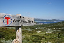 Signs are helpful and convenient, but no substitute for a map and compass. Raggsteindalen in Buskerud.
- It is easy to get lost at ridiculously short distances in unfamiliar terrain. Take a careful look even if you are going only for a minute. Dense forest, fog and open plateaus with no clear landmarks are the most difficult.
- Always take a map and compass with you when leaving the immediate vicinity of your camp (electronics is no substitute, only a supplement – instead of checking battery status you should create a good mental map). Learn to use a compass for navigation and learn to match your map with the terrain.
- If you do get lost, admit it and stop immediately. A few minutes of good rest is surprisingly effective at making you think clearly again. Lines in the terrain can be used to find way back, for instance rivers (rivers can lead you to settlements or to lakes and other points that can be identified on the map), power lines and slopes. But beware of slopes making you change direction and leading you only to a local depression, rivers leading you to hard-to-walk wet terrain, etc. Check the map for what lines are usable.
- Bugs এবং প্রাণী
- Mosquitoes and black flies are a nuisance in June and July, especially in Lapland and Finnmark. They do not carry diseases, but repellents, long sleeves, long pants and perhaps a mosquito hat in the worst areas are recommended. Avoid keeping doors and windows open in the evening.
- টিক্স can carry Lyme disease and TBE in some areas (especially south Norway to south-west Finland). The risk is small for a casual visitor, but you may want to take precautions.
- There are big predators like bears, wolves, lynxes and wolverines in the Nordic countries, but they are generally no threat to people, as they will flee in most circumstances once they smell or hear humans. Back out if you encounter bear cubs, as their mother will protect them. Also musk oxen, elks and boars can be dangerous if you go too close.
- If you are hiking in the hunting season (the autumn), in areas where hunting is allowed, you should wear some orange or red clothing. Ask for local advice about whether any areas should be avoided. Hunting season varies by species. Moose hunting is common in the forest areas of Sweden, Finland, East Norway and Trøndelag. Red deer hunting is common in West Norway. Reindeer hunting occurs mostly in the barren mountains.
- Be careful in sun
- Clear Nordic air, high altitude and snow patches can multiply the effect of the sun, which hardly sets during the Nordic summer. Snow blindness is a serious risk, so bring UV-resistant sunglasses, and preferably mountain goggles. Bring sun cream or sun block (sun protection factor). Light can be strong in the highlands even if the sun is not visible.
- Glaciers
 Do not go on your own. জোসেস্টালব্রাইন glacier.
- Glaciers are one of the most dangerous places for visitors to the Norwegian outdoors. Never underestimate the power of the glacier. Observe warning signs. Never approach the front of the glacier. A glacier is not a stable piece of ice, it is constantly moving and huge chunks regularly fall off. Snowbridges can obscure crevasses.
- The sun's rays get reflected from the white snow, so it necessary to use sunscreen and sunglasses to protect your skin and eyes. Bring warm clothes for tours on the glacier.
- কর না enter a glacier without proper equipment and a skilled local guide.


Rules of mountain conduct
Norway's trekking association has compiled a set of rules or guidelines for sensible hiking, "fjellvettreglene":
- Don't go for a long hike without training.
- Tell where you are going.
- Respect weather and forecast
- Be prepared for storm and cold weather even on shorter hikes. Bring a rucksack with the kind of gear needed.
- Listen to experienced hikers.
- Dont hike alone.
- Use map and compass
- Turn back in time, it is nothing to be ashamed of.
- Don't waste your energy. Dig into snow if necessary.
Volcanic eruption

Out of the Nordic countries, Iceland is the only one with active volcanoes.
As a precautionary mesure carry a cell phone and a battery powered radio, and heed to warnings from the Icelandic civil protection about hazardous areas. Listen to either the radio station Rás 1 or Bylgjan. Rás 1 is on the LW frequencies 189 kHz and 207 kHz. For the FM frequencies see the frequency map of Ras এবং frequencies of Bylgjan। Pay attention to any SMS messages you get, as the Icelandic civil protection does send out SMS messages in Icelandic and English to phones in hazardous areas.
Should an eruption occur the ash can spread throughout the whole country depending on the wind direction. Eruptions increase the chance of lightnings and a glacial eruption will generate n flood in rivers with sources at the melting glacier.
Regardless of where you are in the country during an eruption, consider the wind direction and consider whether the wind can spread the ash to you. As an alternative you can use the mobile website of the Icelandic met office। If so, walk high up in the landscape to avoid poisonous gases, cover your nostrils and mouth with a cloth. Should the ash get thick or if you have an asthma, go into the next day or wilderness hut, close windows on the side that the wind blows at, close the chimney and stay there until the wind direction changes.
Should you be in close proximity of an eruption walk opposite to the wind direction to get out of the area. If you have concerns that you cannot abandon a hazardous area in time, do not hesitate to call the emergency number 112.
সম্মান

Many people you meet on remote trails are there to be with nature only. They might not be interested in socializing and will probably frown upon noisy behaviour. It is common, though, to stop and exchange a few words, e.g. about the terrain ahead, and at least some kind of greeting is usually expected when you meet people on (or off) the trail. Some might of course be interested in where you come from. People are often less reserved with strangers when they are in the wilderness.
Smoking is disliked by many and can be a serious hazard. In hot and dry periods a cigarette butt can cause a forest fire (even if "extinguished"), so just like with other litter, avoid leaving them in nature. Smoking indoors is mostly prohibited. Where locals smoke you might follow their example, but otherwise try to be a good example yourself.
Even if there is right of access, wilderness is often privately owned. In Norway only barren high mountains are public (government) property. Trails and bridges are usually maintained by volunteers (the trekking association for instance) or by landowners for the visitors' benefit. মনে রাখবেন যে আপনি কারও ব্যক্তিগত জমিতে অতিথি। চারণ প্রাণী এবং বড় খেলা থাকতে পারে যা বিরক্ত করা উচিত নয়। পিছনে আবর্জনা ফেলে রাখবেন না। পাথুরে সৈকত এবং পাহাড়ের পথ ধরে প্রান্তরে পাথরের কেয়ার্নগুলি নির্মাণ করা দর্শনার্থীদের মধ্যে এটি ক্রমবর্ধমান জনপ্রিয়। স্টোন কেয়ার্নগুলি ট্রেইল চিহ্নিত করতে ব্যবহার করা হয় এবং বাস্তবে হাইকারের পক্ষে এটি বিভ্রান্তিকর হতে পারে। কেয়ার্ন নির্মাণকারী দর্শনার্থীরা প্রায়শই পাথরের বেড়া থেকে পাথর বেছে নেন, যার মধ্যে কিছু আসলে সংস্কৃতিগত heritageতিহ্য বা ব্যবহৃত হয়। কেবলমাত্র একটি সাধারণ বোল্ডার দিয়ে থাকলেও এ জাতীয় প্রকৃতি পরিবর্তন করা অবৈধ।
সরকারী জমিতে একই জাতীয় বিবেচনা প্রযোজ্য। স্যামির মালিকানার একই ধারণা না থাকায় বেশিরভাগ ল্যাপল্যান্ড সরকারী মালিকানাধীন। বাসিন্দারা মরুভূমির উপরে যেমন নির্ভরশীল তেমনি তাদের জমির মালিকানাও রয়েছে। এবং যেখানে করদাতাদের অর্থের সাহায্যে সুবিধাগুলি বজায় থাকে, সেগুলি একটি সাধারণ ইচ্ছার ফলাফল, যা ব্যক্তিগত অনুদানের চেয়ে কম বিবেচনায় রাখা উচিত।
নাম এবং দরকারী শব্দ রাখুন
মানচিত্রে এবং চিহ্নগুলিতে নামগুলি সাধারণত স্থলচিত্রকে নির্দেশ করে তাই কিছু ল্যান্ডস্কেপ শব্দ বোঝা দরকারী। আপনার যদি আগে থেকে বৃহত্তর মানচিত্রের অধ্যয়ন করার সম্ভাবনা থাকে তবে আপনি সর্বাধিক ঘন ঘন উপসর্গ এবং প্রত্যয়গুলির অর্থ যাচাই করতে চাইতে পারেন, তবে কয়েকটি এখানে তালিকাভুক্ত। তারা প্রায়শই ভূখণ্ডের বৈশিষ্ট্য সম্পর্কে মানচিত্র থেকে স্পষ্ট নয় এমন বিষয়গুলি বলে বা অঞ্চলটির ইতিহাস সম্পর্কে ইঙ্গিত দেয়।
সামি অঞ্চলে জায়গাগুলির নামগুলি সাধারণত সামি উত্সের হয়, যখন এটি স্পষ্ট না হয়। যেমন লেমনজোকি মূলত "উষ্ণ নদী" (সামি: লেমমি; ফিনিশ: লিমিন), "প্রেমের নদী" নয় (ফিনিশ: লেম্পি, লেমন)। অঞ্চলটির ভূখণ্ডের বৈশিষ্ট্যগুলি প্রায়শই সামি শব্দ দ্বারা ডাকা হয় (উদাঃ "jåkk", জোহকা, স্রোতের জন্য সুইডিশ শব্দের পরিবর্তে)।
জড়িত ভাষাগুলি যৌগিক বিশেষ্য ব্যবহার করে। নামগুলি সাধারণত যৌগিক শব্দগুলির দ্বারা তৈরি করা হয়, যেখানে শেষ অংশটি ল্যান্ডস্কেপ বৈশিষ্ট্যটি কী তা নির্দেশ করে। এই ক্ষেত্রে জোসেস্টালব্রাইন থেকে তৈরি একটি নাম জোসেস্টাল (জোস্টে ভ্যালি) এবং ব্রি (হিমবাহ), অন্য কথায় জোসেস্টালে হিমবাহ। প্রায়শই শব্দগুলি বহুবচনে এবং / বা জেনেটিক হয়, যা ফিনল্যান্ডে এবং সিমিতে সবসময় খুব সামান্য হয় না, যা শব্দকে কিছুটা সংশোধন করে।
এছাড়াও, নরওয়েজিয়ান এবং সুইডিশ ভাষায়, সুনির্দিষ্ট নিবন্ধ ("" ") প্রত্যয় হিসাবে উপস্থিত হয়, শব্দটিতে সংহত হয়, তাই ব্রেইন মানে হিমবাহ.
কয়েকটি বিভিন্ন সুমি ভাষা রয়েছে এবং তাদের অরথোগ্রাফিকে কয়েক দশক আগে মানকৃত করা হয়েছিল, যার অর্থ হ'ল কোন ভাষার সাথে জড়িত সে সম্পর্কেও স্বতন্ত্রভাবে বানানগত পার্থক্য রয়েছে।
সুইডিশ বর্ণগুলি ä এবং ö আইসল্যান্ডীয় ভাষায় æ এবং,, নরওয়েজিয়ান ভাষায় এবং ø লেখা হয়; Finnish ফিনিশ এবং বেশিরভাগ সুমি ভাষায় লিখিত হয়। এর মধ্যে বেশিরভাগ ক্ষেত্রেই সুইডিশ d ই এর কাছাকাছি এবং নরওয়েজিয়ান ভাষায় ই লেখা হয়। বানান বা উচ্চারণে এগুলি এবং অন্যান্য কম-বেশি পদ্ধতিগত পার্থক্যগুলি সনাক্ত করা সুমি অঞ্চলের জোকি / জোক্ক / জাক্কি / জোকার মতো অন্য কোন ভাষা থেকে আপনার পরিচিত শব্দটি বুঝতে সহায়তা করে (ফিনিশ, সুইডিশ এবং সিমি বানান)।
সুইডিশ এবং নরওয়েজিয়ান

- কর্ট / কর্তা
- মানচিত্র
- fjell, fjäll
- পর্বত, শিখর, শিখর (গাছের রেখার উপরে প্রসারিত ল্যান্ডস্কেপকে বোঝায়, নির্দিষ্ট শীর্ষে বা সাধারণভাবে পাহাড়কে বোঝাতে পারে)
- vidde
- উঁচু, উন্মুক্ত মালভূমি (গাছের রেখার উপরে)
- innsjø, vann, vatn, sjö
- হ্রদ, পুকুর
- tjern, tjärn
- পুকুর, ছোট হ্রদ, তারান
- স্কোগ
- বন, বন
- মায়ার, কের
- মাইর, বগ
.jpg/220px-Besseggen_Hike,_Norway_(14673663307).jpg)
- তোর, তালসকন
- স্ক্রি, টালাস ডিপোজিটস
- ব্রি / গ্লেসিয়ার, ফন, স্ক্যাভেল
- হিমবাহ, তুষারপাত
- ডাল
- উপত্যকা
- জুভ, ক্লেফ্ট / ক্লিফটা, রাভিন
- ঘাট, নালা, উপত্যকা
- এলভি, বেক / এলভি, å, বেক
- নদী, স্রোত, খাঁড়ি
- ব্রো / ব্রু, সোমবারব্রো, হেলসারব্রু
- ব্রিজ, ব্রিজ শীতকালে প্রত্যাহার, সারা বছর সেতু
- ভাদ
- ফোরড
- স্টুগা / স্টু, হিট
- কুঁড়েঘর, কেবিন
- förfallen
- ক্ষয়
- snaufjell / kalfjäll
- বন্ধ্যা পাহাড়
- tregrense / trädgränsen
- গাছের রেখা
- skyddsområde
- সুরক্ষিত এলাকা
- sti / stig
- পথ, ট্রেইল
- ruskmärkning
- তুষার শাখা আকারে চিহ্ন
- /y / ö, holme, skär
- দ্বীপ, দ্বীপ
- ফস / ফোরস, ভ্যাটেনফল
- জলপ্রপাত, র্যাপিডস
আইসল্যান্ডিক

- কর্ট
- মানচিত্র
- পড়ে গেল, ফজল
- পর্বত
- heiði
- উচ্চ খোলা মালভূমি
- vatn, tjörn
- হ্রদ, পুকুর
- মেরি
- মাইর, বগ
- fjörður
- fjord, বে
- জাক্কুল
- হিমবাহ
- ডালুর
- উপত্যকা
- gjá, gljúfur
- ঘাট, নালা, উপত্যকা
- á
- নদী
- ফস
- জলপ্রপাত
- eyja, sker
- দ্বীপ, দ্বীপ
ফিনিশ এবং সোমী
- কর্তা
- মানচিত্র
- ভোরি, টুনটুরি / টিউড্টার, ভারা / ভারি (ভেরি, ভারি, ভেরি, ওয়ারে)
- পর্বত; ফিনিশ ভাষায় ভোরি হ'ল সাধারণ শব্দ, টুনটুরি এবং ভারা যথাক্রমে গাছের রেখাকে অতিক্রম করে না - তবে সিমির ভারি পাহাড় বা পাহাড়ের প্রায়শই সাধারণ শব্দ (প্রায়শই বড় খাড়া লোকের) প্রায়শই ভারা হিসাবে অনুবাদ হয়; টুনটুরি / ডুট্টারমেলবমি গাছের লাইনের উপরে সমস্ত অঞ্চল সম্পর্কেও ব্যবহৃত হয়
- কাইসা / গাইসা; kero / tseärru; oaivi; কেইলাস / গিয়ালস, কাইটা / স্কাইডি; রোভা / রোভভি
- বিভিন্ন রূপের পর্বত: উচ্চ তুষার coveredাকা শীর্ষ; গাছের লাইনের ওপরে স্তূপাকার আকৃতির পাহাড়; গাছের রেখার উপরে গোল পর্বত ("মাথা"); খাঁজ; বিচ্ছিন্ন বনের সাথে স্টনি পাহাড়
- kহক্কা (তজাহ্ক্কি, তজাহ্কা, তজাহ্ক্কে, জাজকি)
- শিখর, শিখর
- mäki, kallio, harju / puoldsa
- পাহাড়, (পাহাড়ের) শক্ত শিলা, এসকার ker
- স্কিডি, সেলকি / সিলজি
- পর্বত দ্বারা রিজ, জলাশয় অঞ্চল (সমুদ্র বা বড় হ্রদ বিস্তৃত) / বার্চ সহ রিজ
- pahta / pahte
- উঁচু এবং খাড়া পাহাড়ের ধারে
- জারভি / জাভরি (জাভরি, আভেরি, হাভরি, জাভরি, জাভরি, জাভরি, জুউরি, জৌরি, জুরে, জাওর)
- হ্রদ, পুকুর
- ভ্যাসি
- জল, প্রায়শই নামে "হ্রদ" অর্থ
- lähde, কলটিও / গালডু
- বসন্ত
- ল্যাম্পি
- পুকুর, ছোট হ্রদ, তারান
- লাহ্তি / লুওক্তা (লুওক্তা, লোকেতে)
- উপসাগর
- নিমি / এনজেগারগা (এনজেগারগা, নর্কা)
- কেপ

- সু, রাহকা, রামে, আপা / আপনে, জানকি / জেগগি, ভোমা / ভুবমে
- মাইর, বগ; suo হল সাধারণ শব্দ, অন্যরা বিভিন্ন ধরণের; ভোমা / ভুবমিও উপত্যকা
- পালসা
- তুষার oundিপি (ছাঁটাই বা জাল)
- jäätikkö
- হিমবাহ, তুষারপাত
- লাকসো
- উপত্যকা
- রোটকো, কুরু / আউতসি, অ্যাভডজি, গোরসা
- ঘাট, নালা, উপত্যকা
- জোকি / জোকার (জহকি, জুহকা, জোহক, জোক্কি, জোক্ক), এনো / এডনু, পুরো, ওজা / আজা,
- নদী, স্রোত, খাঁড়ি; জোকি / জোকার সাধারণ শব্দ, এনো বেশ বড়, পুরো ছোট, ওজা ক্ষুদ্র
- কাহলামো
- ফোরড
- metsä; কুউসিক্কো, ম্যাননিক্কো, কোভিক্কো ইত্যাদি
- বন, বন; বিভিন্ন গাছের প্রজাতির উত্তরোত্তর কাঠগুলি (কুইসি = স্প্রুস, মন্টি = পাইন, কোইভু = বার্চ)
- রাজা
- সীমানা, সীমা
- পুরাজা
- গাছের রেখা
- rajavyöhyke
- সীমান্ত অঞ্চল
- kuusimetsän raja
- (উত্তরাঞ্চল) স্প্রুস ("কুউসি") বনাঞ্চলের জন্য সীমা
- পোলকু, রিইটি
- পথ, ট্রেইল
- mökki, pirtti, tupa; kammi / gamme
- কুটির, কুঁড়েঘর; টারফ কুটির
- সাইদা
- সুমি গ্রাম বা সম্প্রদায়

- সেতা / সিইডি
- আত্মা, পবিত্র বস্তু
- শাড়ি, লুটো
- দ্বীপ, দ্বীপ
- কোস্কি, নিভা, কুর্কিও, কর্টসি / গর্জে
- র্যাপিডস, পরেরগুলি খাড়া এবং স্টোনি
- সুওয়ান্তো, সাভু
- স্থির জল (একটি র্যাপিডের নীচে)
- কংস
- খাড়া র্যাপিডস, গৌণ জলপ্রপাত
- (ভেসি) পুটস
- জলপ্রপাত
- লাতু (pl। ladut) / láhtu
- স্কিইং ট্র্যাক
সংযোগ করুন

শামুক মেইল
দোকান এবং পর্যটন ব্যবসায়ে মেলবক্স এবং স্ট্যাম্প উপলব্ধ থাকতে পারে। পোস্ট রিস্ট্যান্টের পরিবর্তে আপনি কোনও উপযুক্ত ব্যবহার করতে চাইতে পারেন সি / ও ঠিকানা। স্থানীয় অনুশীলন সম্পর্কে জিজ্ঞাসা করুন।
ফোন
নর্ডিক দেশগুলিতে সাধারণত মোবাইল ফোনের ভাল কভারেজ থাকে তবে আপনার যেখানে এটি প্রয়োজন তা অগত্যা নয়। কিছু প্রান্তরের ঝুপড়িতে জরুরি কলগুলির জন্য ফোন রয়েছে (ফিনল্যান্ডে আর নয়; সুইডেনে এগুলি সাধারণ and এবং আপনার বিলম্বিত হওয়ার বিষয়ে বলার জন্য এবং প্রয়োজনে পরামর্শ দেওয়ার জন্য, শুধুমাত্র জরুরী পরিস্থিতিতে নয়) ব্যবহার করা উচিত।
পার্বত্য অঞ্চলে উপত্যকায় প্রায়ই সংকেত থাকে না। প্রত্যন্ত অঞ্চলে পতিত শীর্ষগুলি ছাড়া কোনও সংকেত নাও থাকতে পারে। আপনি আগেই স্বল্প গতির সংযোগ (এমনকি 9600 বিট / গুলি) দিয়ে গুরুত্বপূর্ণ ইন্টারনেট পরিষেবাদি পরীক্ষা করতে চাইতে পারেন। এসএমএস আবহাওয়া পরিষেবা আছে। 3 জি কেবলমাত্র বড় শহরগুলি এবং গুরুত্বপূর্ণ পর্যটন রিসর্টগুলির কাছে এবং কয়েকটি প্রধান রাস্তার পাশে পাওয়া যেত, তবে এখন ফিনল্যান্ডে এমনকি প্রান্তরের বেশিরভাগ অঞ্চলে পাওয়া যায়।
কভারেজ এক সরবরাহকারী থেকে অন্য সরবরাহকারীর মধ্যে পরিবর্তিত হয়। সংস্থায় যদি আপনার একাধিক ফোন (সিম কার্ড) থাকে তবে আপনার বিভিন্ন সরবরাহকারী থাকতে পারে। মনে রাখবেন যে সেরা সংকেত কোনও প্রতিবেশী দেশ থেকে হতে পারে এবং আপনি যদি ফোনটি সরবরাহকারী চয়ন করতে দেন তবে আপনাকে এমন কোনও ঘরোয়া সিম কার্ডের মাধ্যমে আন্তর্জাতিক কলগুলির জন্যও অর্থ দিতে হবে।
যেখানে সংকেত খারাপ, কল করার চেষ্টা করবেন না, তবে এসএমএস ব্যবহার করুন: বার্তাগুলির জন্য কেবল কয়েক সেকেন্ডের জন্য সংকেত প্রয়োজন, এবং এইভাবে আরও নির্ভরযোগ্য এবং কম শক্তি ব্যবহার করা হবে।
আপনার ফোনটি শুকনো রাখুন। মনে রাখবেন যে যেখানে ব্যাড সিগন্যাল রয়েছে সেখানে ব্যাটারিগুলি আরও দ্রুত ব্যবহার করা হয়। আপনার ফোনটি বেশিরভাগ সময় বন্ধ রাখুন। বৈদ্যুতিনতা সাধারণত ব্যাককাউন্টরিতে পাওয়া যায় না, এমনকি কুটির এবং বাড়িতেও প্রয়োজনীয় নয়।
জরুরী কল
দ্য জরুরী সংখ্যা 112 সমস্ত নর্ডিক দেশে কাজ করে। কিছু জরুরী জন্য বিশেষ নম্বর থাকতে পারে, কিন্তু ☏112 তাদের সব পরিচালনা করতে পারেন। 112 এ কল করা টোল ফ্রি এবং বেশিরভাগ ফোনের সাথে লক সম্পর্কিত কোনও বিষয় ছাড়াই কাজ করে। কেবল সংখ্যাটি টাইপ করুন বা একটি জরুরী বোতামটি ব্যবহার করুন (কিছু স্মার্ট ফোনে)। আসলে, আপনি সম্ভবত কিছু ক্ষেত্রে সিম কার্ডটি মুছে ফেলতে চাইছেন যে ফোনটি সর্বোত্তম সংযোগ উপলব্ধ। দুঃখের বিষয়, সুইডিশ 112 আপনি "5" টিপুন না হওয়া পর্যন্ত সিম-কম কল রাখে। ফিনল্যান্ডে এই ধরনের কলগুলি উত্তর দেওয়ার আগে প্রায় আধা মিনিটের জন্য আটকে রাখা হবে।
জন্য স্যাটেলাইট ফোন জরুরী পরিষেবা নম্বর হয় ☏ 46 63-107-112 (সুইডেন), 358 9 2355-0545 (ফিনল্যান্ড), 354 809-0112 (আইসল্যান্ড চেক!)। ইনমারস্যাট -১ s উপগ্রহগুলি দক্ষিণ দিগন্তের মাত্র ১৫ ডিগ্রি উপরে এবং এটি সহজেই উচ্চতর অঞ্চল বা অন্যান্য বাধা দ্বারা অবরুদ্ধ। আইরিডিয়ামের এই সমস্যা নেই।
জরুরী অবস্থা হতে পারে এমন কোনও সমস্যা সম্পর্কে জরুরি পরিষেবা বলতে দ্বিধা করবেন না। নিশ্চিত হয়ে নিন যে আপনি তাদের নিরাপদে আছেন এবং একইভাবে আপনি যখন দেরী করেন এবং কেউ উদ্ধার কাজ শুরু করার জন্য ফোন করতে পারে তাদের কাছে তাদের ফোন করে। ব্যয়গুলি সহজেই পাঁচটি ফিগার সংখ্যা - প্রতি ঘন্টা ইউরোতে (সাধারণত করদাতার অর্থ দিয়ে দেওয়া হয়, তবে আপনি সিস্টেমটির অপব্যবহার করতে চান না)।
ETRS89 / WGS84 স্থানাঙ্ক হিসাবে অবস্থানটি সর্বোত্তমভাবে বলা যেতে পারে (এটি আগে আপনার মানচিত্রে ব্যবহৃত হয় কিনা তা আগেই পরীক্ষা করে দেখুন)। দিকনির্দেশ এবং একটি সুপরিচিত স্থান থেকে দূরত্ব বা আপনার মানচিত্রে যে কোনও সমন্বয় ব্যবস্থা ব্যবহার করা যেতে পারে। ভুল এড়াতে অবস্থানের কাছে কিছু নামও বলুন। নোট করুন যে উভয় 360 several এবং কয়েকটি মিল সিস্টেম (একটি বৃত্তের জন্য 60, 63 বা 64 হেকটোমিল) কমপাসে এবং কিছু নাম যেমন ব্যবহার করা হয় আইলিগাস ("পবিত্র পতন"), অস্পষ্ট। ফিনল্যান্ডে জরুরি পরিষেবা পৌরসভা ও ঠিকানা চাইতে পারে (তারা বিশাল অঞ্চল পরিবেশন করে) তবে আপনি যখন জানেন না তখন তাদের বলবেন তারা যুক্তিসঙ্গত হবে।
স্যাটেলাইট নেভিগেটর (জিপিএস ইত্যাদি; প্রায়শই স্মার্টফোনগুলিতে অন্তর্ভুক্ত থাকে, কখনও কখনও ক্যামেরায় থাকে) বেশিরভাগ শক্তি ব্যবহার করা হয়, তাই বেশিরভাগ সময় সবচেয়ে ভালভাবে বন্ধ রাখা হয়, তবে প্রায়শই জরুরি পরিস্থিতিতে সঠিক স্থানাঙ্ক দিতে পারে। তাদের উপগ্রহগুলি খুঁজতে কিছুটা সময় নেয় এবং তারা ততক্ষণে ভুল নির্দেশনা দিতে পারে। আপনি তাদের সেটিংস এবং আচরণ বুঝতে পেরেছেন তা পরীক্ষা করে দেখুন।
সামলাতে
বর্জ্য
প্রায়শই ঝুপড়ি, আশ্রয়কেন্দ্র এবং ক্যাম্পফায়ার সাইটে বর্জ্য বিনাশ রয়েছে are বিশেষত যেখানে রাস্তা নেই সেখানে এগুলি ব্যবহার করা আপনার এড়ানো উচিত এবং পরিবর্তে প্যাক আউট করা উচিত। ব্যাককন্ট্রিতে বর্জ্য বিনগুলি খালি করার অর্থ অপ্রয়োজনীয় এবং ব্যয়বহুল ট্র্যাফিক। খাদ্য স্ক্র্যাপ এবং অনুরূপ কোনও বর্জ্য বাক্সে রাখা উচিত নয় যদি না আপনি জানেন যে এটি শীঘ্রই খালি করা হবে। অল্প পরিমাণে জৈব বর্জ্য, যেমন খাদ্য স্ক্র্যাপগুলি পিট টয়লেটগুলিতে স্থাপন করা যেতে পারে (এবং আরও উন্নত কম্পোস্টিং টয়লেট)। কিছু লোকেশনে আলাদা আলাদা কম্পোস্টার রয়েছে। রিসাইক্লিং পয়েন্টস পেপারে মেটাল এবং গ্লাস আলাদাভাবে যত্ন নেওয়া যেতে পারে। জঞ্জাল বর্জ্যগুলি বন্ধ রাখার প্রয়োজন হলে প্রয়োজনে সমাধিও দেওয়া যেতে পারে তবে বিশেষত পিট এবং ট্রেললাইনের উপরে, পচে যাওয়ার ফলে কয়েক বছর সময় লাগতে পারে। খাঁটি কাগজ ক্যাম্পফায়ার এবং চুলাতে পোড়াতে পারে তবে ধাতব বা প্লাস্টিকের আচ্ছাদিত কাগজটি প্যাক আউট করা উচিত। অন্যদের পোড়াবার জন্য বর্জ্য ফেলে রাখবেন না।
টয়লেটস
ট্রেইলের পাশাপাশি ঝুপড়িগুলিতে এবং প্রায়শই আশ্রয়কেন্দ্র এবং ক্যাম্পফায়ার সাইটগুলিতে টয়লেট রয়েছে, আপনি যদি এই পরিষেবাগুলি ব্যবহার করেন তবে সাধারণত আপনার বড় প্রয়োজনের জন্য যথেষ্ট। এগুলি সাধারণত শুকনো টয়লেট হয়: বেঞ্চের একটি গর্তযুক্ত একটি আউট হাউস এবং পিট, কাঠের খড় বা এটির সাথে আপনার মল coverাকানোর অনুরূপ বালতি সহ একটি বালতি। আপনার নিজের টয়লেট পেপার ব্যবহার করতে হতে পারে। আপনার হাত ধোয়া সাধারণত আপনার নিজের সমস্যা হয় (লোকেরা তাদের পানীয় জল গ্রহণ করে না এমন জায়গায় জলপথটি করবেন না বা পানীয় জলের বালতির কাছাকাছি)। ট্রেইল বন্ধ এবং ঝুপড়িগুলির মধ্যে, পরামর্শ of লে-নো-ট্রেস ক্যাম্পিং অনুসরণ করা যেতে পারে।
ধোলাই
দেশগুলির বেশিরভাগ জায়গায় প্রচুর স্রোত এবং হ্রদ বা সমুদ্র তীর রয়েছে, তাই নিজেকে ধোয়ার জন্য জল খুঁজে পাওয়া খুব কমই একটি সমস্যা - তবে বিশেষত উত্তরে এবং জুলাই-আগস্ট ব্যতীত বেশিরভাগ শীতল। কেবল সেটিতে নিজেকে গ্রহণ করুন বা সোনাস ব্যবহার করুন। আপনার হাত ধোওয়ার জন্য আপনার চুলায় সামান্য পরিমাণে জল গরম করা যায় তবে শীতল জল প্রায়শই যথেষ্ট। বেশিরভাগ জায়গায় আপনার হ্রদ বা নদীতে ময়লা বা সাবান পাওয়া এড়ানো উচিত, জমিতে সর্বাধিক ওয়াশিং করা। বাল্টিকের মধ্যে সমুদ্রের জল খুব বেশি নোনতাপূর্ণ নয় এবং খুব কমই এলোমেলোভাবে রয়েছে f
ঝরনা সাধারণত মরুভূমির হাটে পাওয়া যায় না তবে কয়েকটি কেবিনে এবং বাস্তব ক্যাম্পগ্রাউন্ডগুলিতে আপনি যদি এগুলির মুখোমুখি হন তবে উপলভ্য। পরিবর্তে সানাস ব্যবহার করুন, যা বেশ কয়েকটি ঝুপড়ি এবং কেবিনে পাওয়া যায়। জন্য sauna পদ্ধতিটি, সেই নিবন্ধটি দেখুন (যখন ফিনল্যান্ডে নেই, প্রত্যাশিত আচরণটি আলাদা কিনা তা পরীক্ষা করে দেখুন) তবে সঠিকভাবে ধোয়া হ'ল একটি ওয়াশবোলের মধ্যে গরম এবং ঠান্ডা জল মিশিয়ে এবং এটি ব্যবহার করে। ধুয়ে ফেলার জন্য একটি নতুন সেট মেশান।